 My Trips
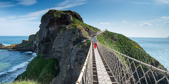


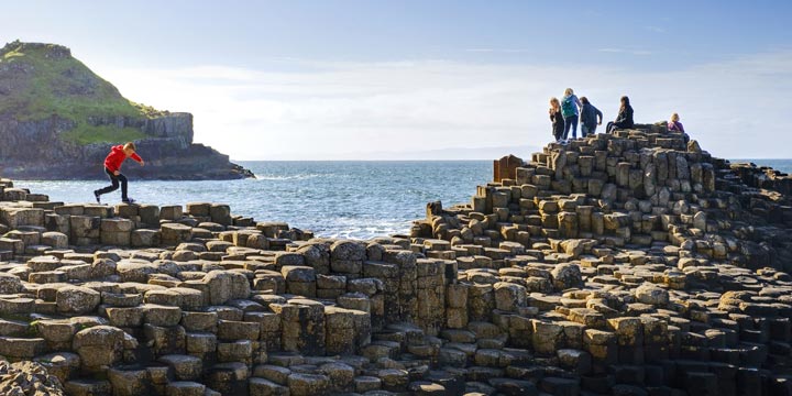

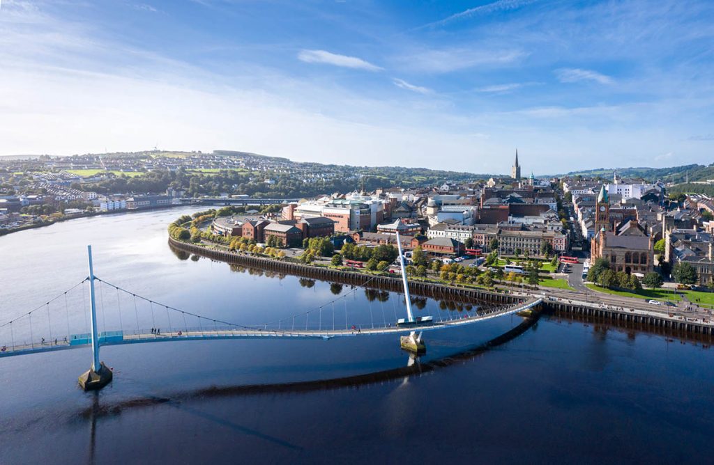
This luxury travel experience includes the mysterious gems of both Ireland and Northern Ireland. Begin your stay in a golf and beach resort, just outside Dublin. The next day, you’re in Belfast, capital of Northern Ireland. We have arranged an immersive experience at the Titanic for you—the passengers’ stories come to life! Discover one of the most stunning coastlines in the world, including the Glens of Antrim, the Giant’s Causeway, and the Carrick-a-Rede rope bridge. (Consider a short detour to Bushmill’s and Belleek.) We’ve also arranged entrance to the mystical Dunluce Castle.
Your next two nights are spent in an exquisite castle. Situated in a hidden pocket of Ireland, it is dotted with ancient ruins and lakes. Let yourself be pampered here. On the way to your next 5-star castle lodging, pull over for local crafts, foods, and stories. This is County Cavan’s legendary, rolling lake country—feel the peace while exploring the magnificent castle grounds. Fall under the spell of Ireland with an apple orchard tour (and tasting) at a lovely cider farm, an afternoon tea in Derry, and a Game of Thrones studio tour. Experience the mysterious side of Ireland on this customized tour!
Included Unique Activities
- Apple Orchard Tour & Tasting
- Entrance to the Award Winning Titanic Experience
- Game of Thrones Studio Tour
- Dunluce Castle Admission
- Derry Girls Afternoon Tea Experience
- 2 Day Derry Sightseeing Pass

Titanic Experience Belfast
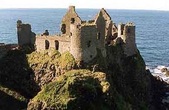
Dunluce Castle Admission

Apple Orchard Tour & Tasting
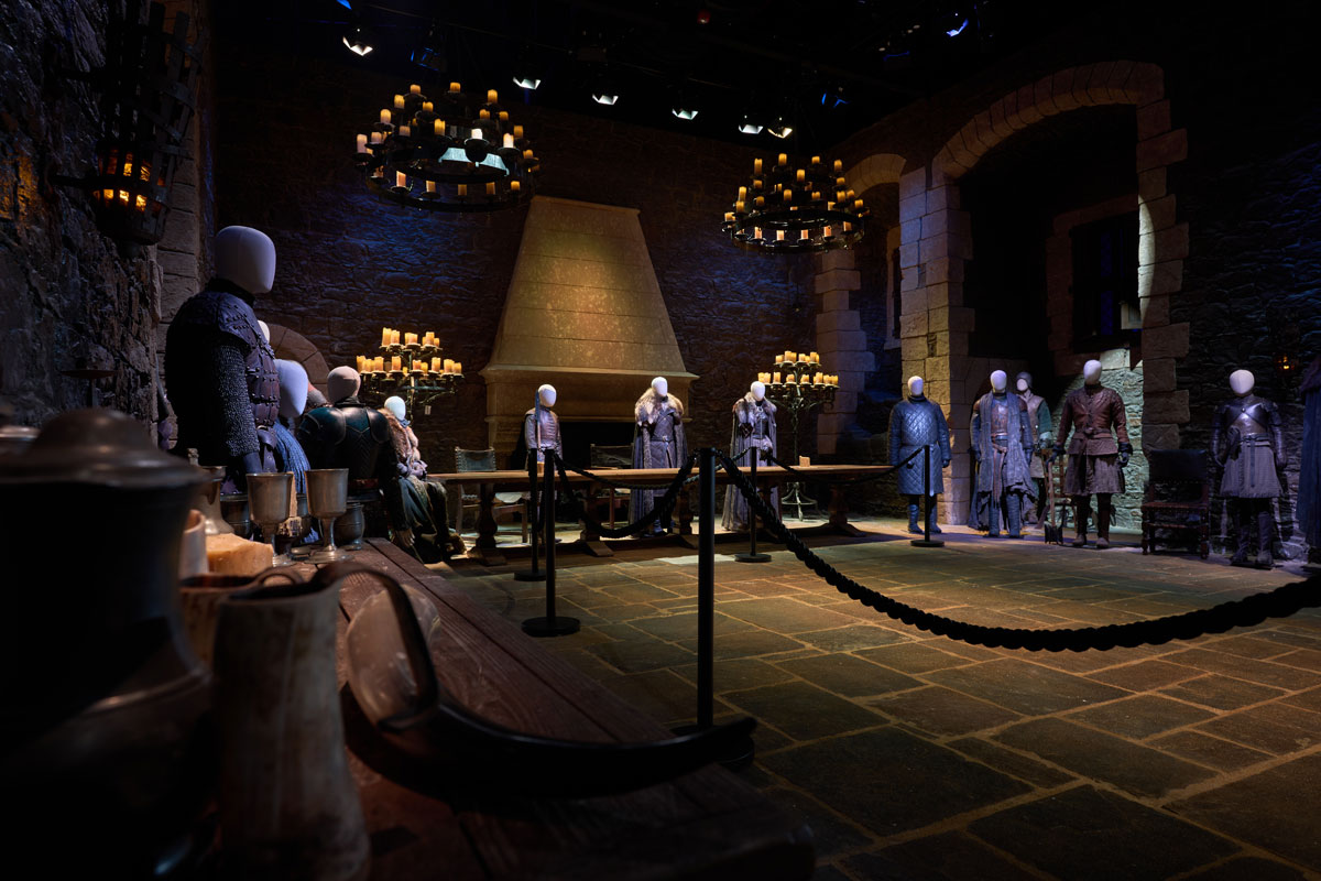
Game of Thrones Studio Tour
Visit Derry - 2 Day Pass
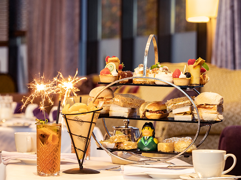
Afternoon Tea at The Everglades Hotel
Accommodations
1 Night
Golf & Beach Hotel


2 Nights
Luxury Historic Hotel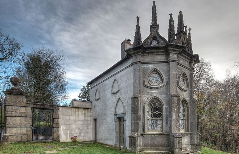


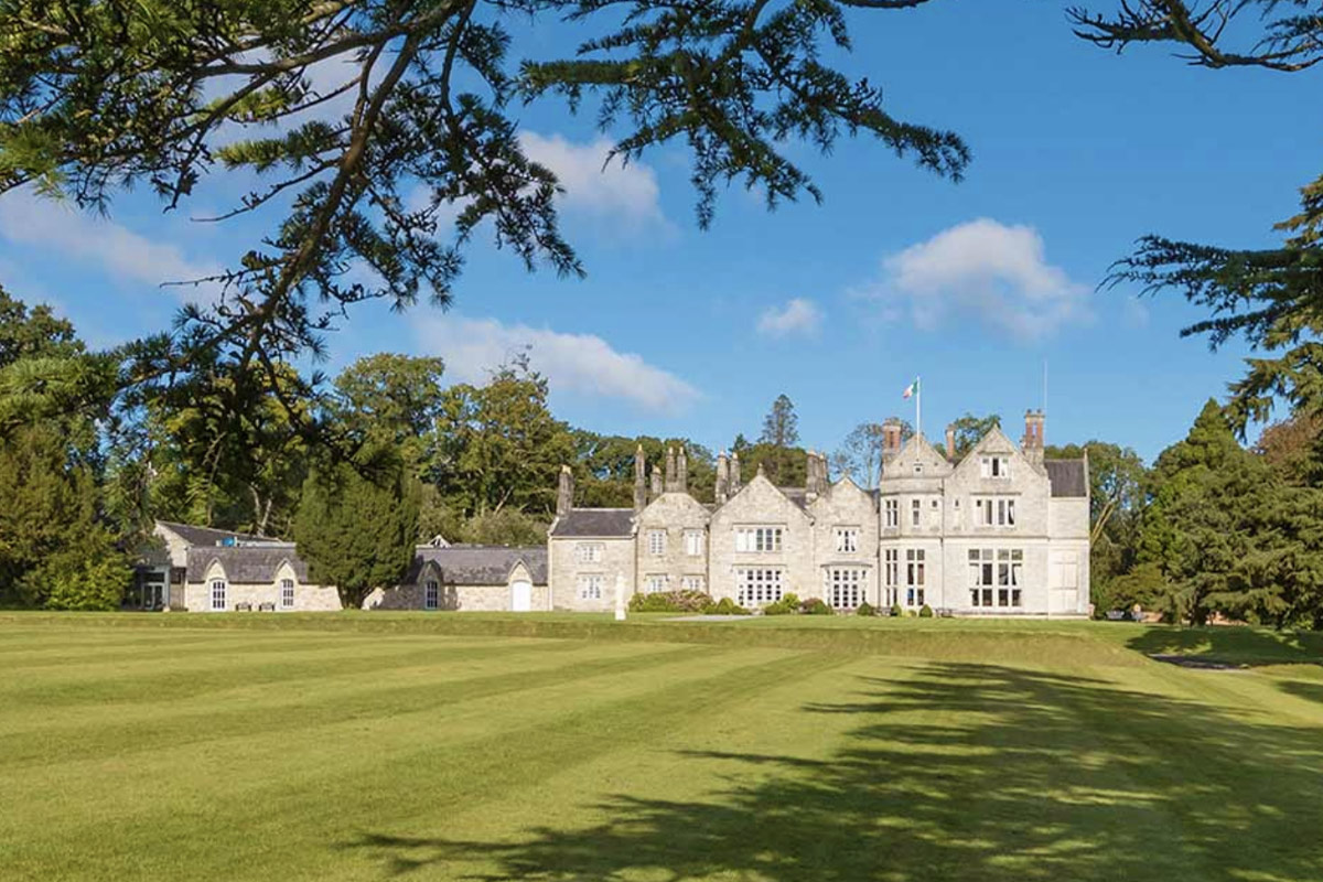
2 Nights
Historic Luxury Castle Hotel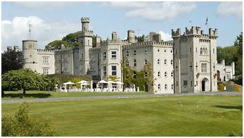
1 Night
Magnificent Castle Hotel with Landscaped GroundsTransportation and Guides
- Rental Car
Meals Included
- 8 Full Irish Breakfasts
Points of Interest
- Stroll through Fragrant Apple Orchards & Savour Homemade Apple Cider
- Visit Medieval Towns and Ancient Castles
- Indulge with Pastries & Tea 'Derry Girls' Style
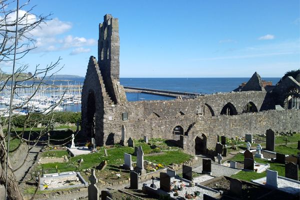
- Visit the 'City of the Dead' at Ireland's Largest Cemetery
- Visit Dunluce Castle and Carrick-a-Rede Rope Bridge
- Be Immersed in the Seven Kingdoms of Game of Thrones
- Explore the Giants Causeway, Antrim Coast and Donegal
- Discover Sligo's Yeats' Country & Hidden Waterfalls

Glasnevin Cemetery, County Dublin
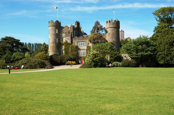
Malahide, County Dublin
Howth, County Dublin

Titanic Belfast, County Antrim

Belfast Botanic Gardens, County Antrim
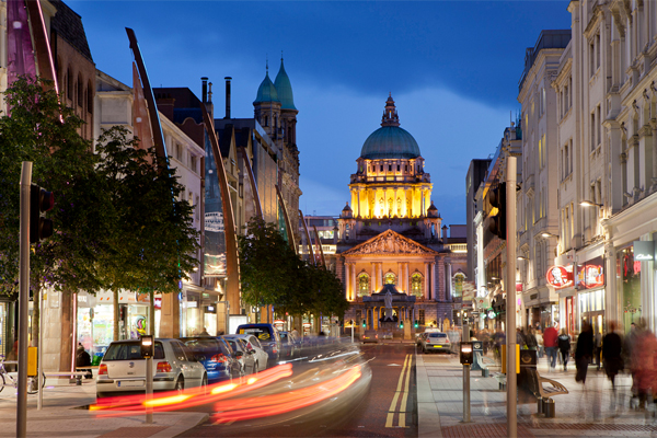
Belfast, County Antrim
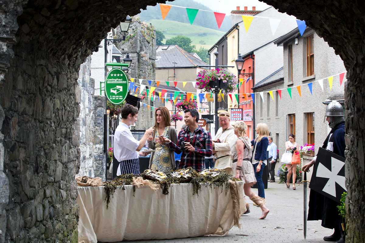
Carlingford, County Louth
Banbridge, County Down
UNESCO World Heritage sites
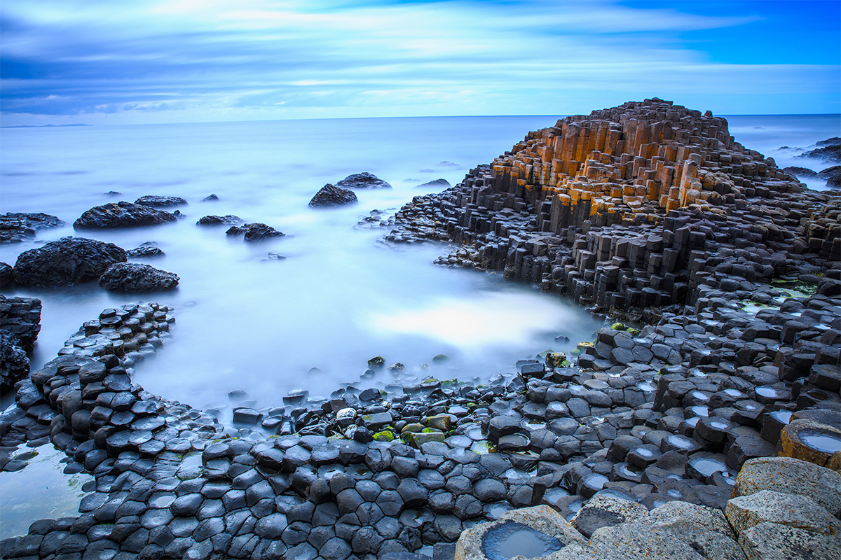
Giant's Causeway
Loading itinerary...
2026 LOW SEASON
Available Dates
Nov, Dec
From $3,914 per person
2026 MID SEASON
Available Dates
Oct
From $3,957 per person
2026 HIGH SEASON
Available Dates
Jul, Aug, Sep
From $4,085 per person
2027 LOW SEASON
Available Dates
Jan, Feb, Mar
From $4,189 per person
2027 MID SEASON
Available Dates
Apr, May, Nov, Dec
From $4,305 per person
2027 HIGH SEASON
Available Dates
Jun, Jul, Aug, Sep, Oct
From $4,353 per person
Your Price Includes
ACCOMMODATION
- 8 nights Accommodation – From Luxury City Hotel to Castle Estate!
- Spend 3 nights in Authentic Castles!
TRANSPORTATION
- Rental Car
DINING OPTIONS INCLUDED
- 8 Full Irish Breakfasts
UNIQUE EXPERIENCES
- Entrance to the Award Winning Titanic Experience
- Apple Orchard Tour & Tasting
- Game of Thrones Studio Tour
- Derry Girls Afternoon Tea Experience
- 2 Day Derry Sightseeing Pass
- Entrance to the Stunning Dunluce Castle
Prices Based On
- Prices are per person based on 4 people traveling together and sharing 2 rooms.
- All Taxes & Fees Included
- Custom Priced Quote (Want to Add/Subtract Days? Let Us Know!)
- Self-guided vacation package. Choose any date to begin your travels.
- Traveling alone? No problem. Just ask us for a single supplement price.
"Family Vacation"
Jul 19, 2026KY
My client's loved their trip to England and Scotland. They were pleased with everything we planned for them and everything went perfectly. Ellie and Authentic Vacations made me look like a rock star. Thank you!
"Revisit to hike the 5 villages"
Jul 1, 2026Cinque Terre, Italy
What a wonderful visit we had in Cinque Terre. The driver was waiting for us at Florence airport and got us to Cinque Terre quickly and safely. Driver was very nice and spoke English well. He had cold water bottles for us to drink and the Mercedes van was very comfortable transportation.
The Hotel was very nice and the people there took very good care of us. We brought more than one suitcase each, because we had 19 days of travel planned, and found that to be a mistake. We would do that differently if we do it again, we would store most of it and take only one to the hotel or ship the rest ahead to the cruise line. The villages have a lot of steps, but the hotel manager had help for us so we didn't have to do much. Very good to us.
The all-day hiking with Andrea was absolutely fantastic. He was very accommodating and a wonderful guide and a wonderful person. He talked us through what we wanted to hike and when we want to use a shuttle or the train so that we could do all 5 villages. He recommended a couple of places for lunch and the restaurant we ate at was fantastic.
The food, especially the seafood, was so delicious and fresh, we really enjoyed everything we ate. The anchovies were so fresh and tasty we had the sampler twice, which is 3 or 4 pieces of anchovies, cooked 4 or 5 different ways. I also got a focaccia sandwich with mozzarella and anchovies and sundried tomatoes. I couldn't believe how good that was to eat.
The driver was picked us up after check-out and drove us to the port in Ravenna. This was a 4 hour trip and he got us there on time and safe. Driver was very nice and spoke English well for us. He also had cold water bottles for us to drink and the Mercedes van was very comfortable transportation.
So except for the fact that we probably over did it, hiking 8 or 9 miles up and down hills, it was exceptional.
Thank you for calling me a few days before and talking me through all the things we needed to know and helping with the train tickets. ItalyBeyond also was very responsive, any time I asked them questions.
Thank you very much for putting this together for us, so that we could experience this wonderful vacation with such wonderful memories. We always enjoy the itineraries you prepare for us. Look forward to the next one.
"Italy anniversary trip"
Jun 18, 2026GA
Ellie did a fabulous job helping me put together the perfect trip for my clients. She paid such great attention to the details I sent her, and my clients said the trip was AMAZING! Thank you Ellie!!!
"mom and daughter trip"
Jun 11, 2026Ireland
What an amazing trip! I chose Authentic because the itinerary sounded exactly what we wanted to see. But what made this the trip of a lifetime was our driver/guide, Colm Dunlea. He was absolutely incredible. The stories he told, the little side trips he took us on, the tips he gave us as we arrived in each of the towns/cities, the pictures he took and all of the extras he gave us were just so very much appreciated. I am forever grateful to Colm Dunlea for all he did. He was BRILLIANT!!!
"85th birthday gift celebration"
Jun 2, 2026Montague Michigan
Our trip to Ireland was beyond amazing. Each day brought new vistas filling us all with the heart of this beautiful land, The accomadations were just magical and each one had a lovely history of its own. The tour itinerary was well designed to teach us about Irelands different areas and history. Special praise to our ProCar chauffer / guide, Mr. Declan Cummins for going way above to care for each traveler . ( We were a varied group.) He is a huge asset to your company, We all grew very fond of him by weeks end. Thank you all for creating this wonderful adventure. I'd do it over again in a heartbeat!
"Denmark Vacation"
May 31, 2026Minneapolis, MN
My clients' 'Denmark in the Spring' trip exceeded expectations — from the seamless logistics to the curated experiences in both Copenhagen and Aarhus, every detail was thoughtfully arranged. Their drivers and guides were exceptional, bringing the destinations to life in ways they couldn't have discovered on their own. They returned home already dreaming of their next trip.
"Mom and daughter trip"
May 28, 2026Wisconsin
My client and her mother contacted me about travel to Ireland. They wanted something private and special. I met my Authentic Vacations' sales rep the night before and decided to send in a request. Best decision ever! Lauren L. received my request and immediately sent me an email with a few ideas, we talked on the phone and within 2 days I had a winning itinerary.
Fast forward. My client emailed me on arrival day and was very pleased with the service. She emailed me again on the last day and raved about their driver Colm Dunlea.
Working with Authentic Vacations was effortless. I highly recommend them and plan to use their service again.
"Family Vacation"
May 21, 2026New York
As a travel advisor, this was the first Ireland trip I entrusted to Authentic Vacations, and they knocked it out of the park. The clients loved having a private driver, thought the hotels were ideal, and a castle stay was the perfect ending to the trip.
1. Click the “GET QUOTE” Button Above.
Complete our inquiry form by selecting your departure date, and all other relevant fields. Be sure to let us know if you're traveling for a special occasion! We can adjust most of our vacation packages to suit your needs, based on the details you provide.
2. Online Account & Quote Created
Your request will be forwarded to our team of Destination Experts, and a price quote will be prepared, based on your submitted preferences and criteria. A free Authentic Vacations online account will also be created, allowing you to view and request changes to your quote at any time. Log into your account via “LOGIN” at the top of any of our webpages.
3. Fine-Tune Your Tour Quote
Work with your assigned Destination Expert to tweak your quote in any way you wish. Our customers continually tell us that our flexibility in this regard is exceptional – your Destination Expert’s sole brief is to create the perfect tour for you!
4. Reserve & Pay Online
Once your quote is 100% to your liking, you can pay for your package with your credit card via your Authentic Vacations online account. We also accept payment by personal check and wire transfer. We only require a 20% deposit to secure your vacation, and our Risk-Free Cancellation Policy provides you with complete peace of mind.
5. Print Your Travel Documents & Go!
Once your vacation has been paid in full, you will be able to print your travel documents directly from your online account. You’re ready to embark on your ideal, authentic vacation!!
Questions?
If you would prefer to discuss your perfect vacation on the phone, we would be delighted to hear from you! Our Destination Experts are standing-by and looking forward to speaking with you at any time during our business hours listed below. We also operate a very responsive and efficient Live Chat service on our website…instant gratification awaits!
Toll-free from the US and Canada: 1-888-443-5259 Rest of World: +1-707-687-0191
Hours of Business:
Monday – Thursday: 7:00am – 5:00pm PST
Friday: 7:00am – 4:00pm PST
Saturday: 6:00am – 3:00pm PST
Sunday: 6:00am – 3:00pm PST
With offices in Scottsdale, San Francisco, London, Dublin, Copenhagen and Edinburgh, we can offer you unrivaled support while you are abroad. We truly believe all our clients deserve an extraordinary, authentic experience!