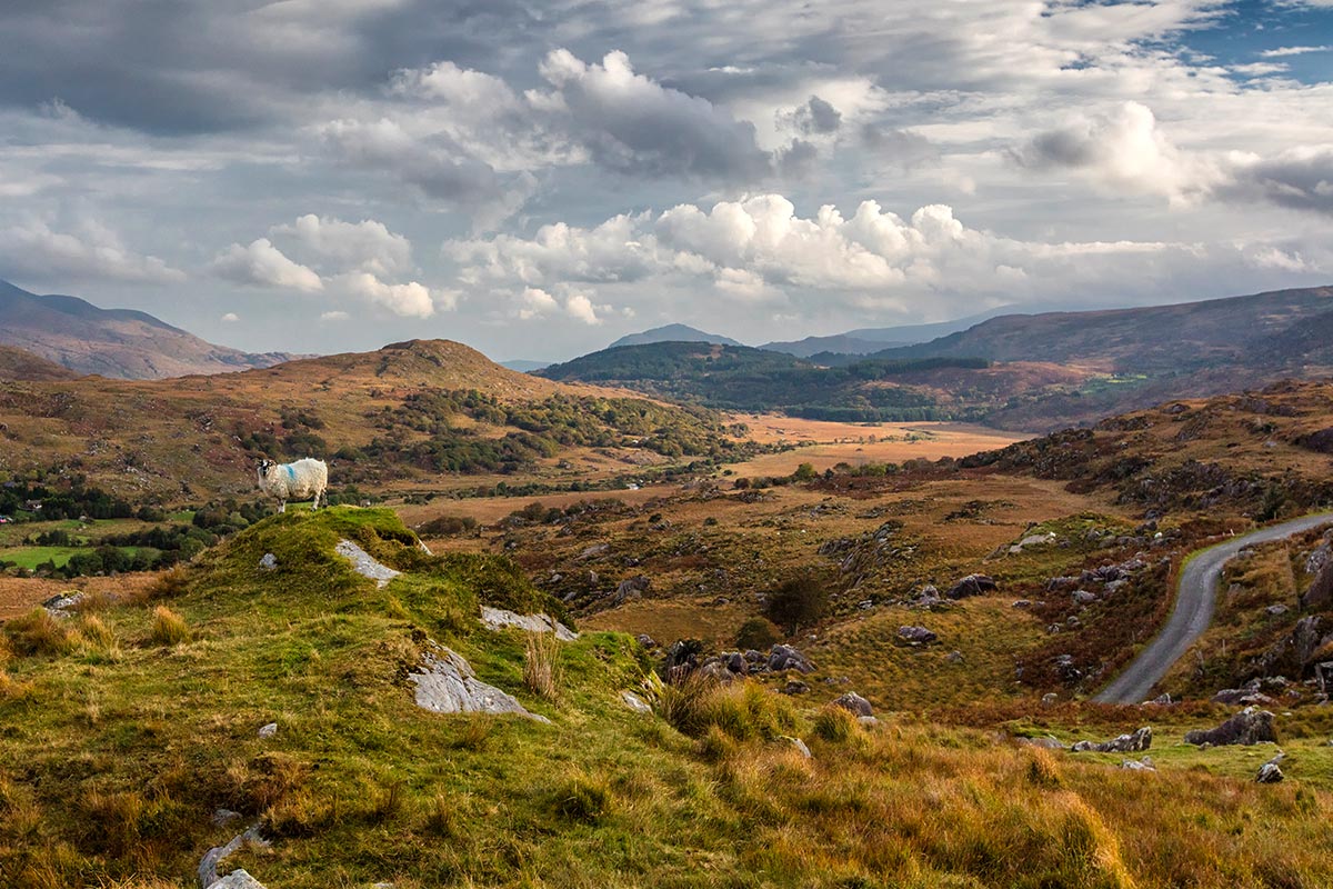
This opulent, tasty tour of Ireland begins in sublime Wicklow. Dine at a fine restaurant that features the best of locally sourced, organic cuisine. Have tea in a lovely village and enjoy a hands-on wild foods experience. This is absolutely unique. Climb into your rental car and head to Kinsale, home of world-renowned chefs, for an exceptional foodie tour. Your next two nights are spent in wild, authentic Dingle. Go to the Cliffs of Moher, listen to traditional music, and enjoy a distillery tour.
Your last night is spent in an exquisite Manor House. Relax and feel the peace. This tour is the best combination of opulent, eco-friendly, and grand lodgings. Explore each village and remember how to breathe again. And, when you sink into your cozy bed, imagine a gentler life. A life filled with gardens, luscious foods, and abundance. The real Ireland is yours.
We only partner with the finest accommodation providers in each country. All properties are tried and trusted to ensure that you’re in excellent hands during your time abroad. From characterful B&Bs & Inns to 5-Star Castles and Stately Manors, we can find the perfect accommodation to suit your Ireland trip. Looking for romance? No problem – Ireland is awash with cozy, inviting accommodations in scenic and private locations. They’re not always easy to find independently, but not to worry, we know exactly where to look! Properties steeped in history and intrigue? We have those in spades – if you’ve always wished to overnight in a centuries-old castle, you’re visiting the right country! If you would like more specific information about this particular accommodation, please just ask your Agent, and he/she will be glad to oblige.
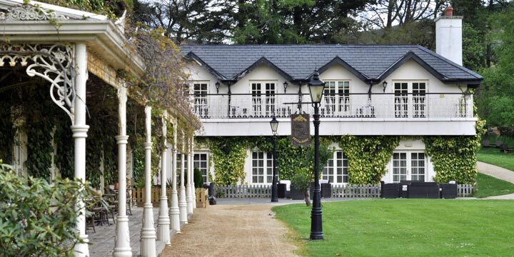
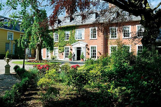
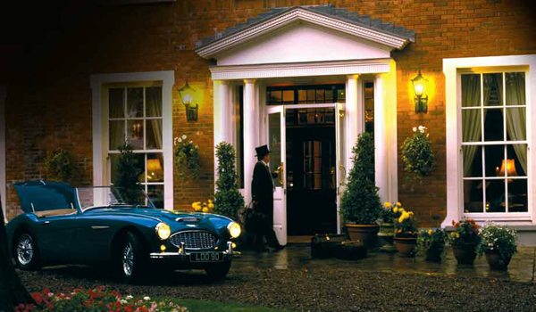
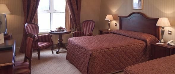
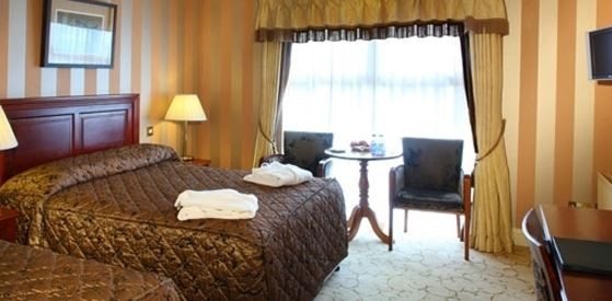
Set within a secluded walled garden, Hayfield Manor is a world apart from the bustle of Cork City. Lush ivy compliments the red brick façade as it welcomes guests into a sanctuary of luxury and unrivaled amenities. Family owned and managed, the manor hotel has become tantamount to the highest levels of customer service. Hayfield Manor is a member property of two hotel collections, Small Luxury Hotels of the World and Ireland’s Blue Book, and is the recipient of myriad awards. As an internationally recognized establishment, Hayfield Manor invites both new and return visitors to experience and enjoy the rich culture of County Cork. Guests are urged to unwind from their daily routines and to indulge in the ornate and verdant surroundings. With several fine-dining options, elegant gardens and terraces, and a relaxing spa, guests will see for themselves how Hayfield Manor has distinguished itself as Cork City’s premier 5-star hotel.
Hayfield Manor offers a variety of guestrooms that have been carefully designed to provide a unique and relaxing stay. Each room displays exquisite antique furnishings and beautiful textiles. While still retaining their old-world charm, the various accommodations are individually styled and outfitted with all of the modern amenities guests may require. For those looking to indulge, look no further than the Beautique Health Spa, equipped with a swimming pool, outdoor jacuzzi, and sauna, among other fitness facilities.
All Guestrooms Feature:
Orthopaedic King Size & Twin Beds
Spacious Marble Bathrooms with Elemis Spa Products
Individually Controlled Air-Conditioning
Plush Bathrobe & Slippers
Complimentary Wi-Fi Access
32” Flat Screen TV
Tea & Coffee Making Facilities
Iron & Ironing Board
Hair Dryer
Direct Dial Telephone
24-Hour Room Service
Laundry Service
All Hotel Guests May Avail of Our Complimentary Valet Parking & Car Park
Orchids Restaurant:
The premier choice for gourmet dishes in Cork City, Orchids Restaurant overlooks the lush garden and terrace of Hayfield Manor. Illumined with candles and soft lighting, the atmosphere makes any dining experience magical. Enjoy delectable Irish Cuisine prepared by Executive Head Chef Mark Staples and his brilliant team.
Perrotts Garden Bistro:
A favorite of visitors and locals alike, Perrotts Garden Bistro serves an array of international and Mediterranean dishes. Open daily for lunch and dinner, the bistro is located in the conservatory area at the front of Hayfield Manor. Awarded 2 AA Rosettes, the restaurant is ideal for a relaxed meal with family and friends or even a working lunch with colleagues.
Hayfield Manor also offers a selection of seasonal and holiday dining options, revolving annually.
Cork City
On the Map: Cork City is located off the southern coast of Ireland. As Ireland's second city, it is well served by good roads - The M8 northeast to Dublin, the N20 north to Limerick & the N25 east to Waterford.
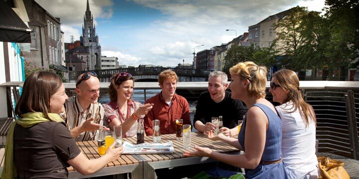
In the bustling city of Cork (often referred to as 'Ireland's Second Capital'), stroll the river walk at the University and pop into the Glucksman Gallery. Relax in a café, and hit Shandon Street, just a short walk from the main shopping district. Climb the 120 foot steeple, and ring the bells of Shandon. Soak up the city views as they fade into the countryside. Award-winning restaurants line the streets, and nightlife choices include Irish Traditional, classy nightclubs, theater, opera, plays, and dance. (Take the haunted night tour of the city jail—it’s a great way to start your evening with a bang.) Of course, there’s the Jameson Old Middleton Distillery in east Cork. Learn how Irish whiskey is made, and finish with a tasting.
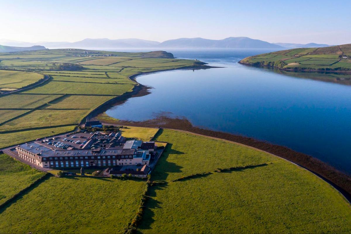
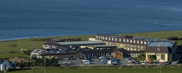
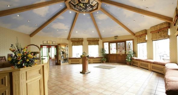
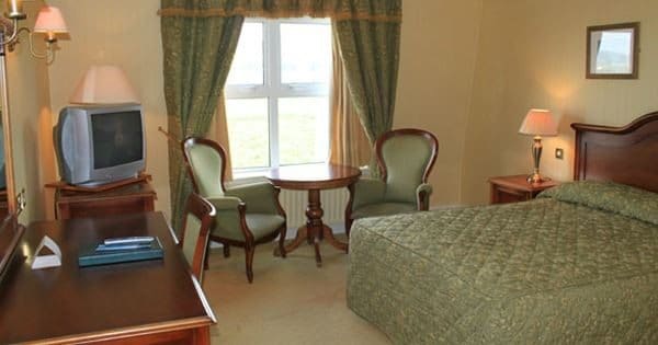
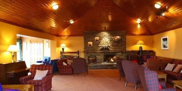
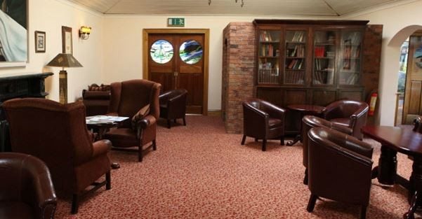
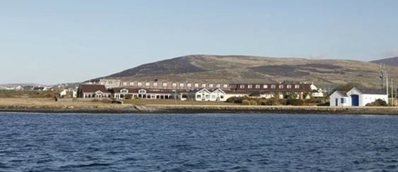
The Dingle Skellig Hotel has the reputation of being one of the finest on the peninsula. The friendly staff ensures to proficiently take care of any queries and to provide local knowledge about the area and its gems. The welcoming family atmosphere and comfortable furnishing give a special value to a holiday in this hotel. After spending days out exploring the Dingle peninsula, the thoughtfully furnished rooms provide a sense of well-being and the location is not to be beaten. Additional to the luxury acccommodation, the impressive spa, sea-view restaurant and kids club cater every need of a traveller looking for true relaxation. The fine hotel is ideal for enjoying a relaxing visit and has a reputation for great hospitality.
The Dingle Skellig Hotel boasts luxury accommodation in Kerry.
All Guestrooms Feature:
Double & Single Beds
Free Wi-Fi
Satellite TV
Telephone
Hairdryer
Tea & Coffee making facilities
There are also a number of Interconnecting Rooms - ideal for families.
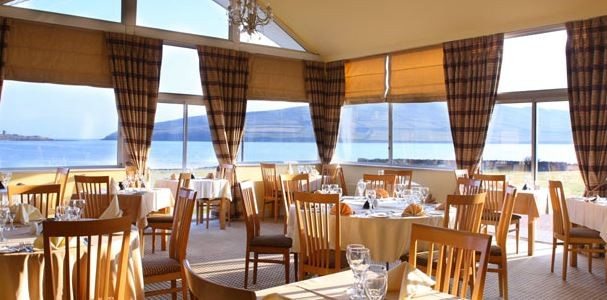
Coastguard Restaurant:
The name of the restaurant indicates its special feature: the most impressive views on Dingle. While enjoying the fresh and local food including seafood from the peninsula, the big windows allow views on Dingle Harbour and Bay, as well as the mountains of the Iveragh Peninsula. The atmosphere created by the seaview and the two beaches just outside the window makes a delicious dinner or lunch a true experience.
Blaskets Bar:
Named after the close Island, the welcoming bar boasts a freindly atmosphere and underlines the warm welcome of the hotel. It is the perfect location to relax, talk about exciting days on the peninsula and take a break between activities. There is also the possibility to enjoy seasonal entertainment including singing and dancing.
Blasket Bistro:
The new bistro offers classic and contemporary dishes with outstanding value. With the stylish furnishing and friendly staff, it is a great alternative to the restaurant.
Cocktail Bar:
The cocktail bar is perfect for advocators of more cosy surroundings and occasions calling for a warm ambience. It is most suitable to enjoy a relaxing drink or a romantic evening.
Gallarus Lounge:
For coffee lovers, or just to enjoy some relaxing time, the Gallarus Lounge offers a beautiful view on the Bay from comfortable surroundings.
Dingle Town
On the Map: Dingle is located in County Kerry on the beautiful southwest coast of Ireland. The town is most easily accessible via the N86 road from Tralee, a major town 50 minutes/ 50km to the east.
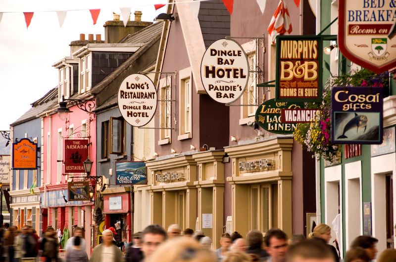
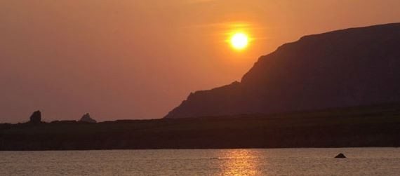
The fishing village, which is impressively beautiful and offers great free time activities like pubs, music and restaurants, is most likely the favourite spot of every (Irish) person to live. A special tip from locals is to try and pay a visit to as many pubs as possible while there. This activity is great to meet the locals and get a truely Irish experience surrounded by stunning views. Not only the beach and bay are a sight to see, but also the ancient archeological sights which are scattered all over the peninsula invite for relaxing strolls and exciting discovery tours. One highlight is the Slea Head loop drive from Dingle which is easily driven in an hour or cycled in an afternoon. For the energetic, a day spent climbing Mount Brandon, the peninsula's highest, will be richly rewarded. The views from the top on a clear day are absolutely stunning.
Check-in time is after 3:00pm on your day of arrival. Check-out time is before 12:00noon. If you require early check-in or late check-out, the hotel may be able to accommodate, contact them directly at +353 65 707 7005. Free parking is available on site.
Transportation and Guides
Rental Car - Automatic Transmission.
Meals Included
7 Full Irish Breakfasts Each Morning
Afternoon Tea
Two Dining Experiences at Award-Winning Restaurants
Food Tour in Kinsale
Points of Interest
Marvel at The Rock of Cashel & Glen of Aherlow
Stay in Charming Cork City & Daytrip to Blarney & Kinsale
Behold Amazing Views on The Ring of Kerry & Stunning Dingle Peninsula
Wonder at The Cliffs of Moher, County Clare's Burren Region and more!
Check-in time is after 4:00pm on your day of arrival. Check-out time is before 12:00pm. Free parking is available on site.
Included Unique Activities
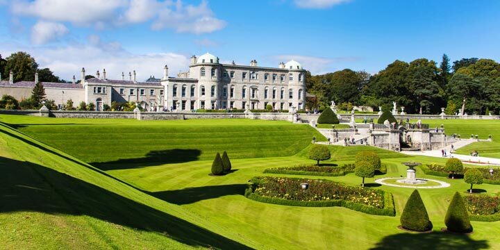
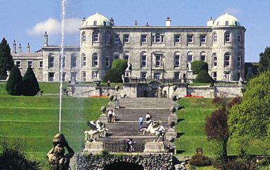
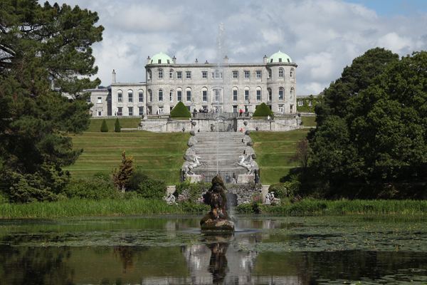
Powerscourt House and Gardens
Enniskerry, County Wicklow
Voted the No. 3 Garden in the World from National Geographic! One mile long and lined by over 2,000 beech trees, even the avenue leading to the Powerscourt House echoes the magnificence of the whole Estate. In addition the 47 acres of gardens are remarkable for their grandeur of scale, at the same time combining great delicacy and refinement of detail. The house was gutted by fire in 1974 but recently has been reborn as an exceptional tourist destination. An exhibition brings to life the rich history of the Estate. The house is now home to the best of Irish design in gifts, clothes, and furniture in the Avoca Stores and the Interiors Gallery. You can also treat yourself to a dish from the Avoca Cookbook in the Terrace Cafe. The gardens at Powerscourt were laid out in two main periods. When the house was rebuilt in the decade after 1731, the surrounding grounds were also remodelled. The design reflected the desire to create a garden which was part of the wider landscape. To the north formal tree plantations framed the vista from the house, while a walled garden, fish pond, cascades, grottos and terraces lay to the south.
Arrive at
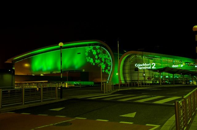
Arrive at Dublin Airport, County Dublin
Arrive at Dublin Airport after your overnight flight if you are coming from the U.S. or Canada.
Dublin is Ireland's main airport - located just north of Dublin City. If you are heading downtown, it takes approximately 20 to 30 minutes from the airport, depending on traffic. There are 2 terminals at Dublin Airport, the second of which opened to air traffic in November 2010. Most flights from the U.S. (on Aer Lingus, Delta, United, US Airways & American Airlines) arrive into Terminal 2.
Suggested Sightseeing
Powerscourt House and Gardens, County Wicklow
On the Map: Powerscourt House & Gardens is located in County Wicklow in the east of Ireland. Powerscourt is accessed via the R117 road, which intersects with the main M11/N11 approx. 30 kilometres south of Dublin City. One mile long and lined by over 2,000 beech trees, even the avenue leading to the Powerscourt House echoes the magnificence of the whole estate. In addition the 47 acres of gardens are remarkable for their grandeur of scale, at the same time combining great delicacy and refinement of detail. The house was gutted by fire in 1974 but recently has been reborn as an exceptional tourist destination. An exhibition brings to life the rich history of the estate, while the double height Georgian ballroom has been restored and hosts weddings and corporate events. The house is now home to the best of Irish design in gifts, clothes, and furniture in the Avoca Stores and the Interiors Gallery. You can also treat yourself to a dish from the Avoca Cookbook in the Terrace Cafe. Or you can visit the Powerscourt Distillery onsite as well. The gardens at Powerscourt, recently voted Number 3 in the entire world by National Geographic, were laid out in two main periods. When the house was rebuilt in the decade after 1731, the surrounding grounds were also remodelled. The design reflected the desire to create a garden which was part of the wider landscape. To the north formal tree plantations framed the vista from the house, while a walled garden, fish pond, cascades, grottos and terraces lay to the south. Walks wound through the wooded grounds and a fine tree-lined avenue was created.
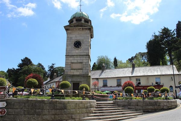
Enniskerry, County Wicklow
On The Map: Enniskerry is located in Country Wicklow, just inland from Ireland's eastern coast, and only 24 kilometres south of Dublin City. The village is accessed via the R117 road, which intersects with the main N11/M11 at Bray Town. Enniskerry is one of Ireland’s most picturesque villages, wonderfully situated in the foothills of the Wicklow Mountains. Thanks to its great location at the gateway to County Wicklow - The Garden of Ireland and its unique character, Enniskerry is a popular place to visit with tourists and locals alike. Enniskerry features superb tearooms & shops, as well as a host of picture postcard cottages and a charming village triangle centred around its clock tower. The village boasts three superb golf courses and a variety of other leisure amenities including Powerscourt Estate which features beautiful gardens, shops and Ireland’s highest waterfall. Enniskerry has a rich Victorian heritage, which is one of the reasons it regularly attracts film and television crews seeking to capture both modern-day sprit and historical charm against a backdrop of stunning scenery.
Enroute Sightseeing
Dublin, County Dublin
On the Map: Dublin, Ireland's Capital City is located on the east coast of the country, and is well served by infrastructure linking it to all parts of the Emerald Isle.
Dublin is a lively cosmopolitan city, filled with personality, pizzazz, and culture. You might spend time strolling the streets, soaking up the atmosphere, relaxing in cafes and pubs, or you could check out a world of historical, literary, and musical delights. A return visit to the Book of Kells, Phoenix Park (twice the size of Central Park), Georgian Dublin, Stephen’s Green, Dublin Castle, the National Museum, Kilmainham Gaol, and the Hugh Lane Municipal Art gallery are all possibilities. Ramble through Grafton Street, a shopper’s paradise, or simply relax and remember this most wonderful tour of the Emerald Isle.
Overnight Location
Wicklow, County Wicklow
On the Map: Wicklow Town is located on Ireland's eastern coast, approximately one hour south of Dublin City. The town is accessed via the N11 road that connects the cities of Dublin (to the north) and Wexford (to the south).
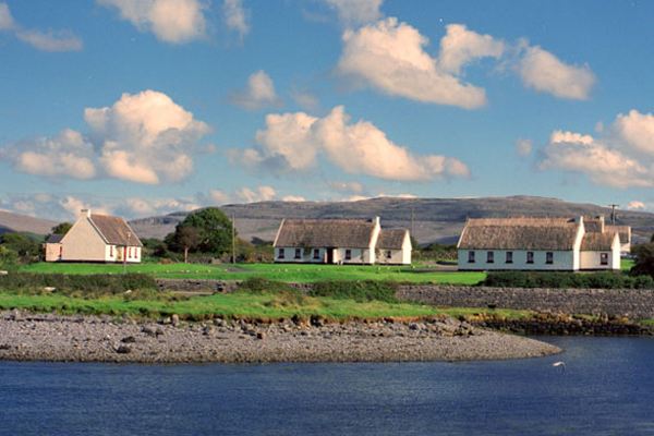
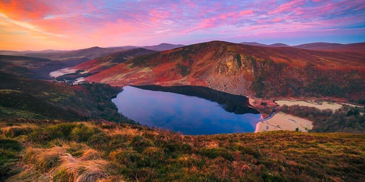
Known as “the Garden of Ireland”, Wicklow has wonderful scenery, with mountains, wooded valleys and lakes. It is fringed on the east by golden sandy beaches. Major routes to the east and west go through two of the highest passes in the country – Sally Gap and Wicklow Gap. Among its spectacular valleys are Glenmalure, Glencree, Glenmacnass, the Glen of Immal, and the most famous of all – Glendalough, the home of one of the country’s most famous early Christian sites. The county is very popular with outdoor enthusiasts for the range of activities it offers – walking, cycling, shore, coarse and game angling, golf, riding, watersports. There are also a number of historic gardens and houses to visit, Powerscourt House being the most famous and impressive. Because of its wonderful scenery, the county has been used as a location for many films over the years, including Excalibur, Braveheart, Far and Away and Michael Collins. The very successful Irish television series Ballykissangel was made in the pretty village of Avoca.
Day 2
Accommodation
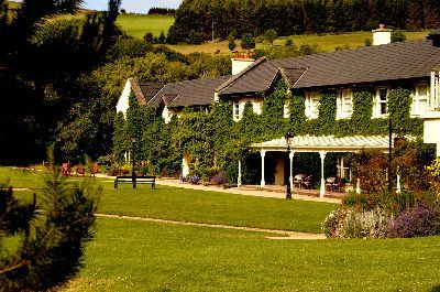
Elegant Eco-Hotel - Wicklow, County Wicklow
Room Type: Double
Check in policies:
Check-in time is after 4:00pm on your day of arrival. Check-out time is before 12:00pm. Free parking is available on site.
Included Unique Activities
Wild Food Pantry & Organic Ethos Tour
Wicklow, County Wicklow
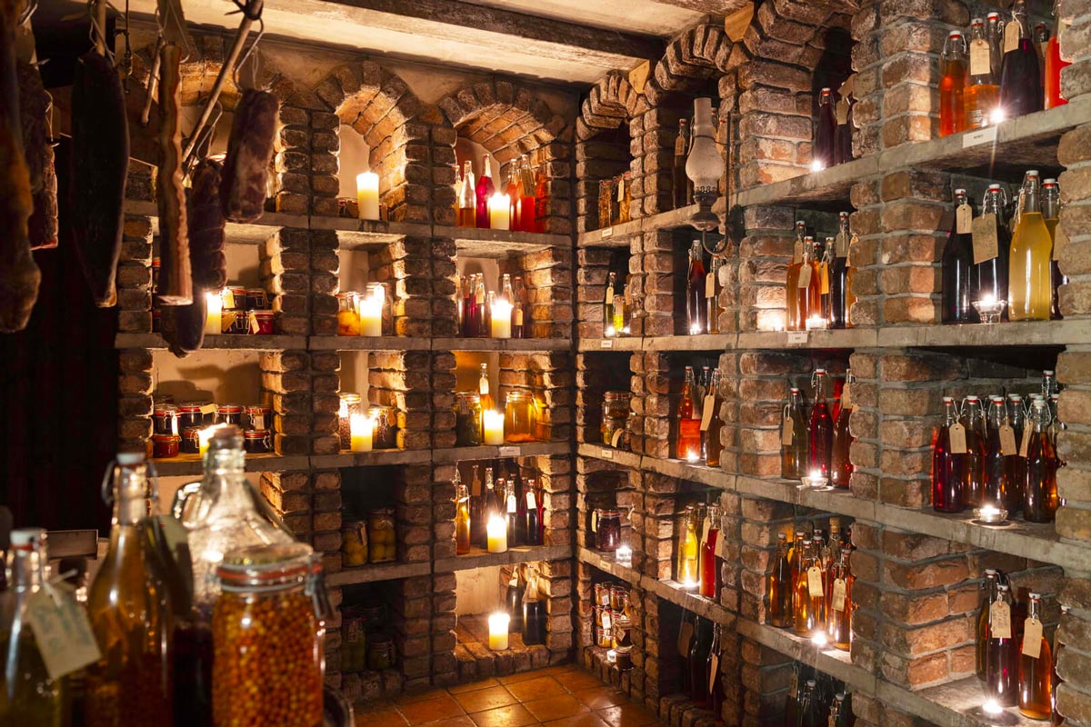
Enjoy a tour of the walk-in Wild Foods Pantry at The Strawberry Tree which features all the produce foraged by the Kitchen Brigade and its location within the restaurant allows guests to pay a visit to see how precious these foods are. The Wild Foods Pantry is also home to some mouth-watering Irish cheeses which can be enjoy whilst learning about the organic wild food ethos at Maccreddin Village.
Dinner at the Strawberry Tree
Wicklow, County Wicklow
Enjoy a special dinner at The Strawberry Tree at Brooklodge Hotel & Macreddin Village. The multi-award winning Strawberry Tree Restaurant is Ireland’s first certified Organic Restaurant. The innovative cuisine is matched by the dramatic surroundings, which includes a walk-in Wild Foods Pantry, featuring much of the produce foraged and prepared by our crew, as well as a selection of meats, cured in our own Smoke House and great Irish cheeses.
Suggested Sightseeing
Wicklow, County Wicklow
On the Map: Wicklow Town is located on Ireland's eastern coast, approximately one hour south of Dublin City. The town is accessed via the N11 road that connects the cities of Dublin (to the north) and Wexford (to the south).
Known as “the Garden of Ireland”, Wicklow has wonderful scenery, with mountains, wooded valleys and lakes. It is fringed on the east by golden sandy beaches. Major routes to the east and west go through two of the highest passes in the country – Sally Gap and Wicklow Gap. Among its spectacular valleys are Glenmalure, Glencree, Glenmacnass, the Glen of Immal, and the most famous of all – Glendalough, the home of one of the country’s most famous early Christian sites. The county is very popular with outdoor enthusiasts for the range of activities it offers – walking, cycling, shore, coarse and game angling, golf, riding, watersports. There are also a number of historic gardens and houses to visit, Powerscourt House being the most famous and impressive. Because of its wonderful scenery, the county has been used as a location for many films over the years, including Excalibur, Braveheart, Far and Away and Michael Collins. The very successful Irish television series Ballykissangel was made in the pretty village of Avoca.
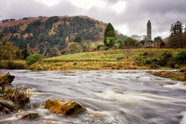
Glendalough, County Wicklow
On the Map: Glendalough is located in County Wicklow, in the east of Ireland - just 1 hour south of Dublin City. Scenically nestled in the Wicklow Mountains, Glendalough is served by a network of small country roads. From the northeast (Dublin), travel on the R755/R756, from everywhere else, arrive from the west on the R756.
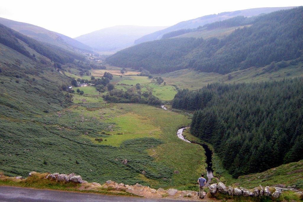
Glendalough ("The Glen of the Two Lakes"), is the site upon which St. Kevin founded a unique monastic settlement in the 6th century. Most of what remains of the settlement is in ruins but the Round Tower at Glendalough, built as a refuge from marauding Vikings, is over a 1000 years old and is remarkably well preserved. The site itself is set next to two clear water lakes beneath the sheer cliffs of a deep glacial valley. It is one of the most serene and beautiful places in all Ireland and it is easy to see why the monks picked it for a place of prayer and contemplation. There are a myriad of walking trails throughout the area making it a truly invigorating place to spend the day.
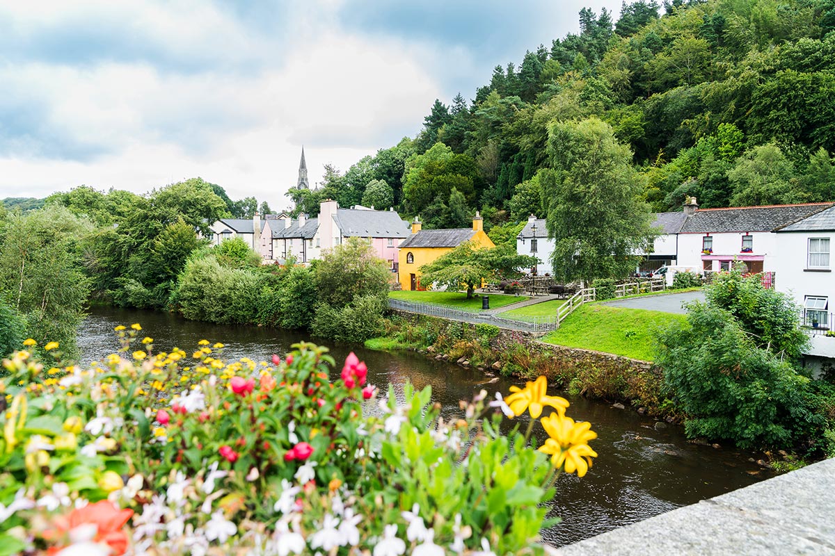
Avoca Village, County Wicklow
On the Map: Nestled in the heart of the Wicklow Mountains, Avoca is reached via a network of country roads. 1 hour/ 66km south of Dublin City in eastern Ireland, Avoca is most easily accessed from the N11 road that runs parallel to Ireland's east coast. In Avoca Village, you will find the "Meeting of the Waters" - the point at which the Avonmore and Avonbeg Rivers come together to form the Avoca River. Avoca is home to Ireland's oldest woollen mill, Avoca Handweavers, established in 1723. This family-owned craft design company began at the Old Mill where weavers produced the beautifully woven fabrics which became Avoca's hallmark. In recent years, Avoca became famous for being the setting of the popular BBC soap opera "Ballykissangel".
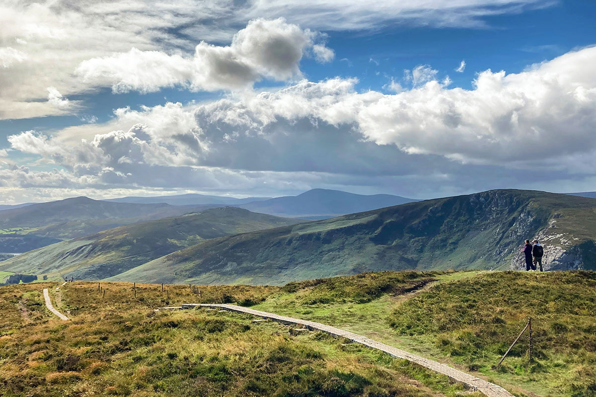
Wicklow Mountains National Park, County Wicklow
Wicklow Mountains National Park covers part of a mountain range that extends over most of County Wicklow on the east coast of Ireland. The upper slopes and rounded peaks are blanketed with heath and bog. The open vistas are interrupted only by forestry plantations and the winding mountain roads. Fast-flowing streams descend into the deep lakes of the wooded valleys and continue their course into the surrounding lowlands.
The primary purpose of Wicklow Mountains National Park is the conservation of local biodiversity and landscape. The Park is also an invaluable recreational space for locals and visitors alike. Over one million visits are estimated to be made each year. The most visited area is the scenic Glendalough Valley where the ancient monastic settlement of St. Kevin is located. Escape from the summer crowds is possible for those coming properly equipped to explore the uplands on foot, where a sense of wilderness and isolation can readily be found.
Day 3
Accommodation
5-Star City Center Manor - Cork, County Cork
Room Type: Double
Check in policies:
Check-In: 4:00 PM Check-Out: 12:00 PM
We offer all of our guests complimentary, secure, on site car parking. We also have a valet service available 7 days a week for a fee.
Included Unique Activities
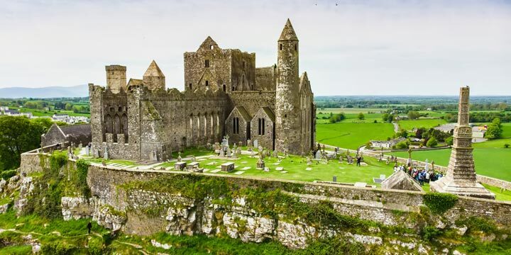
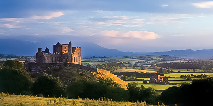
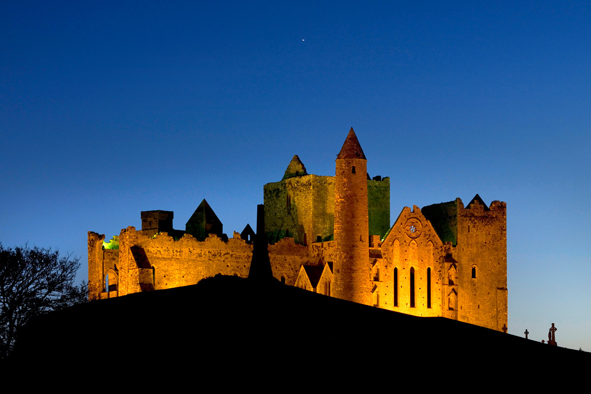
Rock of Cashel Admission
Cashel, County Tipperary
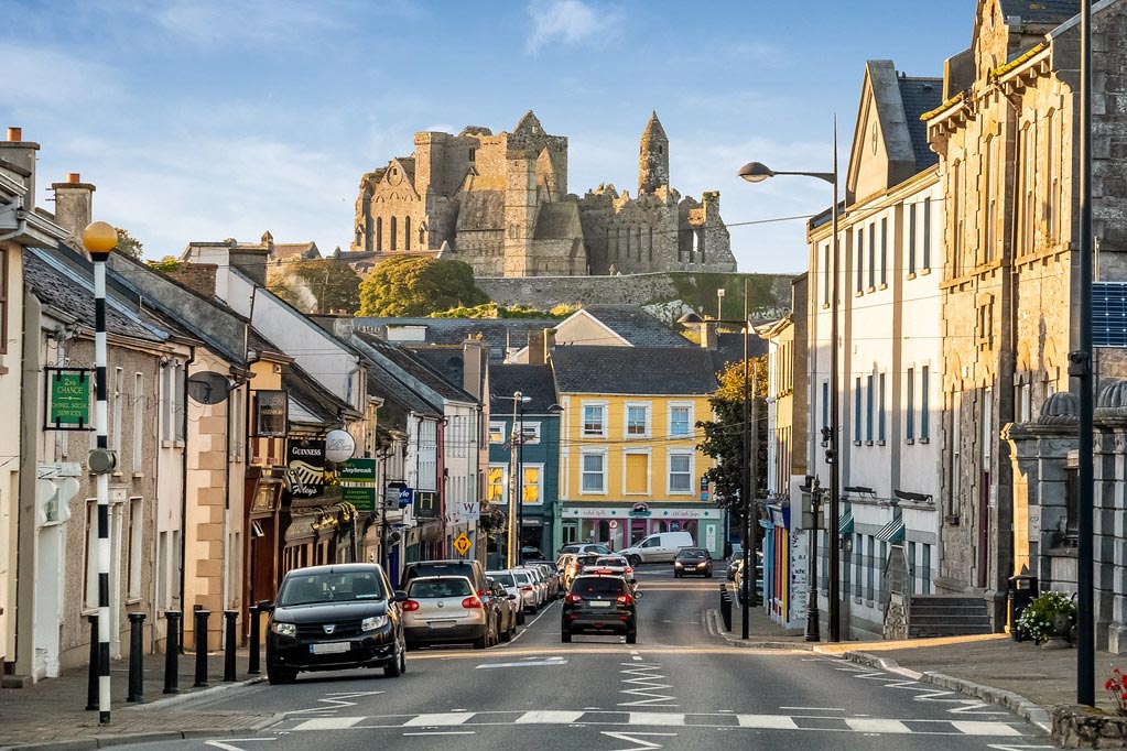
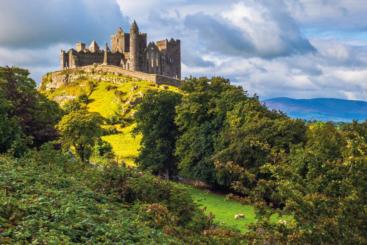
One of the most visited sites in Ireland, The Rock of Cashel is a spectacular group of medieval buildings set on a rocky outcrop of limestone, looming above the town of Cashel, County Tipperary. There is a 12th Century round tower, High Cross and Romanesque Chapel, 13th century Gothic cathedral, 15th century castle and the Hall of the Vicars. Long before the Norman invasion, The Rock of Cashel was the seat of the High Kings of Munster, although there is little structural evidence of their time here. Most of the buildings on the current site date from the 12th and 13th centuries when the Rock was gifted to the Church. The complex has a character of its own, unique and native, and is one of the most remarkable collections of Celtic art and medieval architecture to be found anywhere in Europe.
Suggested Sightseeing
Cashel, County Tipperary
On the Map: Cashel is located in County Tipperary in the southern midlands of Ireland. The main M8 motorway connecting the major cities of Dublin (to the northeast) and Cork (to the southwest) passes right by the town.
If one approaches Cashel from the north on the main Dublin to Cork road, you will round a 21st century bend and suddenly be transported back 1,500 years. There, standing proud on the plains, is the great 4th century fortification of Cashel - the stone fort. This was the seat of kings and medieval bishops for 900 years and flourished until the early 17th century. Indeed there was a settlement here from pre-Christian times, traces of which have long since vanished. Brú Ború - the palace of Ború - is a national heritage centre at the foot of the Rock of Cashel. This cultural and interpretative village is designed around a village green and is home to the study and celebration of native Irish music, song, dance, story telling, theatre and Celtic studies. Cashel itself is a busy little market town and is a handy place to break the journey between Dublin to Cork.
Enroute Sightseeing
Rock of Cashel, County Tipperary
On the Map: Cashel is located in County Tipperary in the southern midlands of Ireland. The main M8 motorway connecting the major cities of Dublin (to the northeast) and Cork (to the southwest) passes right by the town.
The Rock of Cashel (Carraig Phádraig), more formally St. Patrick's Rock, is also known as Cashel of the Kings. One of the most visited sites in Ireland, The Rock is a spectacular group of medieval buildings set on a rocky outcrop of limestone, looming above the town of Cashel, County Tipperary. There is a 12th Century round tower, High Cross and Romanesque Chapel, 13th century Gothic cathedral, 15th century castle and the Hall of the Vicars. Long before the Norman invasion The Rock of Cashel was the seat of the High Kings of Munster, although there is little structural evidence of their time here. Most of the buildings on the current site date from the 12th and 13th centuries when the rock was gifted to the Church. The buildings represent both Hiberno-Romanesque and Germanic influences in their architecture. The complex has a character of its own, unique and native, and is one of the most remarkable collections of Celtic art and medieval architecture to be found anywhere in Europe.
Open Hours:
Mid March. – Mid Oct. Daily 9am – 5:30pm Last admission at 4:45pm Mid Oct. – Mid March Daily 9am – 4:30pm Last admission at 3:45pm
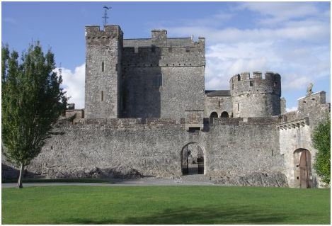
Cahir, County Tipperary
On The Map: Cahir is located in the southern midlands of Ireland in County Tipperary. The town is in very close proximity to both the M8 motorway (connecting Dublin & Cork) and the N24 road (connecting Limerick & Waterford)
Cahir is a small heritage town, with a nice shopping area centred around the town square. Up to very recently, Cahir stood at the intersection of two of Ireland's busiest national routes: from Dublin to Cork, and Limerick to Waterford. As a result, the town was perennially plagued by heavy traffic, until it was eventually by-passed by newly constructed roads and motorways in the last few years. Cahir is now a far more pleasant location to visit and spend time in. Cahir is best known for the impressive Cahir Castle, located in town on an island of the River Suir. The castle is one of the largest & best-preserved in Ireland, and was originally founded in the 12th century. Much of the current structure dates from the 13th century. An audio-visual presentation of the castle's long and varied history is available on-site. The other location of note in Cahir is the Swiss Cottage. The 'Ornamental Cottage' was constructed around 1810, and primarily used for guest entertainment on the Cahir Estate.
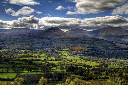
Glen of Aherlow, County Tipperary
On the Map: The Glen of Aherlow is located in County Tipperary in the southern midlands of Ireland. It stretches from the N24 road, just south of the heritage town of Tipperary, through sixteen miles of unspoilt countryside.
The Glen of Aherlow is a quiet country valley, secluded but not isolated, and affords some of the most breathtaking scenery imaginable. The Glen sits between the Galtee mountains on the south and the Slievenamuck Ridge on the North. The Galtees, Ireland's highest inland mountain range, boast five spectacular corrie lakes, dominated by a variety of magnificent peaks including Galteemore at 3,018 ft. This expansive vista is further enhanced by the many streams cascading down the face of the mountain. The foothills are forested, as is the 12 miles of the Slievenamuck ridge, providing the walker with a variety of delightful woodland trails.
Overnight Location
Cork, County Cork
On the Map: Cork City is located off the southern coast of Ireland. As Ireland's second city, it is well served by good roads - The M8 northeast to Dublin, the N20 north to Limerick & the N25 east to Waterford.
In the bustling city of Cork (often referred to as 'Ireland's Second Capital'), stroll the river walk at the University and pop into the Glucksman Gallery. Relax in a café, and hit Shandon Street, just a short walk from the main shopping district. Climb the 120 foot steeple, and ring the bells of Shandon. Soak up the city views as they fade into the countryside. Award-winning restaurants line the streets, and nightlife choices include Irish Traditional, classy nightclubs, theater, opera, plays, and dance. (Take the haunted night tour of the city jail—it’s a great way to start your evening with a bang.) Of course, there’s the Jameson Old Middleton Distillery in east Cork. Learn how Irish whiskey is made, and finish with a tasting.
Day 4
Accommodation
5-Star City Center Manor - Cork, County Cork
Room Type: Double
Check in policies:
Check-In: 4:00 PM Check-Out: 12:00 PM
We offer all of our guests complimentary, secure, on site car parking. We also have a valet service available 7 days a week for a fee.
Included Unique Activities
Kinsale Coastal Foraging and Picnic Tour
Kinsale, County Cork
Ideal for the outdoor enthusiast and foodie. Come meet us at the coastal enclave of Sandycove where we will have a sumptuous picnic waiting for you in this gorgeous location.
Relax, take in the views and breathe in the clean, salty air. We will take you on a wee excursion to forage and learn about wild seaweeds, shellfish and plants. Feast on local and wild foods in your delectable picnic.
Suggested Sightseeing
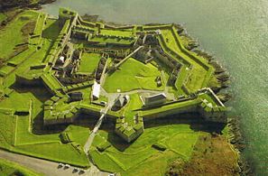
Charles Fort, Kinsale, County Cork
Charles Fort is a classic example of a late 17th century star-shaped fort. William Robinson, architect of the Royal Hospital in Kilmainham, Dublin, and Superintendent of Fortifications, is credited with designing the fort. As one of the largest military installations in the country, Charles Fort has been associated with some of the most momentous events in Irish history. The most significant of these are the Williamite War 1689-91 and the Civil War 1922-23. Charles Fort was declared a National Monument in 1973. Across the estuary is James Fort designed by Paul Ive in 1602.
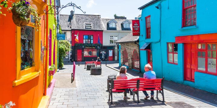
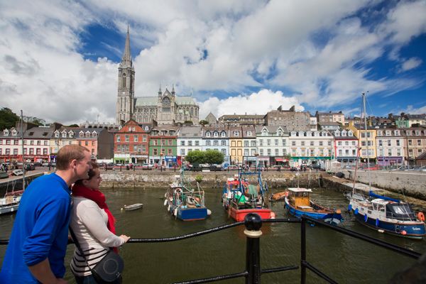
Kinsale, County Cork
On the Map: Kinsale is located in County Cork on Ireland's southern coast. From the main N71 road connecting Cork City (to the north) & Skibbereen/ Bantry (to the west), Kinsale is accessible via a variety of country roads.
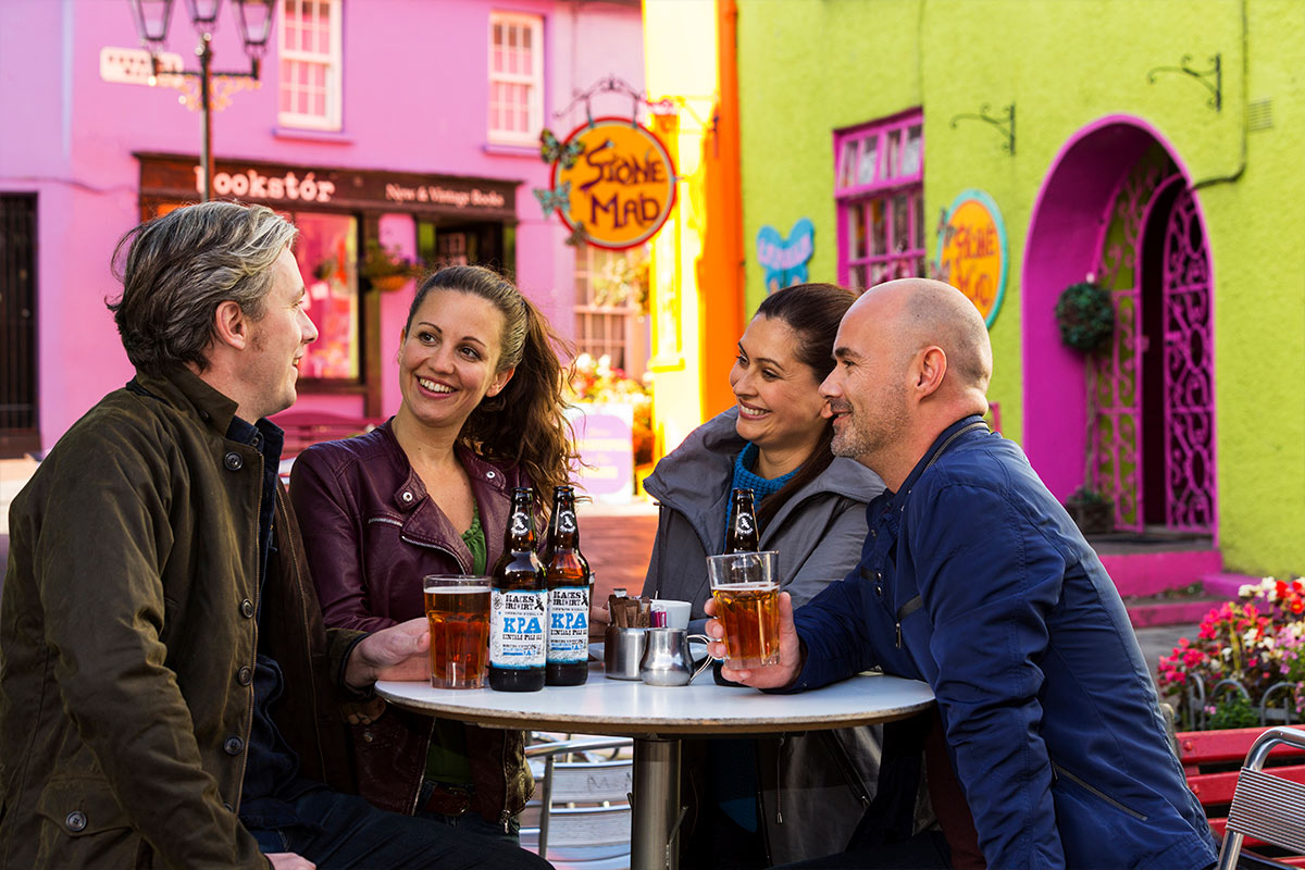
Located just 16 miles from Cork City in a naturally protected harbour, Kinsale is one of the most picturesque, popular and fashionable towns on the southwest coast. Kinsale is a centre for yachting, sea angling, gourmet eating and golf. Restaurants in Kinsale pride themselves on their high reputation for culinary expertise, and the Good Food Circle has been organizing a Gourmet Festival here every autumn for over 25 years. A charming town, its narrow streets are steeped in history and its harbour is always full of boats. Visit the museum housed in the French Prison or, just outside the town, the star-shaped Charles Fort with its spectacular views, before retiring to one of the town's many cozy atmospheric pubs.
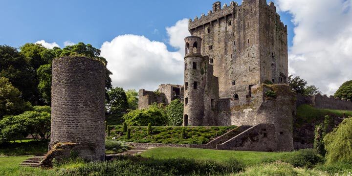
Blarney, County Cork
On the Map: Blarney is located in County Cork in the south of Ireland. The village is a mere 20 minutes/ 11km northwest of Cork City. It is accessed via the R617, which intersects with the main N20 (Limerick City to Cork City) road just north of Cork City.
Blarney is a charming village, most renowned for its famous castle and stone. The impressive Blarney Castle, perched on solid limestone, dates from 1446 and is situated on magnificent grounds. The castle was constructed by one of Ireland's greatest chieftains, Cormac MacCarthy, and has been attracting attention beyond Munster ever since.To acquire 'The Gift of Gab' one must kiss the Blarney Stone - located just beneath the battlements at the very top of Blarney Castle. This involves bending over backwards at quite a height - perhaps not to be attempted by the faint-hearted! Rumor has it that if you kiss the legendary 'Stone of Eloquence', you'll never again be lost for words!
Day 5
Accommodation
Stunning View Hotel - Dingle, County Kerry
Room Type: Double
Check in policies:
Check-in time is after 4:00 pm on the day of your arrival. Check-out is before 12:00pm on day of departure.
Free car parking is available onsite.
Enroute Sightseeing
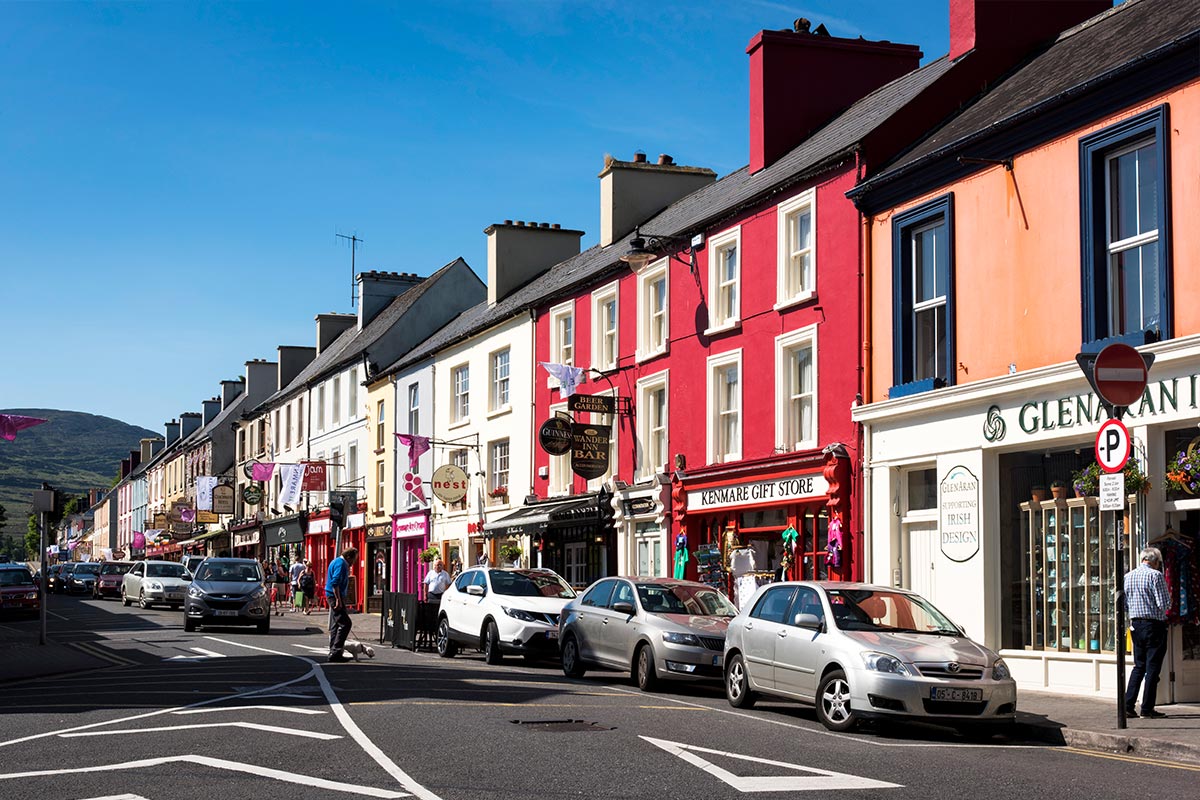
Kenmare, County Kerry
On the Map: Kenmare is located in scenic County Kerry in the southwest of Ireland. The town is accessed via the scenic N71 road that connects the cities of Killarney (to the north) & Glengarriff (to the south).
Kenmare, with its pastel coloured houses, is along with Killarney, a usual starting point for the Ring of Kerry round trip. The small charming town, founded by a handful of Englishmen in 1670, has every tourist convenience imaginable, including 2 of the most luxurious hotels in Ireland, both of which have been awarded much coveted Michelin stars: The Park Hotel and Sheen Falls Lodge. Kenmare boasts a remarkable number of excellent restaurants and quality pubs for a town of its size, and has garnered a fantastic reputation as a gourmet destination in recent years. Owing to its enviable location adjacent to Kenmare Bay and the River Finnehy, all set against the backdrop of the Kerry Mountains, Kenmare's picturesque aspect is hard to match.
Killarney to Kenmare, County Kerry
We appreciate that your time in Ireland is precious, and you simply won't be able to do absolutely everything. Completing the 110 mile Ring of Kerry, for example, might be a stretch on this tour. We do however highly recommend that you at least drive the section from Killarney to Kenmare (or vice-versa), which forms a portion of the Ring. It's only 30 kilometres/ 30 minutes each way on a narrow, winding road, but you are scenically rewarded at almost every turn. Highlights include 'Ladies View', so named for the excitement the vista illicited from Queen Victoria's Ladies-in-Waiting, during her famous 1861 visit. There's a little cafe and plenty of spots to pull in and admire the view that so stimulated the Royal Entourage 150 years ago! A little further along the road, you'll arrive at Moll's Gap. Set high on a rocky ridge, The Gap overlooks mountains, rivers, lush countryside and the famous Lakes of Killarney, with truly breathtaking views - Carrauntoohill, Ireland's highest mountain to one side, the Gap of Dunloe to the other. There's also an Avoca Store & Cafe at The Gap, selling the finest of Irish goods and souvenirs.
Killarney, County Kerry
On the Map: Killarney is located in County Kerry in the southwest of Ireland. The town is reached via the N22 from Tralee/ Limerick (to the north) and the N22 from Cork City (to the southeast).
Killarney lies on the edge of the astoundingly beautiful Killarney National Park, with its three magnificent lakes and the spectacular MacGillycuddy Reeks mountain range. The park is also home to Muckross House and Gardens. Killarney is a wonderful base for all manner of activities including angling and water sports, golf, riding, orienteering, hiking, cycling, and canoeing. The town itself is quite small but full of charm - this you will soon see as you walk down the brick footpaths and pass curious old-style shop fronts. Killarney is well known for its excellent shops, restaurants and cosmopolitan appeal. It is also renowned for its evening entertainment including many singing pubs, cabarets, dancing venues, and banquets. Traditional Irish music can also be heard in many of the local pubs on a nightly basis.
Ring of Kerry, County Kerry
On the Map: The Ring of Kerry (Iveragh Peninsula) is in County Kerry in the southwest of Ireland. Killarney is the usual starting point for people completing the Ring, although Kenmare is another good option for this purpose. The N70 road encircles the entire peninsula.
The Ring of Kerry is one of Ireland’s most scenic touring routes. At 110 miles long, it circles the awe-inspiring Iveragh Peninsula. You’ll feel as if you have moved into nature’s mystic arena, and truly you have, as you pass between soft mountains, through forest glades, around bogs, rivers, lakes and pristine beaches. The road between the magnificent MacGillycuddy Reeks Mountains presents secret passes and valleys dotted along the fabled shores of Dingle and Kenmare Bays. Ireland’s natural beauty sings throughout the Ring of Kerry. You may wish to explore several charming villages along the route, including Glenbeigh, Waterville, and Sneem. Stroll and talk to people—this is what makes your travel experience unique. The Ring attracted Ireland’s first settlers, and has a wealth of ancient sites. A 6th century monastery, clinging to the windswept cliffs of the Skellig Islands, is a UNESCO World Heritage site. Staigue Stone Fort is an Iron Age stronghold dating from 300BC. This is also an area of Ogham Stones, the first mysterious forms of writing and art, nestled along the Ring. Follow the drive to Killarney by way of the Ladies View and the legendary Lakes of Killarney and the National Park. The Ring of Kerry is the stuff of dreams and lifelong memories.
Overnight Location
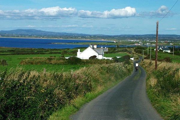
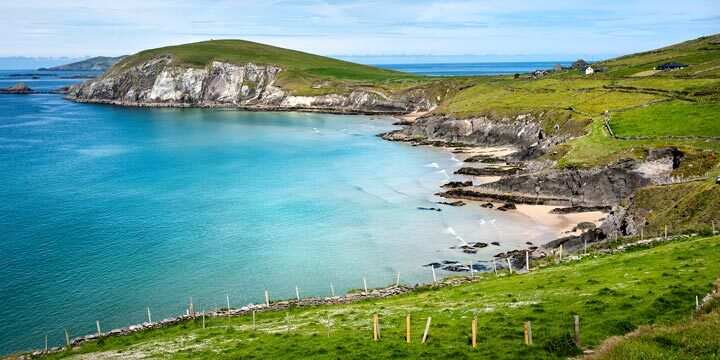
Dingle, County Kerry
On the Map: Dingle is located in County Kerry on the beautiful southwest coast of Ireland. The town is most easily accessible via the N86 road from Tralee, a major town 50 minutes/ 50km to the east.
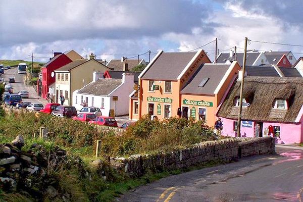
Dingle is located in County Kerry on the lush southwest coast of Ireland. The residents of Dingle, or AnDaingeanas as they are officially known, are the envy of many. Their lovely fishing village is in what, some believe, is the most beautiful part of the Emerald Isle. The village is filled with charm, color, and quirky characters. There are numerous pubs on every block. All offer up lively traditional music and steaming bowls of fresh chowder.
The Dingle Peninsula has many archeological sites, including ancient stone forts and beehive huts. Feel free to wander among them. Every turn of the coastal road reveals beauty that tugs at your heart. One of the highlights is Slea Head Loop. If you’re a climber, the views from Mount Brandon are stunning.
Day 6
Accommodation
Stunning View Hotel - Dingle, County Kerry
Room Type: Double
Check in policies:
Check-in time is after 4:00 pm on the day of your arrival. Check-out is before 12:00pm on day of departure.
Free car parking is available onsite.
Included Unique Activities
Dingle Tasting Tour
Dingle, County Kerry
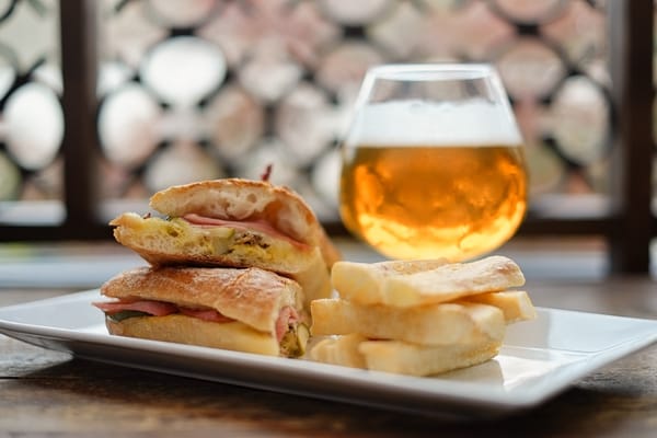
The Dingle Tasting Tour is a mix of tasting and sightseeing in Ireland’s No. 1 foodie town. Our experienced guides will walk you through Dingle stopping at many of the best food and drink destinations the town has to offer. From hidden gems to local favourites, each of our locations are specially selected for the unique taste of Dingle that they offer. Everything from seafood straight off the boat and locally farmed beef to Dingle brewed gin and craft beer, is on the menu. At each stop you will enjoy a variety of tastings of authentic, local food and drinks which have been created and chosen especially for our tours.
Suggested Sightseeing
Dingle, County Kerry
On the Map: Dingle is located in County Kerry on the beautiful southwest coast of Ireland. The town is most easily accessible via the N86 road from Tralee, a major town 50 minutes/ 50km to the east.
Dingle is located in County Kerry on the lush southwest coast of Ireland. The residents of Dingle, or AnDaingeanas as they are officially known, are the envy of many. Their lovely fishing village is in what, some believe, is the most beautiful part of the Emerald Isle. The village is filled with charm, color, and quirky characters. There are numerous pubs on every block. All offer up lively traditional music and steaming bowls of fresh chowder.
The Dingle Peninsula has many archeological sites, including ancient stone forts and beehive huts. Feel free to wander among them. Every turn of the coastal road reveals beauty that tugs at your heart. One of the highlights is Slea Head Loop. If you’re a climber, the views from Mount Brandon are stunning.
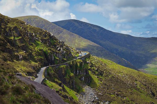
Conor Pass, County Kerry
On the Map: The Conor Pass is located just northeast of Dingle town on the Spa Road.
The Conor Pass is the highest mountain pass in Ireland, and provides the most dramatic and scenic way of entering or leaving Dingle. This narrow, twisting road runs between the town of Dingle and Kilmore Cross on the north side of the peninsula, where roads fork to Cloghane/Brandon or Castlegregory. The views from the road are breathtaking, as the glaciated landscape of mountains and corrie lakes comes into view. From the scenic carpark at the summit there are views as far as the Aran Islands, located off the coast of County Galway
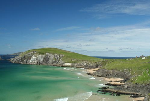
Slea Head, County Kerry
On The Map: Slea Head is located on the Dingle Peninsula in the south west of Ireland. From Dingle town, head west on the R559 that encircles Slea Head and eventually returns to Dingle.
The Slea Head Drive is a circular route, beginning and ending in Dingle, that takes in a large number of ancient & megalithic attractions as well as offering stunning views on the western end of the peninsula. The route is clearly labelled by road signs throughout its length. To properly enjoy the Drive, a half-day should be set aside for the journey. The route is suitable for motorists, but is also ideal for cyclists: it is possible to hire a bike at a number of locations in Dingle.
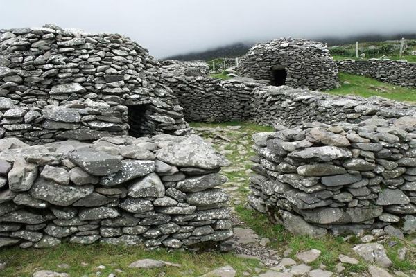
Ancient Dingle, County Kerry
On the Map: The Dingle Peninsula is located in County Kerry on the beautiful southwest coast of Ireland. It is most easily accessed via the N86 road from Tralee, a major town 50 minutes/ 50km to the east.
The Dingle Peninsula is world-renowned as a place of great scenic beauty, and many would argue that it is indeed the most picturesque location in all of Ireland. There is however, simply no argument with regard to its massive archaeological importance. No other landscape in western Europe boasts the density and variety of ancient monuments as the Dingle Peninsula. It has supported various tribes and populations for almost 6,000 years, and because of its remote location and lack of agricultural development, there is a remarkable preservation of over 2,000 monuments! From Stone Forts & Monastic sites to Ogham Stones & ancient Sun Dials, the peninsula literally has it all. One of the most notable sites is the 6th century Gallarus Oratory - a remarkably well-preserved early Christian church. Quite how it has survived the ravages of Atlantic weather for so long is a testament to its builders. No mortar was used in its construction, and aside from a slight sag in the roof, it is in perfect condition! Overlooking the village of Camp, you'll find Cathair Con Ri, the finest promontory hill fort in the country. Stunningly located at 2000 feet above the valley, this impressive cliff-top stronghold dates from 500 BC to 500 AD.
Day 7
Accommodation
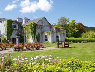
Historic Manor House - Ballyvaughan, County Clare
Room Type: Double
Check in policies:
Check-in time is after 3:00pm on your day of arrival. Check-out time is before 12:00noon. If you require early check-in or late check-out, the hotel may be able to accommodate, contact them directly at +353 65 707 7005. Free parking is available on site.
Included Unique Activities
Cliffs of Moher Exhibition Centre
Doolin, County Clare
The Cliffs of Moher stand at 700 ft, at their highest point, above the wild Atlantic shore below. Their range covers 5 miles. O'Brien's Tower magnificently stands on a headland of the majestic Cliffs. On a clear day, you can spot the Aran Islands, Galway Bay, the Twelve Pins, the MaumTurk Mountains in Connemara, and Loop Head to the south.
The state-of-the-art Atlantic Edge Interpretative Centre is a thrilling and recent development here. A huge, domed cave contains exhibits, displays, and experiences. (There is a ramp that makes the dome accessible to all.) When entering the dome, you have the illusion of walking on water as you follow birds’ footprints. There are four main themes here: Ocean; Rock; Nature; and Man. There is no place else on earth where you feel the raw power of the ocean as you feel it at the Cliffs of Moher. Sunrise and sunset visits are very special and memorable.
Suggested Sightseeing
Doolin, County Clare
On the Map: The small village of Doolin is located on County Clare’s west Atlantic coast. The village is accessed via the R479 - a small country road that intersects with the R478 connecting the towns of Lisdoonvarna (to the north) and Lahinch (to the south).
People flock to Doolin from all over the world to sample wonderful, top quality traditional music in the local pubs. Until recently Doolin had only three pubs. There are now some new establishments on the scene but we recommend sticking to the old reliables: McGann’s, McDermots and O’Connor’s. Even at that you will be spoiled for choice. Each pub is full most nights with musicians and music lovers alike. Be sure to check out all three! The surrounding area has much of interest including the barren yet strikingly beautiful Burren region with, among other things, the 5,000 year-old Poulnabrone Dolmen. Also worth a visit is Doonagore Castle and of course the spectacular 650-foot high Cliffs of Moher, which are only a few miles from Doolin.
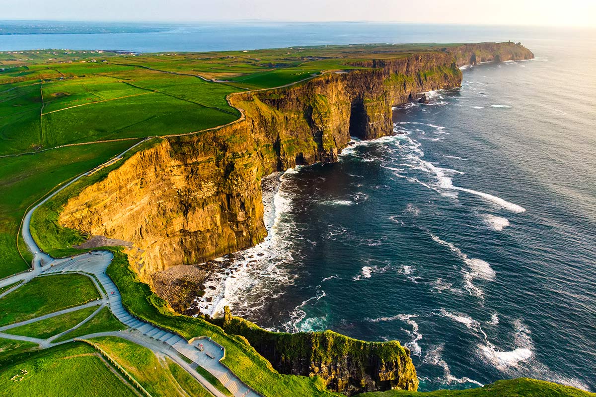
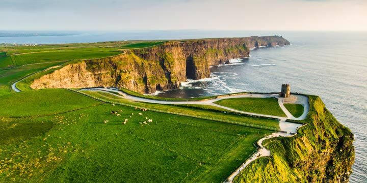
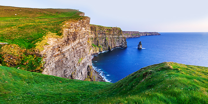
Cliffs of Moher, County Clare
On the Map: The Cliffs of Moher are located on the western coast of County Clare. The Cliffs are accessed via the R478 road that connects Doolin (to the north) and the seaside town of Lahinch (to the southeast).
The Cliffs of Moher are one of Ireland's top Visitor attractions. The Cliffs stand 214 metres (700 feet) tall at their highest point and range for 8 kilometres over the Atlantic Ocean on the western seaboard of County Clare. O'Brien's Tower, constructed by Sir Cornellius O'Brien in 1835, stands proudly on a headland of the majestic Cliffs. From the Cliffs one can see the Aran Islands, Galway Bay, as well as The Twelve Pins, the Maum Turk Mountains in Connemara and Loop Head to the South. There are two paths to take north and south along the cliff edge, providing spectacular views all the way. Construction of an award winning eco-friendly Visitor Centre was completed in 2007. The interpretive centre named 'Atlantic Edge' contains state of the art displays and visitor facilities. The grass-roofed building is cleverly set into the hillside - a unique cave-like structure which minimises the visual impact on this fabulously scenic location.
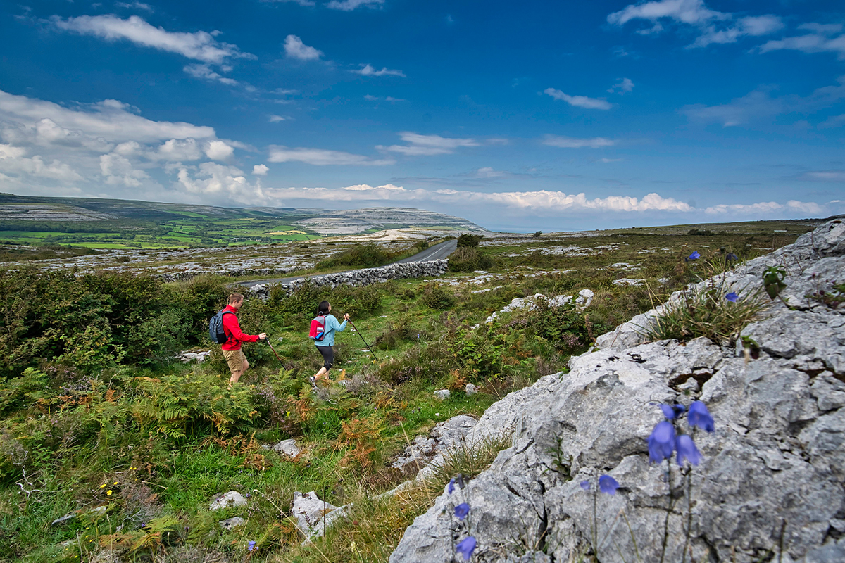
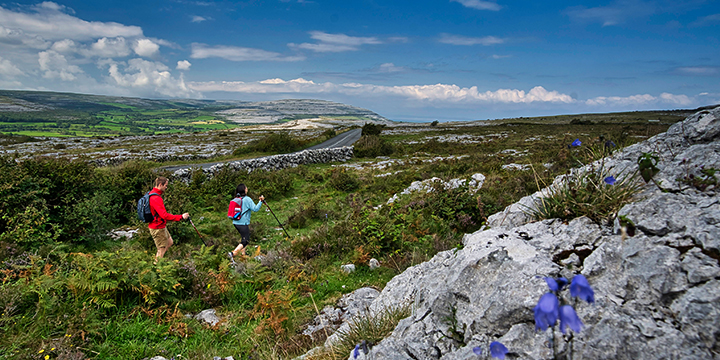
The Burren, County Clare
On the Map: The Burren is located in the north of County Clare in Ireland's west. The closest town is Ballyvaughan to the north, but the Burren is also easily accessible from Doolin, Lisdoonvarna (to the west) and Ennis (to the south).
The Burren, or Boireann, meaning Great Rock, is in County Clare. It is, without dispute, one of the most unique - and strangest - landscapes in Europe. The Burren occupies approximately 250 square kilometers. Bounded by the Atlantic on the west and rocked by Galway Bay to the north, it is a multi-layered landscape where rare and delicate plants have adapted in order to thrive and flourish between harsh crevices. Stroll the meadows, be astonished by the boulders, and read the trail marks and footprints that the ice age and volcanoes left behind. The Burren is littered with ancient and megalithic sites. The most dramatic of these is the Poulnabrone Dolmen, an impressive 5,000 year old portal tomb. Poulnabrone is one of the most famous megalithic monuments in Ireland. Just how the people of the time managed to get the truly massive capstone in place, is a mystery which continues to baffle archaeologists.
Enroute Sightseeing
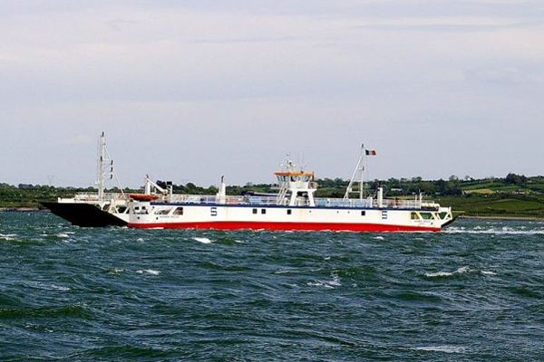
Tarbert-Killimer Car Ferry, County Kerry
On The Map: The Tarbert-Killimer ferry traverses the Shannon Estuary in the west of Ireland & links the counties of Kerry (Tarbert town) to the south & of Clare (Killimer) to the north.
If you are travelling from County Kerry north to County Clare, or vice-versa, you may wish to contemplate taking the Killimer-Tarbert ferry across the Shannon Estuary. The pleasant 20 minute crossing can save quite a few miles in the car, and offer the chance to take a relaxing break from driving. Ferries operate year-round, and advance reservations are not necessary. The ferry departs Killimer every hour on the hour (0700hrs to 2100hrs from June to August & 0700hrs to 1900hrs Rest of Year) and from Tarbert, every hour on the half-hour (0730hrs to 2130hrs from June to August & 0730hrs to 1930hrs Rest of Year).
Spanish Point, County Clare
On The Map: Spanish Point is located in County Clare on the west coast of Ireland. The seaside village is accessed via the R478 road, which loops from the N67 connecting Lahinch to the northeast, and Kilkee to the southwest. Spanish Point takes it’s name from the unfortunate Spanish who died here in 1588, when many ships of the Spanish Armada were wrecked during stormy weather. Those who survived the wrecking and sinking of their ships and made it to land were executed by Sir Turlough O'Brien of Liscannor and Boethius Clancy, High Sheriff of County Clare at the time. Nowadays Spanish Point is a lot more welcoming to visitors! Holiday-makers enjoy the beach and seaside activities that are available here during the summer, swelling the local population each year. Spanish Point is one of County Clare's lesser known beaches, making it an attractive spot to visit all year round - especially for those seeking scenic beauty, peace and tranquillity.
Overnight Location
Ballyvaughan, County Clare
On the Map: Ballyvaughan village is situated in northern County Clare, in the heart of the Burren Region, and close to Ireland's west coast. The village is accessed via the N67 road that connects the cities of Lisdoonvarna (to the west) & Kinvara (to the east).
Ballyvaughan is the ideal place for almost everybody: those who look for peace and tranquility in their holidays, those who look for traditional music and old pubs, for archaeologists, botanists and fishermen. Families will enjoy the safety of the beach in Bishopsquarter, surfers will love the waves in Fanore. Hillwalking and cycling are among the most popular pastimes among locals and tourists alike. It is also a great base for exploring some of the best known landmarks of Ireland - The Cliffs of Moher, Poulnabrone Dolmen and Alliwee Caves to name but a few.
Day 8
Depart From
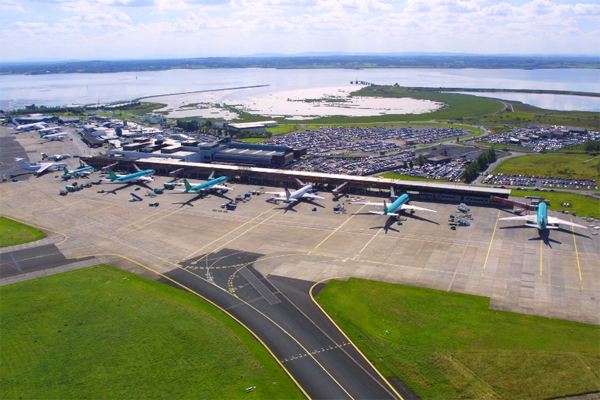
Depart from Shannon Airport, County Clare
Return to Shannon Airport three hours prior to your flight's scheduled departure. Shannon is a small, convenient airport, so this will allow ample time to check in for your flight home.
After check-in and passenger security, browse the array of shops on offer at 'The Loop' in Shannon Airport. Shannon is proud of its 'Duty Free' shops, and it should be: The concept of Duty-Free shopping was invented at Shannon in 1947!
2024 LOW SEASON
Available Dates
Nov, Dec
From $3,756 per person
2024 MID SEASON
Available Dates
Oct
From $3,800 per person
2024 HIGH SEASON
Available Dates
Jun, Jul, Aug, Sep
From $4,046 per person
2025 LOW SEASON
Available Dates
Jan, Feb, Mar
From $3,509 per person
2025 MID SEASON
Available Dates
Apr, May, Nov, Dec
From $3,657 per person
2025 HIGH SEASON
Available Dates
Jun, Jul, Aug, Sep, Oct
From $3,990 per person
Your Price Includes
ACCOMMODATION
7 nights Luxurious Accommodation
TRANSPORTATION
Rental Car - Automatic Transmission
DINING OPTIONS INCLUDED
7 Full Irish Breakfasts Each Morning
Two Dining Experiences at Award-Winning Restaurants
Food Tour in Kinsale
UNIQUE EXPERIENCES
Entrance to Powerscourt House & Gardens
Dinner at the Organic Strawberry Tree Restaurant
Wild Food Pantry Tour
Entrance to the Rock of Cashel
Food Tour in the Gourmet Town of Kinsale
Dingle Tasting Tour
Entrance to the Cliffs of Moher
POINTS OF INTEREST
Marvel at The Rock of Cashel & Glen of Aherlow
Stay in Charming Cork City & Daytrip to Blarney & Kinsale
Behold Amazing Views on The Ring of Kerry & Stunning Dingle Peninsula
Wonder at The Cliffs of Moher, County Clare's Burren Region and more!
Prices Based On
Prices are per person based on 2 people traveling together and sharing 1 room.
All Taxes & Fees Included
Custom Priced Quote (Want to Add/Subtract Days? Let Us Know!)
Traveling alone? No problem. Just ask us for a single supplement price.
"Great trip in Ireland & Scotland"
Nov 24, 2023
Tena
Ireland/Scotland trip was a great trip planned with our group and Jorie. We thoroughly enjoyed each city we visited in both countries. All our hotels were very nice but as older adults, I would advise to pack light which is hard to do if your visit is extended but we had to climb stairs in several places. My favorite thing in both countries are the people. Everyone was so friendly and inviting at hotels, restaurants and local sites. We felt completely safe and comfortable. I would agree with other travelers that driving is stressful for both driver and passengers especially in Ireland where the roads are extremely narrow with rock walls on each side. Next trip will include staying in certain cities with tours out. JerPoint Park in Ireland was a favorite of our group of 4. Authentic Vacations plans, reservations and communications were first rate.
"Wonderful Scottish and Irish adventure"
Nov 14, 2023
James
South Carolina
Lauren, thank you for putting together a wonderful Scottish and Irish adventure. In many unexpected ways it indeed was an adventure that we will remember forever. So sincere thanks. Despite a glitch in St Andrews your team's recovery actually made St Andrews the highpoint of our trip. Staying at Rusacks overlooking the first tee and eighteenth green of the old course was awesome. All the Hotels were first rate. Experiences - awesome The Clontarf Castle is an awesome way to the trip. Well done y'all. Big city stays - We all felt like we could have used an extra day in the larger cities. They all had a story to tell, and we just had enough time to scratch the surface. Self-drive - while less expensive alternative, the person doing the driving misses out on a lot in transit, while the passenger's white knuckle thru the driver's learning process. Also, the roads in Scotland and Ireland are no joke. Would recommend it is worth it to hire a private chauffer driver or go Small Guided for sure.
"Scotland Birthday Trip"
Nov 9, 2023
Michelle
Agency
Adina, I'm following up on my client's train/whiskey tour/ birthday trip to Scotland in October. They had a wonderful time! The whiskey tour day was their favorite, made extra special by their driver Alec who was a superstar. My client's boyfriend is a real train enthusiast. They enjoyed all the train trips, and Nick was like a child on the Jacobite train. Thanks so much for your help with this trip. You clearly know Scotland and planned a very nice route with some unique requirements. I greatly appreciate your expertise and attentive service. I look forward to working with you again in the future. An early Happy Holidays!
"Memorable Trip in Italy"
Nov 9, 2023
Loryl
Fort Thomas, KY
Amber, I received this email from my client Mrs. R this morning - I love being able to share these with you all :).
"Loryl, WOW! What a wonderful trip we had in Italy! Thank you for helping make this trip so memorable. We have so many wonderful memories that we will cherish forever. It was a trip of a lifetime. Thank You! I guess we need to start thinking about our next trip. "
"Trip of a lifetime in Ireland"
Nov 2, 2023
Cathryn
Jennifer, I want to thank you for planning and arranging our wonderful vacation in Ireland. Everything was easy Peezy as my granddaughter would say. The hotels were all beautiful, each one was uniquely different and beautiful. We enjoyed each and the food was enjoyable. We enjoyed all the extra goodies. We were not able to take either sea cruise as the weather canceled the trips. The best decision we made was to have a guide /driver. Martin was an absolute wonder. I wanted to bring him home with us. He saw to every detail and was extremely entertaining to boot. His recommendations were spot on to our interests. I think he knows everyone in Ireland. The car was super too. The back seats were massage chairs. How cool can you get? As a great extra the Owner of Screebe House bought two of my paintings and commissioned two more. Again, many thanks for the trip of a lifetime.
"Two-week trip to Ireland and Scotland"
Nov 1, 2023
Wanda
Our vacation was wonderful we had a great time on our two-week trip to Ireland and Scotland. Jorie helped us plan our trip, she worked hard to include all the places we wanted to see and selected some great adventures for us to enjoy along the way. We truly loved Ireland, the countryside the beautiful sights and the flowers blooming everywhere made our visit one to remember for sure.
"Wonderful Anniversary Trip in Ireland"
Oct 31, 2023
Tim
Hi Jorie, Rose and I had a wonderful time in Ireland! We couldn’t believe how well everything worked out and the locations selected for our stays were excellent. We really loved the Country House and Abbyglen Castle. The staff at Abbbyglen Castle were so nice and made our anniversary evening wonderful! We had no idea there was so much aviation and radio history in Clifden! As for the other locations they were all first-rate as well. We went to the “Man O’ War” Pub for dinner our last night in Ireland. It was a great recommendation. The atmosphere, hospitality, and food were awesome. Again, thank you for helping to set up a wonderful trip which we will never forget.
"All of my clients had only positive feedback"
Oct 31, 2023
Kelly
Mesa, AZ
This was my first time using Authentic Vacations. I worked with Ellie, and she knocked it out of the park! Every detail with transfers, trains, boutique hotels, castles, private tours and fantastic client feedback will keep me coming back! I had 5 vacations with varied budgets this past month. All of my clients had only positive feedback. Emails and phone correspondence were quickly answered, which can make or break my decision to partner with someone. If you are looking for a destination expert, AV will not disappoint! Thank you for making me look like a rockstar, Ellie and AV!!
Complete our inquiry form by selecting your departure date, and all other relevant fields. Be sure to let us know if you're traveling for a special occasion! We can adjust most of our vacation packages to suit your needs, based on the details you provide.
2. Online Account & Quote Created
Your request will be forwarded to our team of Destination Experts, and a price quote will be prepared, based on your submitted preferences and criteria. A free Authentic Vacations online account will also be created, allowing you to view and request changes to your quote at any time. Log into your account via “LOGIN” at the top of any of our webpages.
3. Fine-Tune Your Tour Quote
Work with your assigned Destination Expert to tweak your quote in any way you wish. Our customers continually tell us that our flexibility in this regard is exceptional – your Destination Expert’s sole brief is to create the perfect tour for you!
4. Reserve & Pay Online
Once your quote is 100% to your liking, you can pay for your package with your credit card via your Authentic Vacations online account. We also accept payment by personal check and wire transfer. We only require a 20% deposit to secure your vacation, and our Risk-Free Cancellation Policy provides you with complete peace of mind.
5. Print Your Travel Documents & Go!
Once your vacation has been paid in full, you will be able to print your travel documents directly from your online account. You’re ready to embark on your ideal, authentic vacation!!
Questions?
If you would prefer to discuss your perfect vacation on the phone, we would be delighted to hear from you! Our Destination Experts are standing-by and looking forward to speaking with you at any time during our business hours listed below. We also operate a very responsive and efficient Live Chat service on our website…instant gratification awaits!
Toll-free from the US and Canada: 1-888-443-5259 Rest of World: +1-707-687-0191
Hours of Business:
Monday – Thursday: 7:00am – 5:00pm PST
Friday: 7:00am – 4:00pm PST
Saturday: 6:00am – 3:00pm PST
Sunday: 6:00am – 3:00pm PST
With offices in Scottsdale, San Francisco, London, Dublin, Copenhagen and Edinburgh, we can offer you unrivaled support while you are abroad. We truly believe all our clients deserve an extraordinary, authentic experience!


.jpg)

.jpg)


.jpg)


.jpg)