This is a suggested itinerary for a private group with a minimum of 12 people traveling together. Some of these experiences are seasonal and may not be available. In those instances, we will source alternatives for your group.
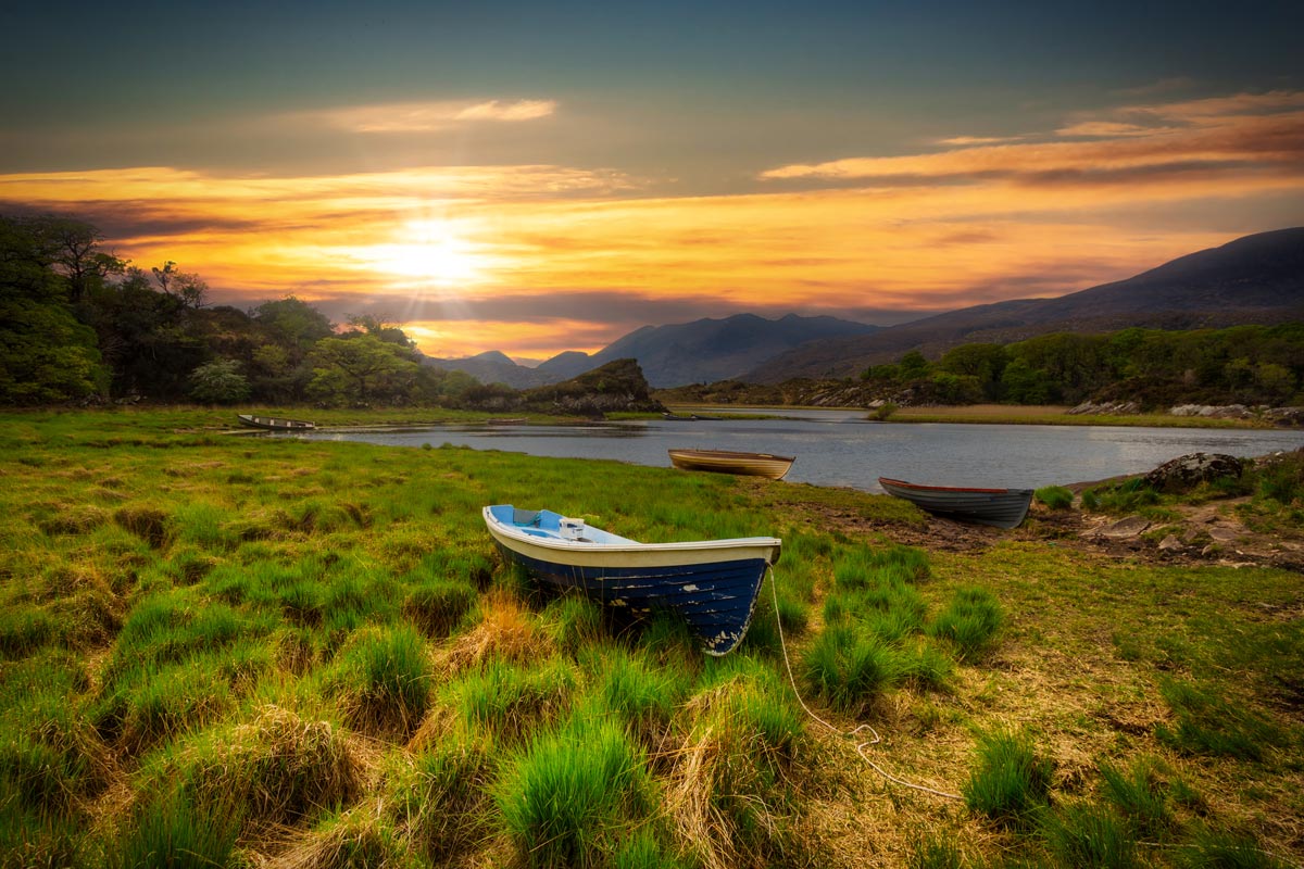
Treasures and hidden wonders comprise this small group tour of Ireland. Begin in Dublin—your personal driver regales you with tales on the way to your sumptuous 5-star hotel. Enjoy an inspired Afternoon Tea; each pastry is heaven. Savor a tasting at Guinness and then dive into pub dining at the cultural quarter, Temple Bar. Medieval Kilkenny is simply sublime… visit her Castle and feel the mysteries unfold.
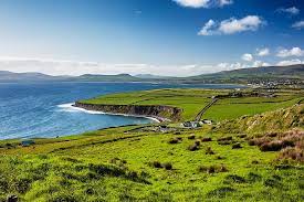
Heading to the magical Kingdom of Kerry, kiss the Blarney Stone and expect to be pampered at your exquisite lakeside hotel. Participate in a superfood seaweed tasting tour! Rollicking Dingle is nearby, but it feels worlds away. This lovely town is a favorite, and you’ll take a traditional Irish cooking course here. In the evening, go to one of her pubs. This town is famous for live music.
Now the Wild Atlantic Way is yours. Feel the ocean’s raw power. Connemara, home of poets and artists, is your base. Your journey ends in sweet County Clare with a feast and overnight stay at a 5-star castle. Try your hand at falconry or archery and then indulge in a spa treatment. This small group tour is authentically Ireland.
From $3,568 per person
Included Unique Activities
Local Driver Meet and Greet and Dublin City tour on arrival
Designer afternoon tea in an iconic Dublin setting
Unique tour of the historic tenement buildings in Dublin
Guinness Storehouse Tour
Traditional Irish Dinner Show
Kiss the Blarney Stone
Kilkenny Castle Visit
Smithwick's Brewery Experience
Jaunting Car Ride to a Brewery with Tour & Tasting
Drive the Ring of Kerry
Get a hand-on traditional Irish Cooking Lesson
Visit the beautiful Harbor town of Dingle
Sit down for an evening with a traditional Seanchaí (storyteller)
Embark on a cultural adventure into the Lost Valley
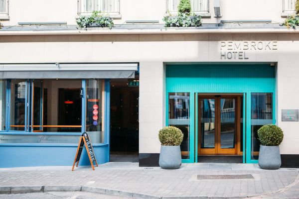
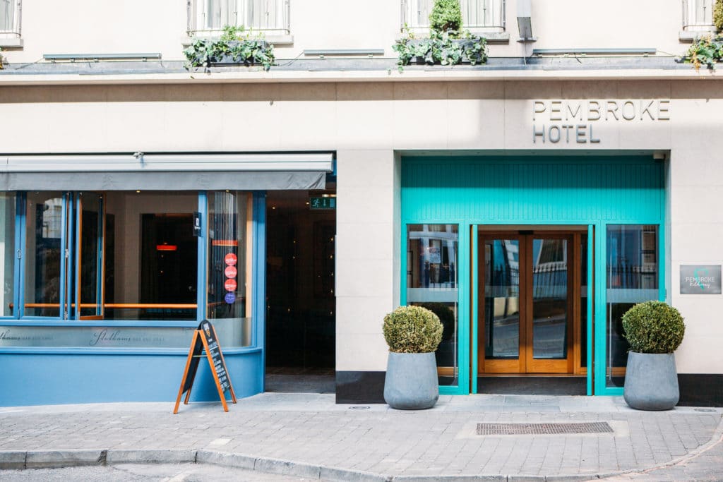
The Pembroke Hotel is a boutique style hotel offering guests a unique experience in the heart of Kilkenny - The Marble City. Situated just off the High Street, this exclusive hotel offering outstanding hospitality in a contemporary 4 star setting. All of the 74 luxurious guest rooms are designed with comfort at the core. Being the closest hotel to Kilkenny Castle, many of the guest rooms offer views of the splendid Castle, the Kilkenny Design Centre & historic Butler House. An unbeatable location, exquisite décor & a team driven by hospitality, The Pembroke is simply a perfect place to stay in Kilkenny.
The Pembroke Hotel offers 74 luxurious and well-appointed guest rooms. All Guestrooms Feature:
Fully Air Conditioned
Flat Screen TV
Internet Access
Tea & Coffee making facilities
Trouser Press, Iron & Ironing Board
Hairdryer
Quality Bathroom Products
Statham's Bar & Grill: Stathams Bar & Grill is a funky establishment offering customers beautiful food, exciting wines and a great pint. Split between two levels, the decor is inviting with a cosmopolitan air of relaxed elegance. The menu features a ‘sharing plate’ which allows customers to enjoy miniature portions of signature dishes. With a very flexible menu in place, there is something to appeal to all tastes and appetites. The options are creative and offer good value for money. There is refreshing honesty in the pricing and both the lunch and dinner menus offer great choice at keen prices. Menu options are simple yet inventive, all carefully thought out by the Executive Head Chef, Chris Farrell. Chris has an illustrious background in the hospitality industry coming to The Pembroke having worked in some of the countries leading properties. Having worked as Executive Head Chef in the five star Sheen Falls Lodge in Kenmare, Chris also worked as Head Chef in Mount Juliet, Inchdoney Island Hotel, and the Killarney Park Hotel, to name but a few. Chris has both a passion and flair for cooking and he is excited about building a reputation for Stathams Bar & Grill and the Pembroke Hotel. “We source quality produce, locally where possible. Our emphasis is on simple cooking with a flair. The menu is designed to appeal to all and we are now ready to present our offering to the local market.”
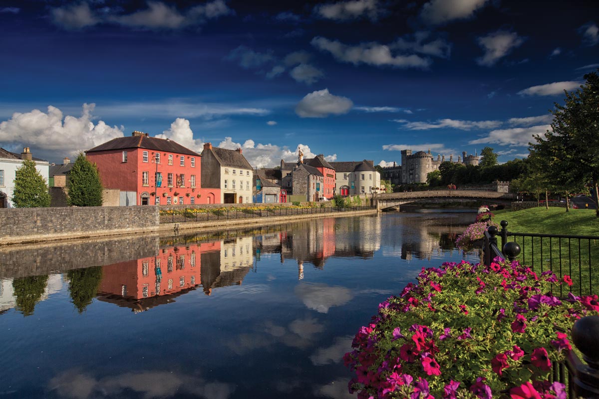
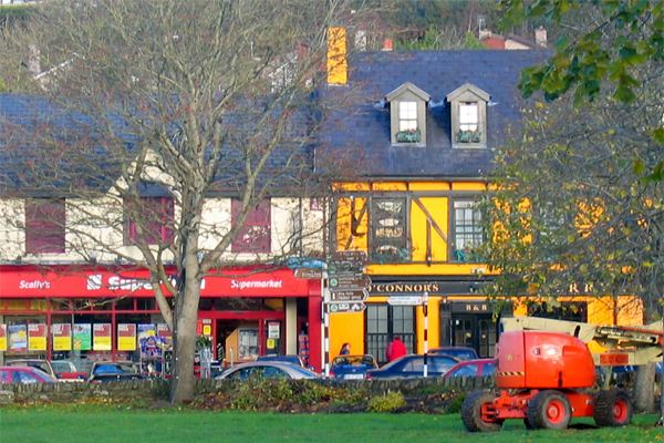
Kilkenny CityOn the Map: Kilkenny City is located in County Kilkenny, in the southeast midlands of Ireland. Kilkenny is well-served by a good network of roads - the M9/N10 from Dublin (to the northeast) and N9/N10 from Waterford City (to the south). Kilkenny, or the Marble City as it is known, is one of Ireland's oldest towns, and proud of it. Its array of ancient buildings is unrivalled. It is renowned for being a vibrant cultural center, devoted to the musical and visual arts. Its two most impressive landmarks are Kilkenny Castle, founded in 1172 and privately owned until 1967, and St. Canice's Cathedral. The current structure of the cathedral dates from the 13th century, though this is nowhere near the beginning of its story, which is rich in folklore and legend. There is no shortage of pubs to explore and enjoy in Kilkenny and during the summer the city is always full of life. The summer also sees the city host an Arts Festival and a very highly regarded Comedy Festival called the Cat Laughs.
We only partner with the finest accommodation providers in each country. All properties are tried and trusted to ensure that you’re in excellent hands during your time abroad. From characterful B&Bs & Inns to 5-Star Castles and Stately Manors, we can find the perfect accommodation to suit your Ireland trip. Looking for romance? No problem – Ireland is awash with cozy, inviting accommodations in scenic and private locations. They’re not always easy to find independently, but not to worry, we know exactly where to look! Properties steeped in history and intrigue? We have those in spades – if you’ve always wished to overnight in a centuries-old castle, you’re visiting the right country! If you would like more specific information about this particular accommodation, please just ask your Agent, and he/she will be glad to oblige.
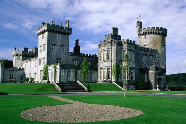
Dromoland Castle is one of Ireland's most magical locations since the 16th century. It was once the home of O'Briens of Dromoland who dates back to one of the last High Kings of Ireland. Thus, the hotel is through and through noble and boasts hospitality. The historic grandeur shows in the baronial facade and the startling interiors. The features of the house are combined with fabulous views, indulgent dining, magnificent bedrooms and lavish decor to make it one of the top hotels. Every resident at the castle hotel is treated like royalty making them feel especially welcome on the 450-acre estate. The castle really captures the feeling of living like king and queen making a stay unforgettable.
From lakeside look-outs to sumptuous suites, canopied beds to breakfast-in-bed, bubble baths to lazy lie-ins (not forgetting secret staircases to love nests), each room at Dromoland Castle has been thoughtfully designed to meet with royal approval.
All Guestrooms Feature:
Dromoland Castle's signature soft slippers and bathrobes
Nespresso coffee maker
Full stocked minibar – charged on consumption
Interactive television with music and movies on demand
Complimentary WiFi
24 hour in-room dining
Hairdryer
Iron/Ironing board
Personal safe
American socket (110v)
Turndown service each evening
Asprey luxury bathroom amenities
The Fig Tree Restaurant
The restaurant in the Golf & Country Club is lively and welcoming where sportspeople, locals and guestes dine alike. The menu offers a great range from sandwiches to steaks and salads, as well as fish and chips or chowder. The dinners are prepared with Irish ingredients.
Afternoon Tea
The tradition is celebrated like a feast of royalty in the castle hotel. Guests may enjoy a great variety of teas along with sandwiches, scones and clotted cream, jams and pastries. With teas from all around the world this Afternoon Tea is a special experience in the rooms of the magnificent Dromoland Castle.
The Cocktail Bar
Once a library, the room has been transformed into a intimate and comfortable bar with cosy window seats overlooking the lawns. It is great to enjoy a casual snack or relax with a drink from the cocktail list or some wine, Irish whiskey or gin.
The Gallery
Enjoying drinks, coffee and small lunch in the impressive Gallery of the castle should not be missed. The unique atmosphere provides a relaxing and luxurious feeling surrounded by beautiful antiques.
Earl of Thomond
The flagship restaurant of the castle is perfect to enjoy a delightful meal from the most outstanding Irish produce. Combined with exquisite wines and the silk and chandelliers of the room, the restaurant is the spot to dine like king and queen.
The Dromoland Estate
On the Map: Dromoland Castle is located in County Clare in the west of Ireland. The castle is reached via the R458, a country road that intersects the M18 motorway between the city of Ennis (to the north) and Shannon Airport/ Limerick City (to the south).
The Dromoland Castle is the perfect starting point for tours through the South and South West of Ireland along The Wild Atlantic Way. The area combines unique views, wild beaches, splendid lakes and charming villages. Also lively festivals are never far off. A day trip can also be taken to the UNESCO World Heritage Cliffs of Moher and The Burren. The county is also not short of history. Spots to visit are the medieval town of Ennis, Bunratty Castle and the Georgian buildings of Limerick City. Aran Islands and Galway City are just some of the other spots to visit while staying at Dromoland Castle.
Transportation and Guides
Chauffeur Transportation with Professional Driver/Guide
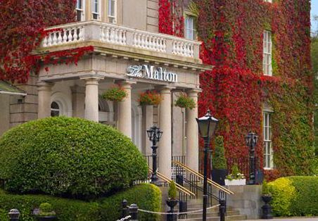
Central 5-Star Boutique Hotel - Dublin, County Dublin
Room Type: Double
Check in policies:
Check-in is from 3:00pm on your day of arrival. Check-out time is before 12:00 noon.
Full valet parking services are available at a rate of €25 per night per vehicle.
Included Unique Activities
Dublin City Welcome and Orientation
Dublin, County Dublin
A Hundred Thousand Welcomes to Ireland! Making visitors feel welcome and at home in Ireland is one of the true Irish customs. Begin your Irish experience with a Meet and Greet at Dublin Airport followed by a city orientation. Your local driver will be ready to answer any questions you may have about Ireland as they guide you through Dublin city pointing out significant sights and historical landmarks as you go along. After your introduction to the city, you will be transferred to your accommodation.
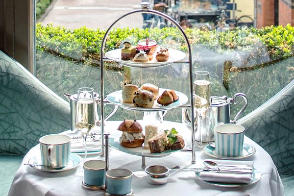
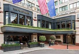
Afternoon Tea at the Westbury
Dublin, County Dublin
Sink back into a sumptuous sofa and enjoy a Dublin institution - Afternoon Tea at The Westbury. Enjoy views over Grafton Street as you sample an enticing selection of sandwiches, scones and divine homemade pastries. Try fragrant teas from all over the globe served in pretty silver teapots.
Suggested Sightseeing
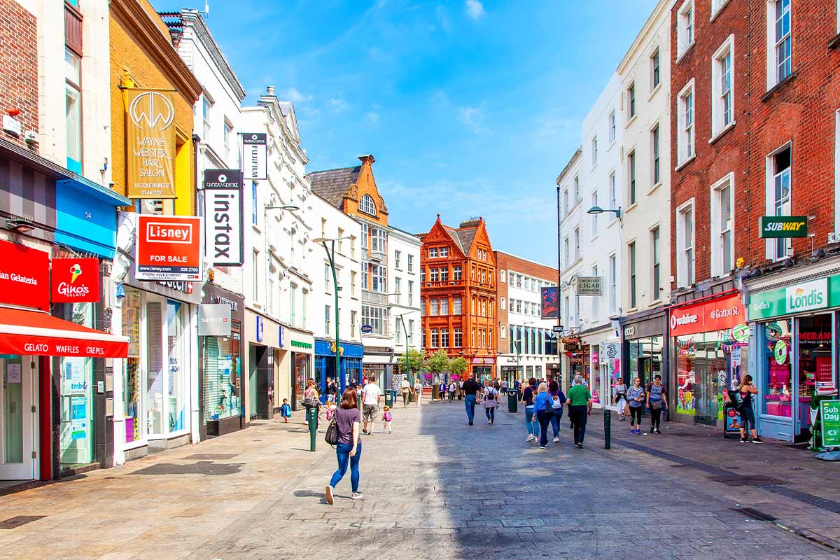
Grafton Street, County Dublin
Location: Grafton Street runs from Saint Stephen's Green in the south to College Green in the north
Grafton Street is without doubt Ireland's premier shopping street - in terms of retail rent, it's the fifth most expensive in the world! With beautiful historic buildings housing iconic Irish businesses such as Brown Thomas, Weir & Sons and Bewley’s Grafton Street Café, Grafton Street offers an experience that cannot be found elsewhere in the country. Since the 1980s, the street has been mostly pedestrianized, with the exception of a short stretch that runs between Nassau Street and College Green and contains the 18th century Trinity College Provost's House, home to the head of the college. If shopping's not your thing, Grafton Street is still worth checking out. It's a bustling, atmospheric spot, and high quality street performers including musicians, poets and mime-artists commonly perform to the shopping crowds.
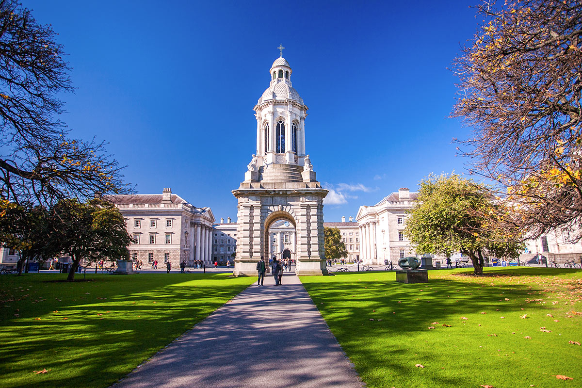
Trinity College, County Dublin
On The Map: Trinity College is located in the heart of Dublin City. Just south of the River Liffey, the campus grounds are bordered by Grafton, College, Pearse, Nassau & Leinster Streets.
Time spent in Dublin would not be complete without a visit to Trinity College. Founded in 1592 by Queen Elizabeth 1st, it is one of the oldest universities in the British Isles, and the very oldest in Ireland. Standing on a self contained site in the very heart of Dublin, the College itself covers some 35 acres of cobbled squares and green spaces surrounded by buildings which represent the accumulated architectural riches of nearly three centuries. Although Trinity offers much of interest to the visitor, the crown jewel is without doubt the Book of Kells. The Book is an 'illuminated manuscript', globally celebrated for its lavish decoration. The manuscript contains the four Gospels in Latin based on a Vulgate text, written on vellum (prepared calfskin), in a bold and expert version of the script known as 'insular majuscule'. Written in the 9th century, it has been on display in the Old Library at Trinity College Dublin from the mid-19th century, and attracts over 500,000 visitors a year.
O'Connell Street, County Dublin
On The Map: Located in the heart of Dublin city, the street's layout is simple but elegant. Within O'Connell Street and it's side streets you'll find endless historical monuments, dining choices and shopping districts, both traditional and high street. O'Connell Street has often been centre-stage in Irish history, attracting the city's most prominent monuments and public art through the centuries, and formed the backdrop to one of the 1913 Dublin Lockout gatherings, the 1916 Easter Rising, the Irish Civil War of 1922, the destruction of the Nelson Pillar in 1966, and many public celebrations, protests and demonstrations through the years – a role it continues to play to this day. State funeral corteges have often passed the GPO on their way to Glasnevin Cemetery, while today the street is used as the main route of the annual St. Patrick's Day Parade, and as the setting for the 1916 Commemoration every Easter Sunday. It also serves as a major bus route artery through the city centre.
Attractions:
General Post Office (GPO), Statue of Daniel O'Connell, The Spire, Staute of James Stewart Parnell, Clery's Department Store, Major Shopping Districts.
Arrive at
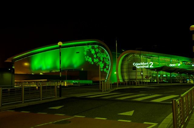
Arrive at Dublin Airport, County Dublin
Arrive at Dublin Airport after your overnight flight if you are coming from the U.S. or Canada.
Dublin is Ireland's main airport - located just north of Dublin City. If you are heading downtown, it takes approximately 20 to 30 minutes from the airport, depending on traffic. There are 2 terminals at Dublin Airport, the second of which opened to air traffic in November 2010. Most flights from the U.S. (on Aer Lingus, Delta, United, US Airways & American Airlines) arrive into Terminal 2.
Overnight Location
Dublin, County Dublin
On the Map: Dublin, Ireland's Capital City is located on the east coast of the country, and is well served by infrastructure linking it to all parts of the Emerald Isle.
Dublin is a lively cosmopolitan city, filled with personality, pizzazz, and culture. You might spend time strolling the streets, soaking up the atmosphere, relaxing in cafes and pubs, or you could check out a world of historical, literary, and musical delights. A return visit to the Book of Kells, Phoenix Park (twice the size of Central Park), Georgian Dublin, Stephen’s Green, Dublin Castle, the National Museum, Kilmainham Gaol, and the Hugh Lane Municipal Art gallery are all possibilities. Ramble through Grafton Street, a shopper’s paradise, or simply relax and remember this most wonderful tour of the Emerald Isle.
Day 2
Accommodation
Central 5-Star Boutique Hotel - Dublin, County Dublin
Room Type: Double
Check in policies:
Check-in is from 3:00pm on your day of arrival. Check-out time is before 12:00 noon.
Full valet parking services are available at a rate of €25 per night per vehicle.
Included Unique Activities
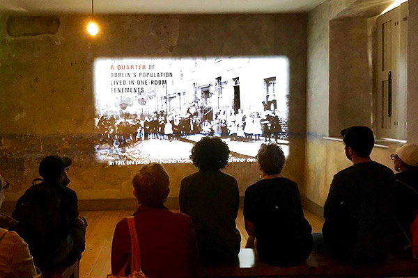
The Tale of Henrietta Street
Dublin, County Dublin
Home to both tenement squalor and aristocratic grandeur, 14 Henrietta Street tells the tale of 300 years of city life. Your guide will take you on an intimate journey that connects to the personal stories of many of the house's former residents, revealing the building’s hidden histories. See the house, hear its stories and discover the layers of Dublin history within its walls.
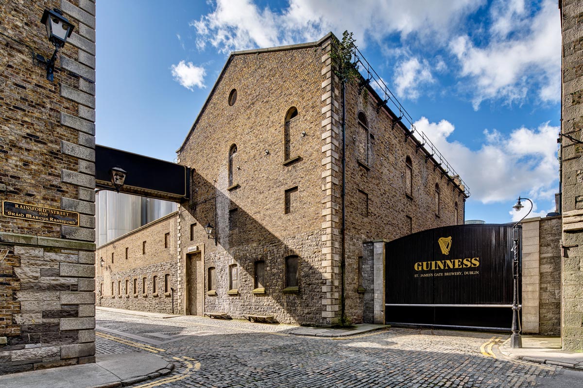
Guinness Storehouse Tour
Dublin, County Dublin
Prepare yourself for an unforgettable Irish welcome, delving deep into the wonder of world-famous Guinness! The brewery is located in the heart of Dublin at historic St. James Gate. Originally a small brewery, it is now a 7-story visitor experience that brings the history, story, and taste of the Emerald Isle’s iconic brew to life.
Imagine the world’s largest pint glass (Guinness did start the Guinness Book of World Records, after all) rising to the top of the building. Amazing. The dramatic story begins 250-years-ago and incorporates a family legacy handed down through generations. You’ll end your time here at the Gravity Bar, enjoying a complimentary pint of Guinness. Relax and enjoy spectacular views of Dublin. Plan to spend 1 ½ to 2 hours here.
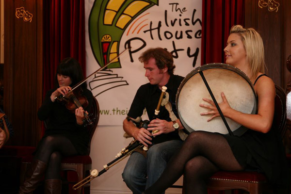
The Irish House Party Dinner and Show
Dublin, County Dublin
This show is completely unique in Dublin. Unlike any other traditional Irish music night in the city, it is organized and hosted by traditional Irish musicians and dancers in an intimate and homey setting. The night begins at 6:30 pm with a delicious three course dinner. After dinner, your host leads you to The Parlour Room for The Irish House Party show. The show includes live traditional Irish music with All-Ireland champion musicians and dancers, a humourous introduction to Irish music and writers, entertaining stories about Dublin and its unique characters, and 'Sean Nos' (old style singing) in our native Irish language. The Irish House Party has gained a reputation for being the most authentic Irish experience in Dublin. It has been attended and highly recommended by Noble Prize winning poet Seamus Heaney, and world renowned pianist John O’Connor among others.
Suggested Sightseeing
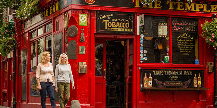
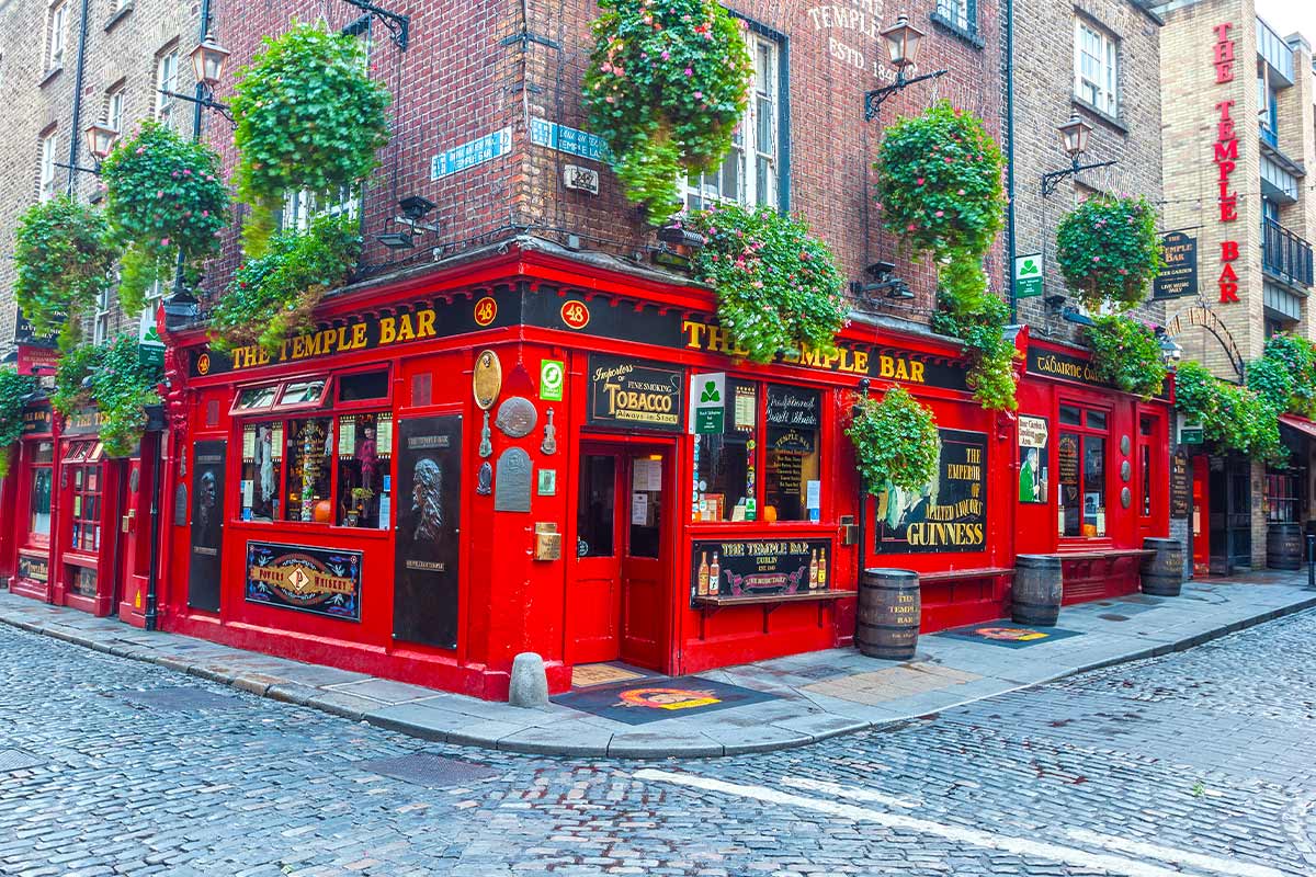
Temple Bar, County Dublin
Location: Temple Bar lies in the heart of Dublin City. Located on the south bank of the River Liffey, and just west of Trinity College and Grafton Street.
The lively and vibrant Temple Bar District - Dublin's Cultural Quarter, is well worth a visit. Best known for being Dublin’s major nightlife center, Temple Bar comes alive after dark, with many pubs, restaurants and nightclubs to choose from. For those visiting during the day, the area boasts a timeless charm, with narrow cobbled streets and a plethora of cultural organizations, such as the Irish Film Centre & Project Arts Centre. There are also a variety of small galleries and stores - perfect for a day of shopping. While Temple Bar after dark might not be for everyone, the area is the perfect spot to spend a sunny afternoon.
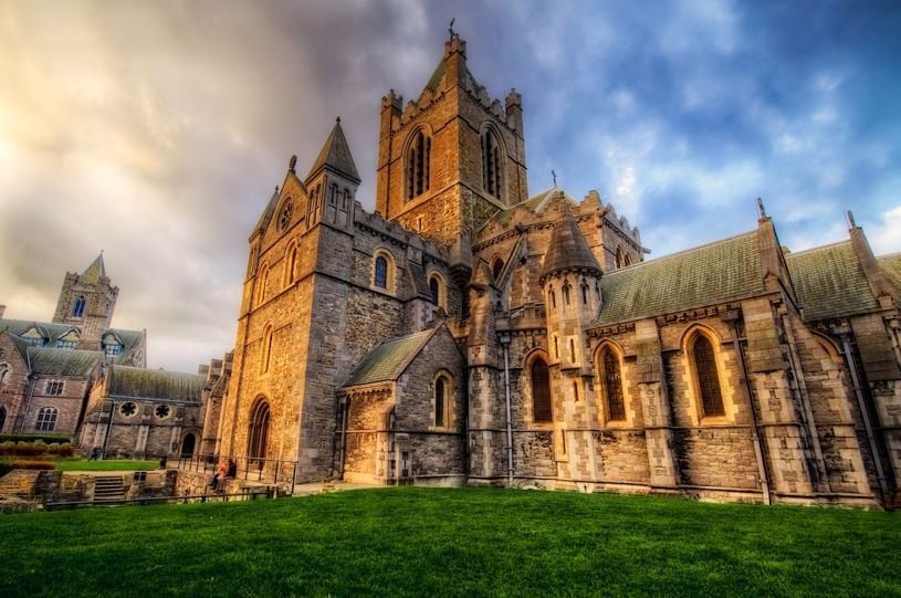
Christ Church Cathedral, County Dublin
Christ Church Cathedral is a leading visitor attraction and has been a place of pilgrimage for almost 1,000 years. Located in the heart of Medieval Dublin and renowned for its beauty, architecture and exquisite floor tiles, Christ Church Cathedral was founded in 1030 by Sitric, King of the Dublin Norsemen. In 1152 it was incorporated into the Irish Church and eventually led by the famous Archbishop and patron saint of Dublin, Laurence O’Toole. The cathedral is home to the famous 12th-century crypt, one of the oldest and largest in Britain and Ireland. The restored crypt houses the important Treasures of Christ Church exhibition which features manuscripts and artefacts that give visitors some impression of nearly one thousand years of worship in the cathedral and nearby churches.The Treasury also plays host to a rare 14th century copy of the Magna Carta Hiberniae.
Dublin, County Dublin
On the Map: Dublin, Ireland's Capital City is located on the east coast of the country, and is well served by infrastructure linking it to all parts of the Emerald Isle.
Dublin is a lively cosmopolitan city, filled with personality, pizzazz, and culture. You might spend time strolling the streets, soaking up the atmosphere, relaxing in cafes and pubs, or you could check out a world of historical, literary, and musical delights. A return visit to the Book of Kells, Phoenix Park (twice the size of Central Park), Georgian Dublin, Stephen’s Green, Dublin Castle, the National Museum, Kilmainham Gaol, and the Hugh Lane Municipal Art gallery are all possibilities. Ramble through Grafton Street, a shopper’s paradise, or simply relax and remember this most wonderful tour of the Emerald Isle.
Day 3
Accommodation
4-Star Elegant City Center Hotel - Kilkenny, County Kilkenny
Room Type: Double
Check in policies:
Check-in time is after 4:00pm on your day of arrival. Check-out time is before 12:00noon.
We have complimentary private parking for guests, please set down in front of hotel and a team member will guide you.
Included Unique Activities
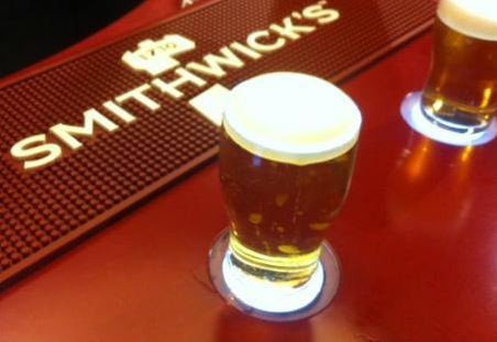
Smithwick's Experience
Kilkenny, County Kilkenny
Smithwick's unique ale, with its rich ruby glow and creamy head, is the perfect marriage of innovation and tradition. It's infused with hints of caramel and biscuit, a tingle of orange marmalade and a finish so crisp you could snap it in two. The story of Smithwick's is as interesting as the ale itself - truly a beer forged in adversity... It arrives in your glass by way of a darkened medieval abbey, a reprehensible royal, heinous laws, two world wars, two fat turkeys and more! On this Smithwick's tour, you will learn all about this crafty beer. The tale begins in 1231 when some clever monks discovered a way of turning water into ale. Find out how the brew gained worldwide notoriety in the 18th century, and in the Brewhouse portion of the tour, learn how the varied ingredients are combined to create a unique character and flavor. Finally, it's onto the Tasting Room to sample a pint and insure that the secrets of Smithwick's wonderful brewing process have been applied with good effect! (Soft drinks are also available.)
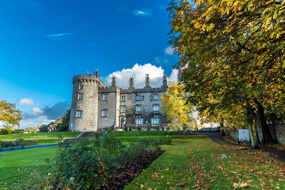
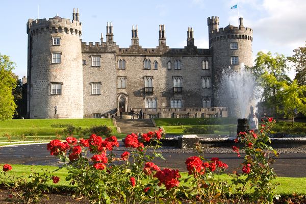
Kilkenny Castle
Kilkenny, County Kilkenny
Kilkenny Castle is dramatically perched on high ground, commanding a view, and a crossing, of the River Nore. (The River Nore winds through Kilkenny—explore her shoreline.) The medieval castle dominates the “High Town” of Kilkenny City. Over a period of eight centuries, many additions and alterations have been made. The Castle is now a complex structure of various architectural styles.
The original Anglo-Norman Castle was built for the 4th Earl of Pembroke, Willliam Marshall, at the beginning of the 13th century. James Butler, 3rd Earl of Ormond, purchased the Castle in 1391. It stayed in the powerful Butler family for 600 years until Arthur, 6th Marquess of Ormonde, quite generously presented it to the people of Kilkenny in 1967 for £50. Various programs of archaeological excavation, conservation, and restoration are carried out here.
Suggested Sightseeing
Kilkenny, County Kilkenny
On the Map: Kilkenny City is located in County Kilkenny, in the southeast midlands of Ireland. Kilkenny is well-served by a good network of roads - the M9/N10 from Dublin (to the northeast) and N9/N10 from Waterford City (to the south). Kilkenny, or the Marble City as it is known, is one of Ireland's oldest towns, and proud of it. Its array of ancient buildings is unrivalled. It is renowned for being a vibrant cultural center, devoted to the musical and visual arts. Its two most impressive landmarks are Kilkenny Castle, founded in 1172 and privately owned until 1967, and St. Canice's Cathedral. The current structure of the cathedral dates from the 13th century, though this is nowhere near the beginning of its story, which is rich in folklore and legend. There is no shortage of pubs to explore and enjoy in Kilkenny and during the summer the city is always full of life. The summer also sees the city host an Arts Festival and a very highly regarded Comedy Festival called the Cat Laughs.
Kilkenny Castle, County Kilkenny
On The Map: Kilkenny Castle is situated in the heart of mediaeval Kilkenny City, in the southeast midlands of Ireland.
Kilkenny Castle stands dramatically on a strategic height, commanding a crossing of the River Nore and dominating the 'High Town' of Kilkenny City. Over the eight centuries of its existence, many additions and alterations have been made to the fabric of the building, making Kilkenny Castle today a complex structure of various architectural styles. The original castle was constructed in the early 13th century for the 4th Earl of Pembroke. The Castle later became the principal Irish residence of the powerful Butler family, and remained so for almost 600 years from 1391 to 1967. The Butler ownership ended when Arthur, 6th Marquess of Ormonde (1893-1971), presented it to the people of Kilkenny in return for a token payment of £50. Due to major restoration works, the central block now includes a library, drawing room, and bedrooms decorated in 1830's splendour, as well as the beautiful Long Gallery. A suite of former servant's rooms is the Butler Art Gallery, which mounts frequently changing exhibitions of contemporary art. The Parade Tower is the Castle's conference venue.
Overnight Location
Kilkenny, County Kilkenny
On the Map: Kilkenny City is located in County Kilkenny, in the southeast midlands of Ireland. Kilkenny is well-served by a good network of roads - the M9/N10 from Dublin (to the northeast) and N9/N10 from Waterford City (to the south). Kilkenny, or the Marble City as it is known, is one of Ireland's oldest towns, and proud of it. Its array of ancient buildings is unrivalled. It is renowned for being a vibrant cultural center, devoted to the musical and visual arts. Its two most impressive landmarks are Kilkenny Castle, founded in 1172 and privately owned until 1967, and St. Canice's Cathedral. The current structure of the cathedral dates from the 13th century, though this is nowhere near the beginning of its story, which is rich in folklore and legend. There is no shortage of pubs to explore and enjoy in Kilkenny and during the summer the city is always full of life. The summer also sees the city host an Arts Festival and a very highly regarded Comedy Festival called the Cat Laughs.
Day 4
Accommodation
Preferred Luxury Hotel - Killarney, County Kerry
Room Type: Double
Check in policies:
Check-in time is after 4:00pm on your day of arrival. Check-out time is before 12noon.
Free car parking is available on site.
Included Unique Activities
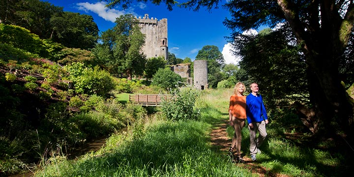
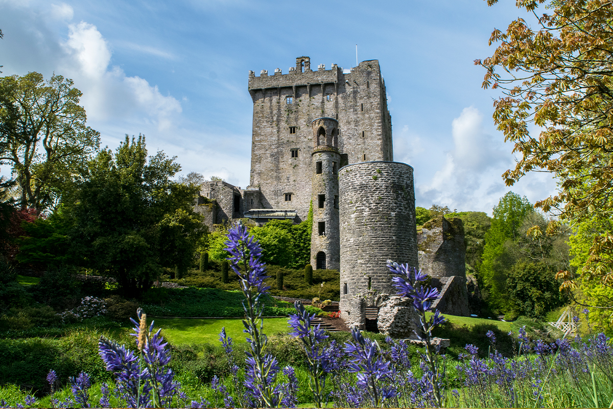
Blarney Castle and Park Admission
Blarney, County Cork
Historic Blarney Castle is famous for the Blarney Stone which, it is said, can confer the gift of eloquence to anyone who kisses it. The word 'Blarney' was introduced into the English language by Queen Elizabeth I, as she was talking about the Lord of the Castle who kept putting her off, saying, “He is just full of Blarney.” The stone itself is set in a wall. To kiss it, a person has to lean back from the parapet and place a smooch. There are treasures to be found on the grounds of Blarney Castle! The Rock Close, and its surroundings, is a curious place of ancient trees and stones. According to legend, it was a Druid place of worship. Be still and feel the aura of magic with the Wishing Steps, Witch’s Kitchen, and Druid’s Cave, all from the mists of time.
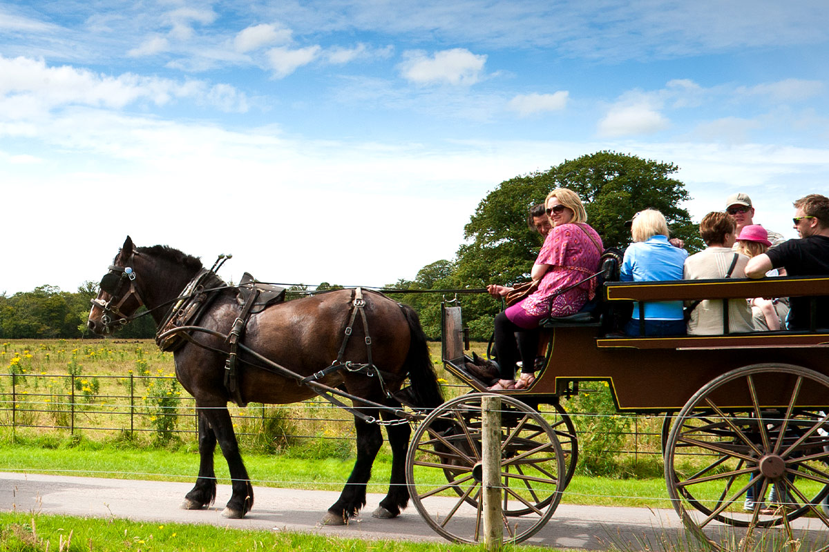
Killarney Jaunting Car Tour with Brewery Experience
Killarney, County Kerry
Take in the extraordinary sights and sounds of the Killarney National Park whilst enjoying panoramic views of famous Killarney landmarks. Learn about the history and diverse ecosystem of the 26,000-acre Park aboard a traditional Jaunting Car, complete with your very own personal Jarvey driver / guide.
Explore the grounds of 15th century Ross Castle and experience magnificent scenes across the Lakes of Killarney. Afterwards, soak up the buzz of Killarney nightlife at the town’s local Brewery and discuss the highlights of your trip over a delicious rustic Pizza and an ice-cold Killarney Craft Beer. (Yes, the Irish love Pizza and Beer too ... so you will fit right in with the locals!)
Included: 1 x Craft Beer per person (soft drink or wine also available as a substitute) & 1 x 12" hand-crafted Wood-Fired Pizza of your choice per person
Suggested Sightseeing
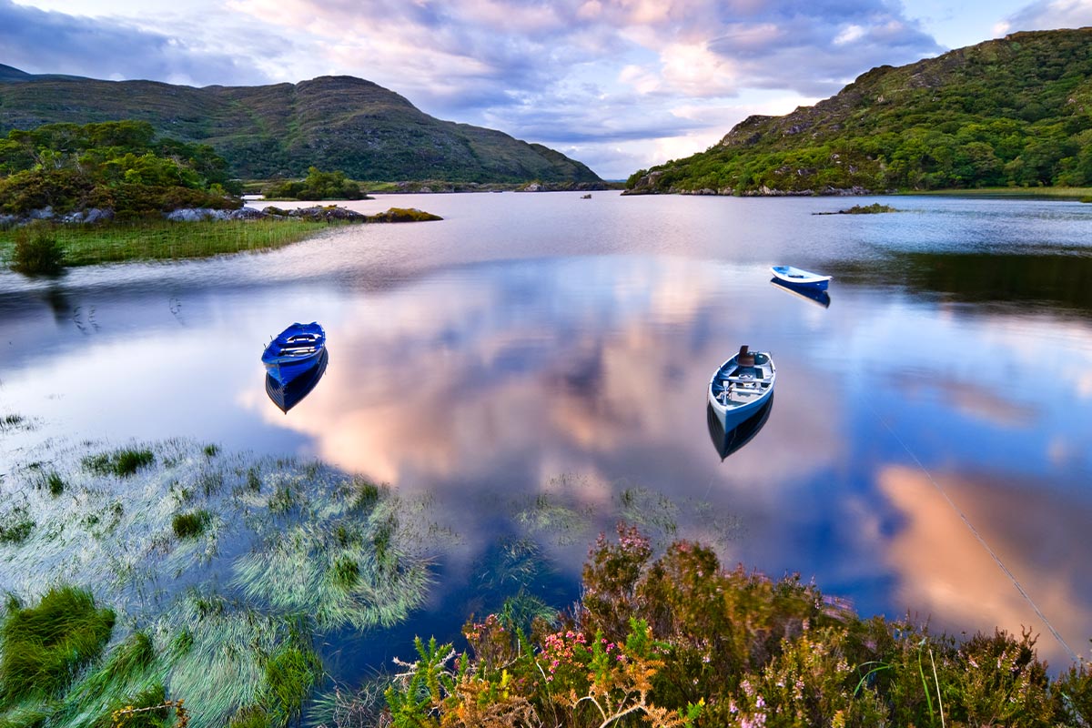
Killarney National Park, County Kerry
On the Map: Killarney is located in County Kerry in the southwest of Ireland. The town is reached via the N22 from Tralee/ Limerick (to the north) and the N22 from Cork City (to the southeast).
On the southwestern edge of Killarney Town lies an untamed, rugged & mountainous country. The area includes the McGillycuddy's Reeks, Ireland's highest mountain range. At the foot of these mountains nestle the world famous lakes of Killarney. Here, where the mountains sweep down to the lake shores, their lower slopes covered in woodlands, you'll discover the 26,000 acre Killarney National Park . The distinctive combination of mountains, lakes, woods and waterfalls under ever changing skies, lends the area a special scenic beauty. The Park contains many features of national and international importance such as the native oakwoods and yew woods, together with an abundance of evergreen trees and shrubs. A profusion of bryophytes and lichens thrive in the mild Killarney climate. The native red deer are unique in Ireland, with a presence in the country since the last Ice Age. At the heart of the National Park is Muckross House and Gardens. The house, a late 19th century mansion features period furnishings and artefacts and is a major visitor attraction in itself. Killarney National Park was designated as a Biosphere Reserve in 1981 by the United Nations Educational, Scientific and Cultural Organisation (UNESCO).
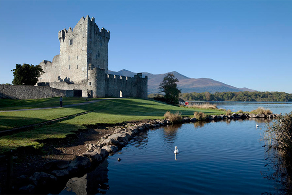
Ross Castle, County Kerry
On The Map: Ross Castle is located on the southern outskirts of Killarney, County Kerry in the southwest of Ireland. From Killarney town centre, head south on the N71/Muckross Road for Kenmare. Ross Road is right turn off the N71, and is well signposted.
Ross castle overlooks the Lower Lake in Killarney, and commands magnificent views of Purple Mountain, Innisfallen Island & Ross Island. The Castle is a typical example of an Irish Chieftain stronghold during the Middle Ages. The date of its foundation is uncertain, but construction was most likely completed in the late 15th century, by one of the O'Donoghue Ross chieftains. The castle is surrounded by a fortified bawn, and its curtain walls defended by circular flanking towers, two of which remain. Ross was the last Munster stronghold to hold out against Oliver Cromwell's infamous British forces, before eventually being taken by General Ludlow in 1652. The castle contains an impressive collection of 16th & 17th century oak furniture. Legend has it that Brian Boru, Ireland's most famous High King was educated on the site of the castle by the Monks in the 9th Century. Please note that this is a very popular attraction, and visitors may experience a delay entering the castle during the busy summer months.
Killarney, County Kerry
On the Map: Killarney is located in County Kerry in the southwest of Ireland. The town is reached via the N22 from Tralee/ Limerick (to the north) and the N22 from Cork City (to the southeast).
Killarney lies on the edge of the astoundingly beautiful Killarney National Park, with its three magnificent lakes and the spectacular MacGillycuddy Reeks mountain range. The park is also home to Muckross House and Gardens. Killarney is a wonderful base for all manner of activities including angling and water sports, golf, riding, orienteering, hiking, cycling, and canoeing. The town itself is quite small but full of charm - this you will soon see as you walk down the brick footpaths and pass curious old-style shop fronts. Killarney is well known for its excellent shops, restaurants and cosmopolitan appeal. It is also renowned for its evening entertainment including many singing pubs, cabarets, dancing venues, and banquets. Traditional Irish music can also be heard in many of the local pubs on a nightly basis.
Blarney, County Cork
On the Map: Blarney is located in County Cork in the south of Ireland. The village is a mere 20 minutes/ 11km northwest of Cork City. It is accessed via the R617, which intersects with the main N20 (Limerick City to Cork City) road just north of Cork City.
Blarney is a charming village, most renowned for its famous castle and stone. The impressive Blarney Castle, perched on solid limestone, dates from 1446 and is situated on magnificent grounds. The castle was constructed by one of Ireland's greatest chieftains, Cormac MacCarthy, and has been attracting attention beyond Munster ever since.To acquire 'The Gift of Gab' one must kiss the Blarney Stone - located just beneath the battlements at the very top of Blarney Castle. This involves bending over backwards at quite a height - perhaps not to be attempted by the faint-hearted! Rumor has it that if you kiss the legendary 'Stone of Eloquence', you'll never again be lost for words!
Overnight Location
Killarney, County Kerry
On the Map: Killarney is located in County Kerry in the southwest of Ireland. The town is reached via the N22 from Tralee/ Limerick (to the north) and the N22 from Cork City (to the southeast).
Killarney lies on the edge of the astoundingly beautiful Killarney National Park, with its three magnificent lakes and the spectacular MacGillycuddy Reeks mountain range. The park is also home to Muckross House and Gardens. Killarney is a wonderful base for all manner of activities including angling and water sports, golf, riding, orienteering, hiking, cycling, and canoeing. The town itself is quite small but full of charm - this you will soon see as you walk down the brick footpaths and pass curious old-style shop fronts. Killarney is well known for its excellent shops, restaurants and cosmopolitan appeal. It is also renowned for its evening entertainment including many singing pubs, cabarets, dancing venues, and banquets. Traditional Irish music can also be heard in many of the local pubs on a nightly basis.
Day 5
Accommodation
Preferred Luxury Hotel - Killarney, County Kerry
Room Type: Double
Check in policies:
Check-in time is after 4:00pm on your day of arrival. Check-out time is before 12noon.
Free car parking is available on site.
Included Unique Activities
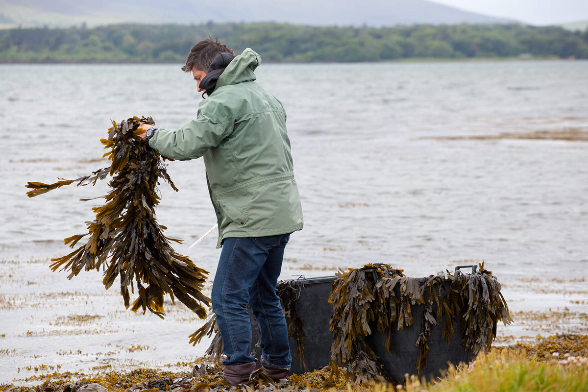
Seaweed Foraging Walk
Derrynane Beach, County Kerry
Join John at historical Derrynane Harbour for a seaweed Discovery & tasting Walk along the diverse shoreline. Enjoy some seaweed nibbles including the flavoursome Duilleasc, which sustained the monks on the Skellig Island which sits 12km away on the horizon and their only international visitors in 600 years - the Norse Vikings!
We will graze on fresh seaweeds as we stroll along the Wild Atlantic Way - including Nori, the famous Sushi roll wrapping. Discover how to sustainably harvest these sea plants and learn how they earned their name as a super-food. We learn about the rich history of seaweed use from gunpowder to medicine, from firefighting to brewing. Next we visit an ancient ‘Shell Midden’ - A recorded archaeological site that may date back as early as 8,000 BC, which is evidence of Ireland’s earliest settlers who thrived on seaweeds, fish & shellfish.
Visitors are given 2 Seaweed postcards and can email us for a synopsis of the tour, a Seaweed Nutritional Chart & a Seaweed Identification Chart. Duration 1 hour.
Dinner at The Great Southern Hotel
Killarney, County Kerry
The Great Southern Hotel Killarney takes dining seriously, and their restaurants follow a single principle: The freshest of quality ingredients, sourced locally and cooked to perfection. Executive Chef, Will Fitzgerald, describes his cooking as "Creative Cuisine, Classically Influenced", using the best of local produce from local suppliers and artisan food producers. A range of herbs and vegetables are grown in the hotel gardens providing it with wonderful fresh ingredients to add to recipes. Menus also feature fresh breads and pastries from their bakery - the hotel's exciting in-house bakery. Whether the occasion calls for luxury on a grand scale or quiet intimacy, dining at The Great Southern is an experience you'll be sure to enjoy.
Suggested Sightseeing
Ring of Kerry, County Kerry
On the Map: The Ring of Kerry (Iveragh Peninsula) is in County Kerry in the southwest of Ireland. Killarney is the usual starting point for people completing the Ring, although Kenmare is another good option for this purpose. The N70 road encircles the entire peninsula.
The Ring of Kerry is one of Ireland’s most scenic touring routes. At 110 miles long, it circles the awe-inspiring Iveragh Peninsula. You’ll feel as if you have moved into nature’s mystic arena, and truly you have, as you pass between soft mountains, through forest glades, around bogs, rivers, lakes and pristine beaches. The road between the magnificent MacGillycuddy Reeks Mountains presents secret passes and valleys dotted along the fabled shores of Dingle and Kenmare Bays. Ireland’s natural beauty sings throughout the Ring of Kerry. You may wish to explore several charming villages along the route, including Glenbeigh, Waterville, and Sneem. Stroll and talk to people—this is what makes your travel experience unique. The Ring attracted Ireland’s first settlers, and has a wealth of ancient sites. A 6th century monastery, clinging to the windswept cliffs of the Skellig Islands, is a UNESCO World Heritage site. Staigue Stone Fort is an Iron Age stronghold dating from 300BC. This is also an area of Ogham Stones, the first mysterious forms of writing and art, nestled along the Ring. Follow the drive to Killarney by way of the Ladies View and the legendary Lakes of Killarney and the National Park. The Ring of Kerry is the stuff of dreams and lifelong memories.
Killarney, County Kerry
On the Map: Killarney is located in County Kerry in the southwest of Ireland. The town is reached via the N22 from Tralee/ Limerick (to the north) and the N22 from Cork City (to the southeast).
Killarney lies on the edge of the astoundingly beautiful Killarney National Park, with its three magnificent lakes and the spectacular MacGillycuddy Reeks mountain range. The park is also home to Muckross House and Gardens. Killarney is a wonderful base for all manner of activities including angling and water sports, golf, riding, orienteering, hiking, cycling, and canoeing. The town itself is quite small but full of charm - this you will soon see as you walk down the brick footpaths and pass curious old-style shop fronts. Killarney is well known for its excellent shops, restaurants and cosmopolitan appeal. It is also renowned for its evening entertainment including many singing pubs, cabarets, dancing venues, and banquets. Traditional Irish music can also be heard in many of the local pubs on a nightly basis.
Derrynane Beach, County Kerry
On the map: Derrynane Beach is a lovely sheltered sandy beach with a natural harbour situated on the Ring Of Kerry, two miles Southeast from the village of Caherdaniel. It is a Blue Flag Beach which is lifeguarded during the bathing season. Nearby is the Derrynane Abbey & Burial ground. Access to the beach is also available from nearby Derrynane House with a short walk.
Day 6
Accommodation
Preferred Luxury Hotel - Killarney, County Kerry
Room Type: Double
Check in policies:
Check-in time is after 4:00pm on your day of arrival. Check-out time is before 12noon.
Free car parking is available on site.
Included Unique Activities
Traditional Irish Cooking Experience
Dingle, County Kerry
It is the finest ingredients that make Irish food special, fish and shellfish straight from our wild Atlantic shores, mountain lamb from our rolling hillsides, whiskey from the Dingle distillery, free range eggs and local artisan cheeses.
In this half-day hands-on class, you engage with passionate teachers and earn a deeper understanding on how the rich culture and wild landscape have shaped Irish food and ingredients for hundreds of years.
Learn the history of Irish food while you enjoy tea and scones, followed by a fun hands-on cooking experience after which you will get to sit down and eat the food you have prepared. and with each bite you will feel a true sense of both the sea and land.
You will leave with first-hand knowledge of the foods that were created and shaped by our ancestors.
Suggested Sightseeing
Slea Head, County Kerry
On The Map: Slea Head is located on the Dingle Peninsula in the south west of Ireland. From Dingle town, head west on the R559 that encircles Slea Head and eventually returns to Dingle.
The Slea Head Drive is a circular route, beginning and ending in Dingle, that takes in a large number of ancient & megalithic attractions as well as offering stunning views on the western end of the peninsula. The route is clearly labelled by road signs throughout its length. To properly enjoy the Drive, a half-day should be set aside for the journey. The route is suitable for motorists, but is also ideal for cyclists: it is possible to hire a bike at a number of locations in Dingle.
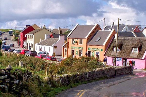
Dingle, County Kerry
On the Map: Dingle is located in County Kerry on the beautiful southwest coast of Ireland. The town is most easily accessible via the N86 road from Tralee, a major town 50 minutes/ 50km to the east.
Dingle is located in County Kerry on the lush southwest coast of Ireland. The residents of Dingle, or AnDaingeanas as they are officially known, are the envy of many. Their lovely fishing village is in what, some believe, is the most beautiful part of the Emerald Isle. The village is filled with charm, color, and quirky characters. There are numerous pubs on every block. All offer up lively traditional music and steaming bowls of fresh chowder.
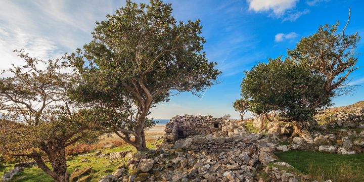
The Dingle Peninsula has many archeological sites, including ancient stone forts and beehive huts. Feel free to wander among them. Every turn of the coastal road reveals beauty that tugs at your heart. One of the highlights is Slea Head Loop. If you’re a climber, the views from Mount Brandon are stunning.
Inch Beach, County Kerry
On the Map: Inch Beach is a sand spit jutting into the sea between Dingle Harbour and Castlemaine Harbour
The Blue Flag Inch Beach stretches for 5 kilometers and provides family-friendly beach fun with an easy gradient into the water and plenty of space, making it a safe environment for many different types of water sports. The Dingle Peninsula is one of the most striking regions on Ireland’s West Coast, steeped in natural beauty as well as rich history, mythology, and traditional Irish culture.
Day 7
Accommodation
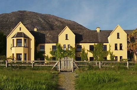
Lakeside Country Retreat - Connemara, County Galway
Room Type: Double
Check in policies:
Check in time is 2:00pm, check out time is 12:00 noon. Hotel will try and accommodate alternative times, just call on 095 34706.
Included Unique Activities
Dinner at Lough Inagh Lodge
Connemara, County Galway
Enjoy country house cooking at it's best, featuring locally sourced ingredients. Each ingredient is carefully sourced from only the finest local suppliers with seafood and wild game being specialties.
Evening with an Irish Storyteller
Connemara, County Galway
Listening to a traditional Irish storyteller around a fire has to be one of the best ways of immersing yourself in Irish culture. Connemara’s bleak and beautiful landscape and strong tradition of storytelling have given rise to fantastic superstitions, folklore and legends which were passed down through the generations in tales told by a winter fire. Your local storyteller will come to your hotel or local pub and bring to life the exciting myths and legends of Irish history!
Suggested Sightseeing
Connemara, County Galway
On the Map: Connemara encompasses a large area northwest of Galway City in the west of Ireland. It is most easily accessed via the N59 road that loops around the region and connects the cities of Galway (to the southeast) & Westport (to the northeast).
This striking region is one of the few places left in the country where the native language, Gaeilge, is still spoken as a first language. Stopping in the fishing village of Roundstone, you’ll spot currachs, old-style featherweight row boats, still being used daily. The village has an impressive crafts complex, selling everything from teapots and hand-knit sweaters to traditional Irish musical instruments.
In Connemara you will be constantly enchanted by the ever-changing scenery of mountains and valleys, lakes, bays, and beaches. This is Ireland's big sky country.
Enroute Sightseeing
Adare Heritage Village, County Limerick
On the Map: Adare is located just 20km southwest of Limerick City / 43km south of Shannon Airport. The main N21 road (connecting the cities of Limerick & Tralee/Killarney) passes right through the centre of the village.
Adare is a quaint picturesque place, lined with traditional thatched-roof cottages. Snuggled in a wooded and lush countryside setting, Adare is widely regarded as being Ireland's prettiest and most unique village. Situated on the river Maigue, a tributary of the Shannon river, Adare (Gaelic name: "Ath Dara" - the "ford of the oak" - from the combination of water and woodland) dates back, at least, to the early 13th century. Adare village has a rich wealth of heritage, as well as architectural and scenic beauty. Two groups of world famous, ornate, thatched cottages line part of the village's broad main street, punctuated with beautiful stone buildings, medieval monasteries and ruins. Situated in the centre of County Limerick, with just 15 minutes from Limerick City and 45 minutes from Shannon Airport, Adare Village is an ideal base from which to explore County Limerick's many visitor attractions such as Lough Gur and King John's Castle.
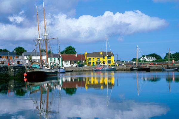
Galway, County Galway
On the Map: Galway is a coastal city, located in County Galway in the west of Ireland. Galway is well-served by a good network of roads - the M6/N6 from Dublin (to the east) and M18/N18 from Limerick & Cork (to the south).
In a recent nationwide survey the people of Galway were found to be Ireland's happiest! And visiting Galway City, the capital of their county it is not hard to see why. It is a lively university city of narrow streets, quaint shopfronts, bustling pubs and stunning surrounding scenery. It has always attracted a bohemian mix of musicians, artists and intellectuals and that attitude is palpable as you walk the streets. Galway has been commercially important since the 11th century when it was a centre for trade with Spain and Portugal. In 1477 Christopher Columbus paid a visit. Galway earned the title “City of the Tribes” around that time, when it was ruled by 14 wealthy merchant families. Today it is lively, with loads of things to do, and is so popular that it can get very crowded in summer, especially during the annual Galway Races. The annual Arts Festival also attracts thousands, especially for its street parade, organized by the multi-award winning production company, Macnas. Its famous Druid Theatre produces and stages plays and has toured internationally, winning awards, including Tonys on Broadway.
Overnight Location
Connemara, County Galway
On the Map: Connemara encompasses a large area northwest of Galway City in the west of Ireland. It is most easily accessed via the N59 road that loops around the region and connects the cities of Galway (to the southeast) & Westport (to the northeast).
This striking region is one of the few places left in the country where the native language, Gaeilge, is still spoken as a first language. Stopping in the fishing village of Roundstone, you’ll spot currachs, old-style featherweight row boats, still being used daily. The village has an impressive crafts complex, selling everything from teapots and hand-knit sweaters to traditional Irish musical instruments.
In Connemara you will be constantly enchanted by the ever-changing scenery of mountains and valleys, lakes, bays, and beaches. This is Ireland's big sky country.
Day 8
Accommodation
Lakeside Country Retreat - Connemara, County Galway
Room Type: Double
Check in policies:
Check in time is 2:00pm, check out time is 12:00 noon. Hotel will try and accommodate alternative times, just call on 095 34706.
Included Unique Activities
The Lost Valley Guided Walk Through History
Louisburgh, County Mayo
The Lost Valley has remained largely untouched since the villagers were evicted and driven out during ‘The Great Famine’ of the mid 1800’s. The tumbled down walls of their cabins, the multitude of potato plots they left behind, even the stones removed from the rocky soil remain in clusters, exactly as they left them, giving testament to the hardships endured by these Celtic people.
Your 3 hour fully guided tour with The Bourke Family will introduce you to the heritage and history of The Lost Valley while you make your way at a relaxed, leisurely pace on a well developed trail along the points of interest in the valley.
As The Lost Valley is now an active working farm, visitors can experience life on the farm with pet lamb feeding, a working sheep dog demonstration and a sheep shearing demonstration in season on request.
Suggested Sightseeing
Westport, County Mayo
On the Map: Westport enjoys a coastal location in County Mayo, in the west of Ireland. The town is accessed via the N59 road from Clifden (to the south), or N5 road from Castlebar (to the east).
Westport is a postcard-pretty town with as lovely a main street as you'll be likely to find anywhere in Ireland. The town lies in the shadow of Croagh Patrick with Clew Bay and its 365 islands just to the west. While in Westport be sure to visit Westport House and climb at least a little of Croagh Patrick. Westport House dates from 1730 and offers everything from a dungeon to a zoo! Croagh Patrick is a 765-meter hill where St. Patrick is said to have banished the snakes from Ireland. This hill is climbed (often barefoot) by thousands of Catholic pilgrims each July. South of Westport are some stunning scenic drives leading into the Connemara region. A trip northwards will bring you to remote Achill island which is accessible by a small bridge. Even further off the beaten path is Belmullet in the northwest corner of County Mayo. Westport also boasts a great selection of traditional pubs, among them Matt Molloy's of the Chieftains.
Doolough Valley, County Mayo
A stone memorial adjacent to an informal layby along Doo Lough Pass, a high-quality driving route between Mweelrea Mountain and Sheeffry Hills, north of Doo Lough. This famine memorial is a reminder of the Great Famine which occurred in Ireland during the mid 19th century, marking one of the most tragic periods in Irish history. The memorial itself is a plain stone cross engraved with the words ‘Doolough Tragedy 1849’.
On 30 March 1849, during the height of the Potato Famine, hundreds of starving men, women, and children set off from Louisburgh for Delphi Lodge, where they had heard they would be reassessed for famine relief. The reassessment did indeed take place the next day, but there was no food for the starving families upon their arrival, and they were forced to begin the long walk back to Louisburgh. The freezing, bitter weather took its toll on the malnourished and weak, and during the 16-mile return journey, many died. Their bodies were left by the side of the road, and some – it was said – with their mouths stuffed with grass in a desperate last bid for sustenance.
Every year, a Famine Walk to Louisburgh from Delphi commemorates the tragedy.
Louisburgh, County Mayo
On The Map: Louisburgh is located in County Mayo on Ireland's dramatic western Atlantic coast. The town is most easily accessed via the major town of Westport to the east. From Westport, take the R335 road heading west for approx. 20 kilometres to reach Louisburgh
The small town of Louisburgh occupies an enviable position on the south shore of Clew Bay. Louisburgh was founded just over two hundred years ago, in 1795, by Lord Altamont. Unusual for Ireland, Louisburgh was planned and built on the pattern that exists to this day - a four street system with a central cross roads, known locally as "The Square". The area around these shores is famous for being home to one of Ireland's most legendary figures - Grace O'Malley, or Grainne Mhaol (Bald Grainne in reference to the close cropped hair of her youth). Known as the Pirate Queen of Connaught, many historical tales and legendary exploits are attributed to her. Remains of her presence are still visible today on Clare Island, and her story is brought vividly to life in the Grainne ni Mhaille Centre in Louisburgh. The coastal countryside around Louisburgh is a joy to behold, with a trip around Achill Island being a must. For those seeking a bit more action, the major town of Westport is only 20 kilometres to the east.
Day 9
Accommodation
Lakeside Country Retreat - Connemara, County Galway
Room Type: Double
Check in policies:
Check in time is 2:00pm, check out time is 12:00 noon. Hotel will try and accommodate alternative times, just call on 095 34706.
Included Unique Activities
Connemara Oyster Farm & Tasting
Letterfrack, County Galway
Food can evoke all our senses -taste, smell, vision, and feel. A tour of the DK Connemara Oyster Farm truly does reach all these senses. Smell the fresh Wild Atlantic air. See the farm crew working hard in the water to grow the most perfectly formed oysters. Shuck your own oyster & take a punt at the weight of an oyster, again learning more about the work put in to create a flawless oyster.
The tour lasts approximately 1 hour & goes through the whole process of how the farm brings the oysters from seeds right through to your plate. The tour is suitable for ages 6 & up, with moderate ability. It is perfect for anyone interested in Irish culture, tradition, seafood or just loves Connemara and stunning views. Oyster tasting is included as part of the tour and you can also purchase your own fresh oysters to bring home with you.
Suggested Sightseeing
Letterfrack, County Galway
Letterfrack is a small vibrant village on a crossroads beside the sea on the Wild Atlantic Way with a large village green surrounded by trees and overlooked by the majestic Diamond Mountain and Connemara National Park.
The village is renowned for its live traditional Irish music. The well-known environmentalist and music lover Leo Hallisey organizes two weeks a year Bog Week (Summer) and Sea Week (late Autumn) when musicians and music lovers congregate for music as well as hill-walking and a program of talks and discussions on environmental matters. Other organized and impromptu sessions there is live traditional music every Sunday throughout the year.
The village also has a great choice of places to eat and drink from its three pubs two of which serve a high standard of bar food at Clover Fox or dine in the old style elegance of The Rosleague Manor Hotel. The village also has a great café just off the village green and a tea shop at the National Park. Alternatively, you could have a picnic at one of the benches on the village green. You will get all the supplies you need at the Country Store. There’s another little treasure of a shop in the centre of the village which is also well worth a visit.
There is plenty to do and see in the village as the Connemara National Park is based in the village and is the starting point for some lovely walks including a track all the way to the top of the Diamond Mountain suitable for the most inexperienced hill walker.
Connemara National Park, County Galway
On The Map: Connemara National park is located in County Galway in the west of Ireland. The main park entrance is close to the village of Letterfrack on the main N59 road that connects Clifden to the south, and Westport to the northeast.
Connemara National Park covers some 2,957 hectares of scenic mountains, expanses of bogs, heaths, grasslands and woodlands. Connemara arguably provides the best walking or hiking in Ireland. Some of the Park's mountains, namely Benbaun, Bencullagh, Benbrack and Muckanaght, are part of the famous Twelve Bens or Beanna Beola range. Connemara National Park was established and opened to the public in 1980. Much of the present Park lands formed part of the Kylemore Abbey Estate and the southern part of the Park was at one time owned by Richard 'Humanity Dick' Martin, who helped form the Society for the Prevention of Cruelty to Animals during the early 19th century. The Park has a Visitor's Centre (open March to October), that offers an audio-visual presentation about the region. 4 rewarding hiking trails begin at the centre, and a tea-room, playground and picnic area are also available. As well as its great natural beauty, many remains of human presence can be found in the Park. The oldest are megalithic court tombs some 4,000 years old. There is also an early 19th century graveyard about which little is known. Ruined houses, a disused lime kiln, old sheep pens, an ice house, drainage systems and old walls in various parts of the Park, are all evidence of a greater population and more extensive use of these lands in the past.
Sky Road, Clifden, County Galway
On The Map: The Sky Road drive begins in Clifden Town. Clifden is located on Ireland's west coast in the Connemara Region of County Galway. Clifden is reached via the N59 road from Galway to the southeast, and Westport to the northeast.
The Sky Road is an exhilarating 11km/7ml circular drive west of Clifden Town. The Sky Road is well signposted from Clifden. You will first pass Abbeyglen Castle Hotel (on your left), and after approx 400 metres beyond the hotel, take a look back towards Clifden. The 12 Bens mountains provide a wonderful backdrop to the town, and its two church spires, complete Clifden's distinctive skyline. The scenery along the Sky Road is quite simply, stunning. As you travel, the Sky Road separates into the lower and upper roads. The lower road takes you along the shoreline, and although pleasant, the upper road is more popular, owing to the commanding views it offers over the entire area. As the upper road rises, you are treated to breathtaking island & coastline views. There is a good-sized car park at the highest point of the upper road for wonderful photo opportunities. If you continue along the Sky Road thereafter, you will eventually join the main N59 Road, a few kilometres north of Clifden.
Connemara, County Galway
On the Map: Connemara encompasses a large area northwest of Galway City in the west of Ireland. It is most easily accessed via the N59 road that loops around the region and connects the cities of Galway (to the southeast) & Westport (to the northeast).
This striking region is one of the few places left in the country where the native language, Gaeilge, is still spoken as a first language. Stopping in the fishing village of Roundstone, you’ll spot currachs, old-style featherweight row boats, still being used daily. The village has an impressive crafts complex, selling everything from teapots and hand-knit sweaters to traditional Irish musical instruments.
In Connemara you will be constantly enchanted by the ever-changing scenery of mountains and valleys, lakes, bays, and beaches. This is Ireland's big sky country.
Clifden, County Galway
Clifden is the “capital” of Connemara and is beautifully nestled between the Twelve Bens and the Atlantic Ocean. Peruse the many shopping choices in Clifden from sweater shops, quality gift shops, boutiques to antique and souvenir shops. Lunch in tea-shops, pubs and in the evenings, indulge in Clifden's emerging reputation as the West's 'Gourmet Capital' by dining in its fine restaurants. Traditional Irish music and song have long been associated with Connemara and Clifden still rings to the sound of our own traditional music and culture throughout the year. The town boasts the longest running community arts festival in Ireland each September when the Clifden community arts week has its annual celebration of culture and the arts in the area. Today it represents all that is good about life in the west of Ireland, good food, good friends and good craic.
Day 10
Accommodation
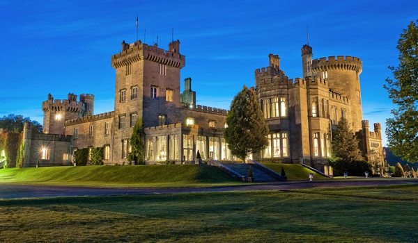
World-renowned Castle Hotel - Dromoland, County Clare
Room Type: Double
Check in policies:
Check-in time is after 3:00pm on your day of arrival. Check-out time is before 12noon. Free parking is available onsite.
Included Unique Activities
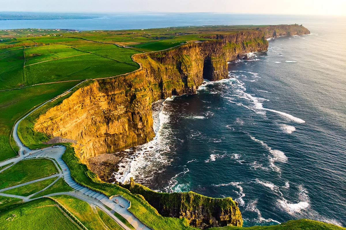
Cliffs of Moher Exhibition Centre
Doolin, County Clare
The Cliffs of Moher stand at 700 ft, at their highest point, above the wild Atlantic shore below. Their range covers 5 miles. O'Brien's Tower magnificently stands on a headland of the majestic Cliffs. On a clear day, you can spot the Aran Islands, Galway Bay, the Twelve Pins, the MaumTurk Mountains in Connemara, and Loop Head to the south.
The state-of-the-art Atlantic Edge Interpretative Centre is a thrilling and recent development here. A huge, domed cave contains exhibits, displays, and experiences. (There is a ramp that makes the dome accessible to all.) When entering the dome, you have the illusion of walking on water as you follow birds’ footprints. There are four main themes here: Ocean; Rock; Nature; and Man. There is no place else on earth where you feel the raw power of the ocean as you feel it at the Cliffs of Moher. Sunrise and sunset visits are very special and memorable.
Dinner at The Earl of Thomond Restaurant
Dromoland, County Clare
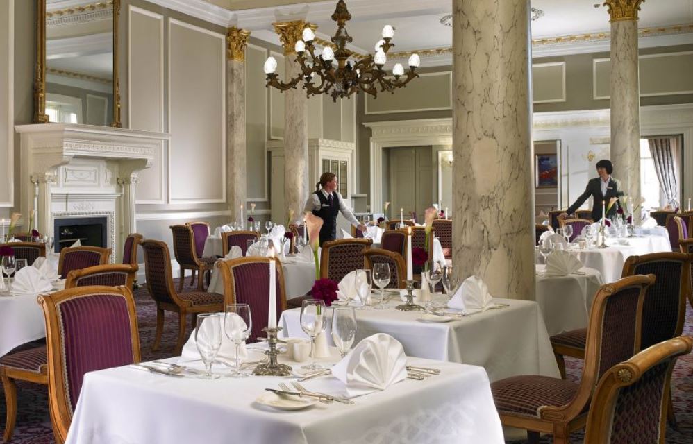
This evening, you'll enjoy a culinary treat at The Earl of Thomond Restaurant, an award-winning establishment of international renown. Elaborately decorated with oak wainscoting and other formal features, the restaurant offers a relaxed but elegant dining experience. The Earl of Thomond features innovative cuisine, served with tradition and a hint of creative flair. Every detail is attended to, from the use of locally sourced, quality-assured produce to customized wine recommendations from the Castle Sommeliers.
Suggested Sightseeing
Doolin, County Clare
On the Map: The small village of Doolin is located on County Clare’s west Atlantic coast. The village is accessed via the R479 - a small country road that intersects with the R478 connecting the towns of Lisdoonvarna (to the north) and Lahinch (to the south).
People flock to Doolin from all over the world to sample wonderful, top quality traditional music in the local pubs. Until recently Doolin had only three pubs. There are now some new establishments on the scene but we recommend sticking to the old reliables: McGann’s, McDermots and O’Connor’s. Even at that you will be spoiled for choice. Each pub is full most nights with musicians and music lovers alike. Be sure to check out all three! The surrounding area has much of interest including the barren yet strikingly beautiful Burren region with, among other things, the 5,000 year-old Poulnabrone Dolmen. Also worth a visit is Doonagore Castle and of course the spectacular 650-foot high Cliffs of Moher, which are only a few miles from Doolin.
Dromoland, County Clare
On the Map: Dromoland Castle is located in County Clare in the west of Ireland. The castle is reached via the R458, a country road that intersects the M18 motorway between the city of Ennis (to the north) and Shannon Airport/ Limerick City (to the south).
Dromoland Castle is one of Ireland's grandest hotels and also one of its best-loved. The ancestral home of the O'Briens, barons of Inchiquin and direct descendants of Brian Boru, High King of Ireland, it is one of the few Irish estates tracing its history back to Gaelic royal families. Today, Dromoland is an oasis of tranquility. The grandeur of the castle itself, its magnificent furnishings and the surrounding lakes and parkland offer guests an experience almost impossible to find at other luxury hotels. It is a truly enchanting place.
Enroute Sightseeing
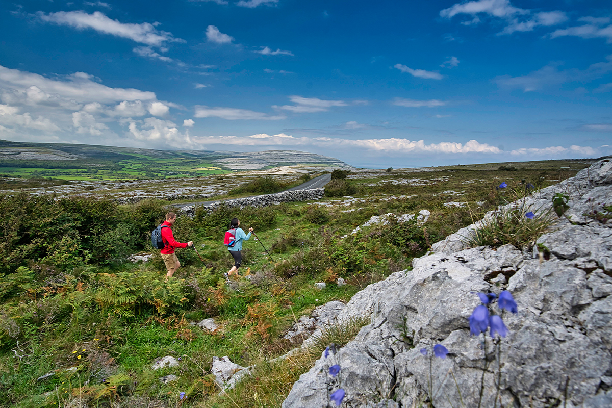
The Burren, County Clare
On the Map: The Burren is located in the north of County Clare in Ireland's west. The closest town is Ballyvaughan to the north, but the Burren is also easily accessible from Doolin, Lisdoonvarna (to the west) and Ennis (to the south).
The Burren, or Boireann, meaning Great Rock, is in County Clare. It is, without dispute, one of the most unique - and strangest - landscapes in Europe. The Burren occupies approximately 250 square kilometers. Bounded by the Atlantic on the west and rocked by Galway Bay to the north, it is a multi-layered landscape where rare and delicate plants have adapted in order to thrive and flourish between harsh crevices. Stroll the meadows, be astonished by the boulders, and read the trail marks and footprints that the ice age and volcanoes left behind. The Burren is littered with ancient and megalithic sites. The most dramatic of these is the Poulnabrone Dolmen, an impressive 5,000 year old portal tomb. Poulnabrone is one of the most famous megalithic monuments in Ireland. Just how the people of the time managed to get the truly massive capstone in place, is a mystery which continues to baffle archaeologists.
Kinvara, County Galway
On the Map: Kinvara is located in County Galway on the west coast of Ireland. The village is reached via the N67 road from Ballyvaighan/ Lisdoonvarna to the west, and Galway City to the north.
Kinvara (in Gaelic, Cinn Mhara) means Head of the Sea and gives one a very good insight into Kinvara's history. Essentially, Kinvara has grown into what it is today, from its association with the sea. Dunguaire Castle was built around 1500, for the O' Hynes family. The first record of Kinvara, as a market place dates back to 1615, when Oliver Martyn, residing in Dunguaire Castle was granted a licence to hold a Saturday market in Kinvara. During the 1600's, access to Kinvara was a lot easier by sea than by land and as a result of the growth in business and commerce in Galway, the harbour and village was developed by merchants/business men of the time. Kinvara continued to thrive until the mid 1800's, when the Great Irish Famine took its toll. Today, with much improved economic and social condtions, Kinvara has become one of the most vibrant small communities in Ireland, with a fantastic mixture of old and new, encompassing a huge pride for Irish heritage and culture.
Doolin, County Clare
On the Map: The small village of Doolin is located on County Clare’s west Atlantic coast. The village is accessed via the R479 - a small country road that intersects with the R478 connecting the towns of Lisdoonvarna (to the north) and Lahinch (to the south).
People flock to Doolin from all over the world to sample wonderful, top quality traditional music in the local pubs. Until recently Doolin had only three pubs. There are now some new establishments on the scene but we recommend sticking to the old reliables: McGann’s, McDermots and O’Connor’s. Even at that you will be spoiled for choice. Each pub is full most nights with musicians and music lovers alike. Be sure to check out all three! The surrounding area has much of interest including the barren yet strikingly beautiful Burren region with, among other things, the 5,000 year-old Poulnabrone Dolmen. Also worth a visit is Doonagore Castle and of course the spectacular 650-foot high Cliffs of Moher, which are only a few miles from Doolin.
Overnight Location
Dromoland, County Clare
On the Map: Dromoland Castle is located in County Clare in the west of Ireland. The castle is reached via the R458, a country road that intersects the M18 motorway between the city of Ennis (to the north) and Shannon Airport/ Limerick City (to the south).
Dromoland Castle is one of Ireland's grandest hotels and also one of its best-loved. The ancestral home of the O'Briens, barons of Inchiquin and direct descendants of Brian Boru, High King of Ireland, it is one of the few Irish estates tracing its history back to Gaelic royal families. Today, Dromoland is an oasis of tranquility. The grandeur of the castle itself, its magnificent furnishings and the surrounding lakes and parkland offer guests an experience almost impossible to find at other luxury hotels. It is a truly enchanting place.
Day 11
Depart From
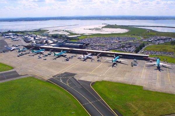
Depart from Shannon Airport, County Clare
Return to Shannon Airport three hours prior to your flight's scheduled departure. Shannon is a small, convenient airport, so this will allow ample time to check in for your flight home.
After check-in and passenger security, browse the array of shops on offer at 'The Loop' in Shannon Airport. Shannon is proud of its 'Duty Free' shops, and it should be: The concept of Duty-Free shopping was invented at Shannon in 1947!
2024 LOW SEASON
Available Dates
Nov, Dec
ON SALE! From $3,768 $3,568 per person
2024 MID SEASON
Available Dates
Oct
ON SALE! From $4,218 $4,018 per person
2024 HIGH SEASON
Available Dates
Jul, Aug, Sep
ON SALE! From $4,768 $4,568 per person
2025 LOW SEASON
Available Dates
Jan, Feb, Mar, Nov, Dec
ON SALE! From $3,956 $3,756 per person
2025 MID SEASON
Available Dates
Apr, May, Oct
ON SALE! From $4,429 $4,229 per person
2025 HIGH SEASON
Available Dates
Jun, Jul, Aug, Sep
ON SALE! From $5,006 $4,806 per person
Your Price Includes:
ACCOMMODATION
10 Nights Authentic Irish Accommodations including 1 Night Castle Stay
TRANSPORTATION
Chauffeur Transportation with Professional Driver/Guide
DINING OPTIONS INCLUDED
Delectable Breakfast Each Morning
6 Dining Experiences
INCLUDED UNIQUE EXPERIENCES
Local Driver Meet and Greet and Dublin City tour on arrival
Designer afternoon tea in an iconic Dublin setting
Unique tour of the historic tenement buildings in Dublin
Guinness Storehouse Tour
Traditional Irish Night Dinner Show
Kiss the Blarney Stone
Kilkenny Castle Visit
Smithwick's Brewery Experience
Jaunting Car Ride to a Brewery with Tour & Tasting
Drive the Ring of Kerry
Get a hand-on traditional Irish Cooking Lesson
Visit the beautiful Harbor town of Dingle
Sit down for an evening with a traditional Seanchaí (storyteller)
Embark on a cultural adventure into the Lost Valley
Ireland's oldest Oyster Farm Tour & Tasting
Visit the spectacular Cliffs of Moher
Stay in one of Ireland's top Castles
Enjoy a fine dining farewell dinner
Prices Based On
All Taxes & Fees Included
Prices are Per Person based on 12 people traveling together
Traveling Alone? No Problem. Just Ask Us for a Single Supplement Price.
"Family Vacation in Italy"
Jul 19, 2024
Amber W.
Amarillo, Texas
Amber was amazing! She listened and came up with an itinerary that was more than we could have asked for and checked every box! She was available and responsive every step of the way. She happily answered any and all questions and provided great insight and suggestions along the way. Thank you for making this process invaluable.
"70th Birthday Celebration in Scotland"
Jun 30, 2024
Douglas B.
Damascus, PA
Our trip to Scotland exceeded all our expectations. We were fortunate to be the only ones in our group so had the ability to add stops and learn a lot more. This was especially due to our amazing guide May Chen who is now a good friend. She really knows her geography, geology, history and how to show someone new around Scotland. She is a great driver as well and she was so responsive to all our needs and wishes.
"Wonderful Paris & London Trip"
Jun 27, 2024
Betsy W.
Modern Travel Pros
I wanted to pass along some feedback from my clients who just came back from their Paris and London trip. I do think they had a wonderful time!
"I wanted to say thank you for all of your hard work and help in making this trip amazing for us. It was truly incredible and exceeded our expectations. Gary was spectacular and I’d recommend him a thousand times over. We were very happy with all of your hotel selections. Locations were great for everything. Let your Disney lover clients know they truly don’t need more than a day at Disneyland Paris. I can’t stress enough how perfect the location was for our hotel in London. Public transportation is soooooo easy to navigate from there and you are truly in the center of everything. Our hotel in Paris was great too. The entire city is just absolutely stunning. Paris is a bit more spread out than London so it’s tougher to be in the middle of everything, but that location was great. Super close to the subway and great food options within walking distance. I wouldn’t have changed anything about any of our hotels."
"Great trip to Paris, Italy and Switzerland"
Jun 27, 2024
Betsy W.
Modern Travel Pros
My clients had a great trip! Here is their feedback: "Paris was Hannah’s favorite and I thought Switzerland would be mine, but it ended up being Venice. Switzerland was a close second! Overall, it was an amazing trip with wonderful memories to share. Thank you for all your help!"
"We got to see all of Ireland!"
Jun 27, 2024
Craig & Mary
10
It was a great Small Guided Vacation and we got to see all of Ireland. North to South and all the little points and villages. The Wild Atlantic, West coast, Cliffs of Moher, Giants causeway....Galway and Dingle Peninsula were my favorite and the Blarney castle. I never knew all that stuff was still going on in Belfast with the walls and the separation. The black cab tour was excellent. Cork, and Kilkenny were all great. I bought the Aran sweater and the wife got hers plus a Claddagh ring with earrings and a necklace. Don't worry for all 14 days I had my fill of Guinness. Lots of pictures too. Thanks for everything!
"I just LOVE LOVE LOVE working with Authentic!"
Jun 26, 2024
Izhar N.
CA
My clients returned from their whirlwind Scottish adventure...loved it !!!...they were able to do everything Bob wanted, and, even Shelly enjoyed the distilleries. Her favourite, actually, was hiking on the Isle of Islay...so, guess it was all worth it!! I, personally, want to say that your ground staff were FABULOUS!!!! Things happen...but, it was all sorted, and both I and my clients were extremely appreciative!! Again, I just LOVE LOVE LOVE working with you and Authentic !!!!
"Our Scotland trip was fantastic"
Jun 26, 2024
Steve & Jeanine G.
10
Hi Katie, we wanted to let you know that the trip was fantastic. The accommodations were awesome--particularly Witchery and The Old Manse. All excursions and car rental went smoothly. Thanks for all your help.
"We had an AMAZING time in Italy!"
Jun 26, 2024
Tamara L.
Agency
Hi Katie, here is a great feedback from my clients who just came back from Italy:
This was an amazing experience and the trip of a lifetime. We will absolutely return to Italy, and look forward to working with you to help us plan another great itinerary! Even though we are still shaking off some serious jet lag from the trip home, we are still basking in the glow of a wonderful trip and enjoying reflecting on the memories. Thank you so much for your help and making this trip a reality for us!
Complete our inquiry form by selecting your departure date, and all other relevant fields. Be sure to let us know if you're traveling for a special occasion! We can adjust most of our vacation packages to suit your needs, based on the details you provide.
2. Online Account & Quote Created
Your request will be forwarded to our team of Destination Experts, and a price quote will be prepared, based on your submitted preferences and criteria. A free Authentic Vacations online account will also be created, allowing you to view and request changes to your quote at any time. Log into your account via “LOGIN” at the top of any of our webpages.
3. Fine-Tune Your Tour Quote
Work with your assigned Destination Expert to tweak your quote in any way you wish. Our customers continually tell us that our flexibility in this regard is exceptional – your Destination Expert’s sole brief is to create the perfect tour for you!
4. Reserve & Pay Online
Once your quote is 100% to your liking, you can pay for your package with your credit card via your Authentic Vacations online account. We also accept payment by personal check and wire transfer. We only require a 20% deposit to secure your vacation, and our Risk-Free Cancellation Policy provides you with complete peace of mind.
5. Print Your Travel Documents & Go!
Once your vacation has been paid in full, you will be able to print your travel documents directly from your online account. You’re ready to embark on your ideal, authentic vacation!!
Questions?
If you would prefer to discuss your perfect vacation on the phone, we would be delighted to hear from you! Our Destination Experts are standing-by and looking forward to speaking with you at any time during our business hours listed below. We also operate a very responsive and efficient Live Chat service on our website…instant gratification awaits!
Toll-free from the US and Canada: 1-888-443-5259 Rest of World: +1-707-687-0191
Hours of Business:
Monday – Thursday: 7:00am – 5:00pm PST
Friday: 7:00am – 4:00pm PST
Saturday: 6:00am – 3:00pm PST
Sunday: 6:00am – 3:00pm PST
With offices in Scottsdale, San Francisco, London, Dublin, Copenhagen and Edinburgh, we can offer you unrivaled support while you are abroad. We truly believe all our clients deserve an extraordinary, authentic experience!


.jpg)


.jpg)


.jpg)
.jpg)
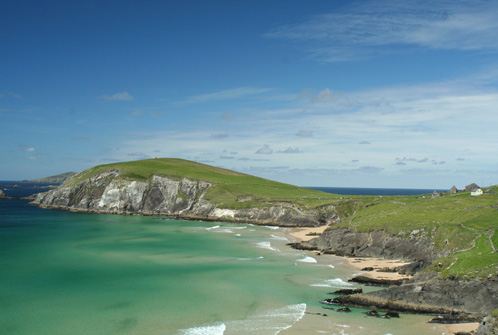
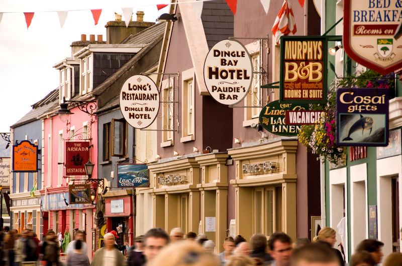
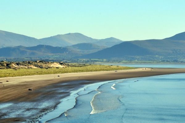

.jpg)
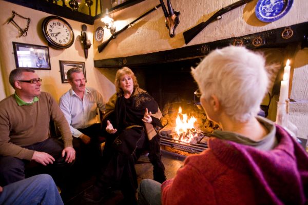
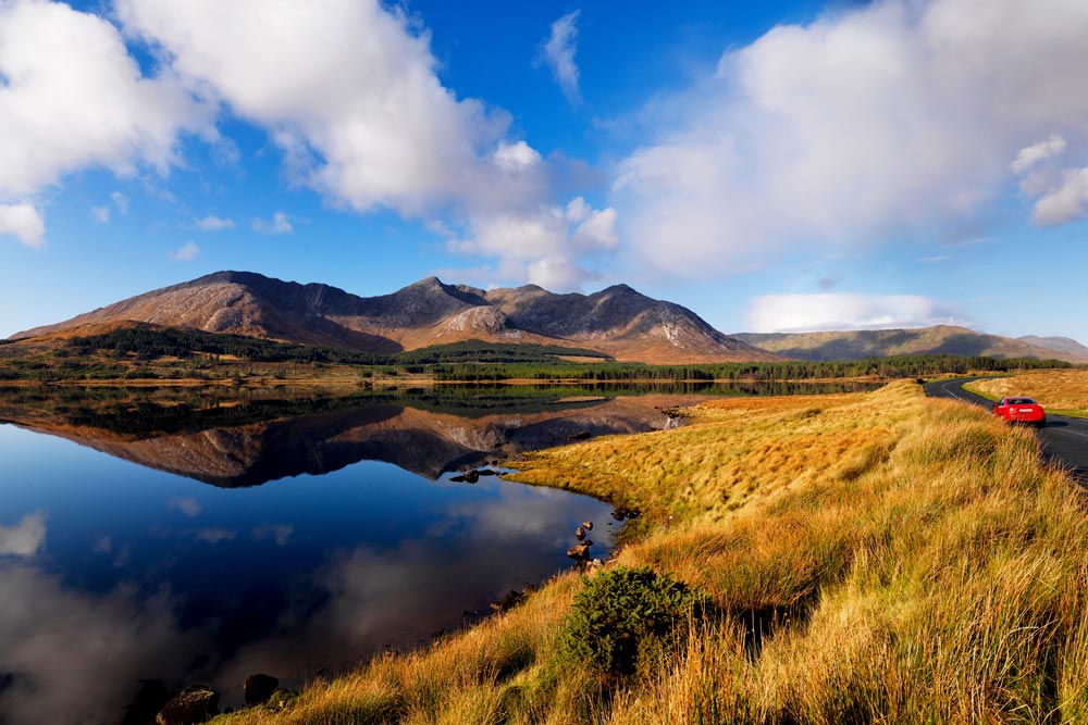
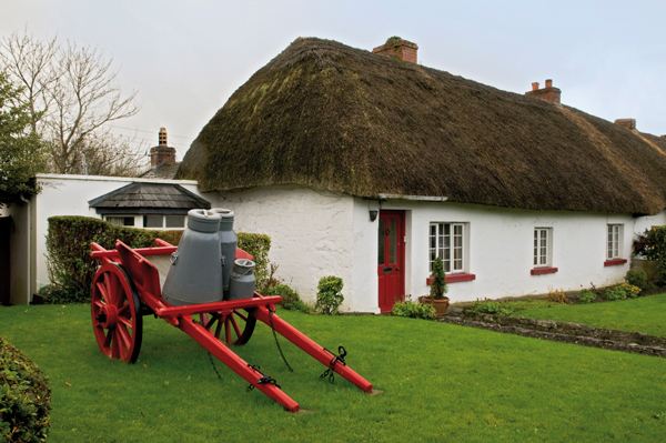
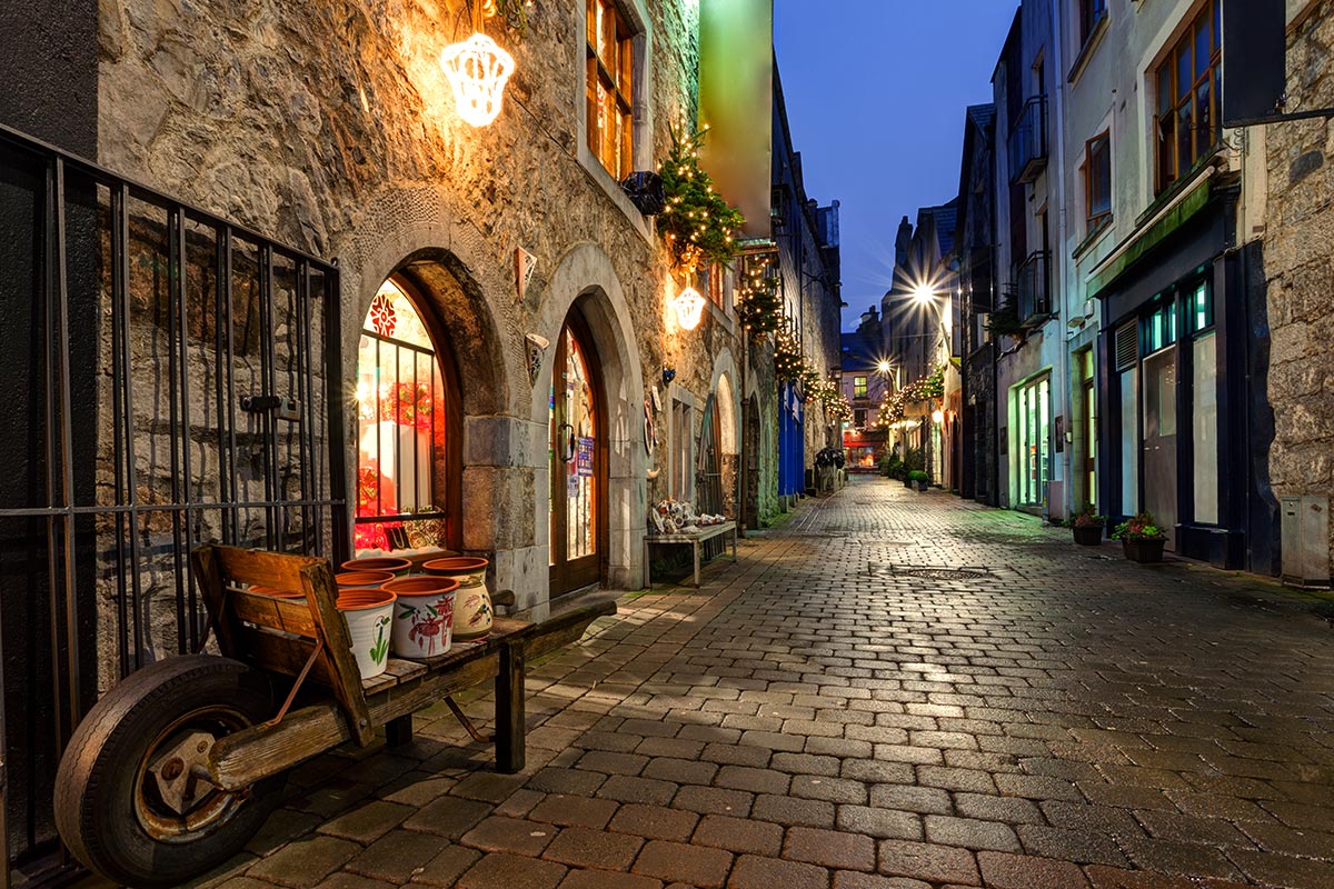
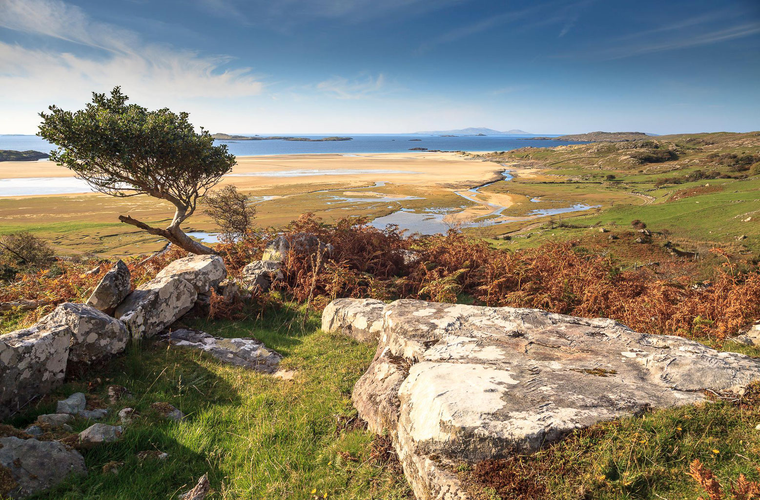
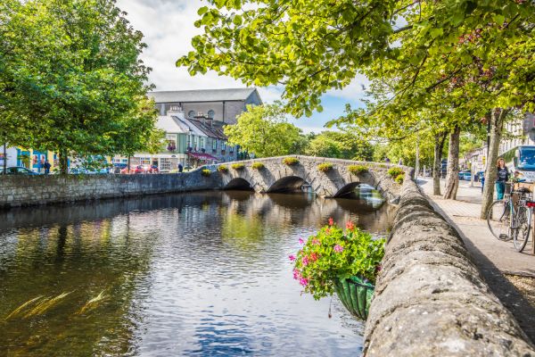
.jpg)
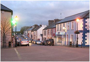
.jpg)
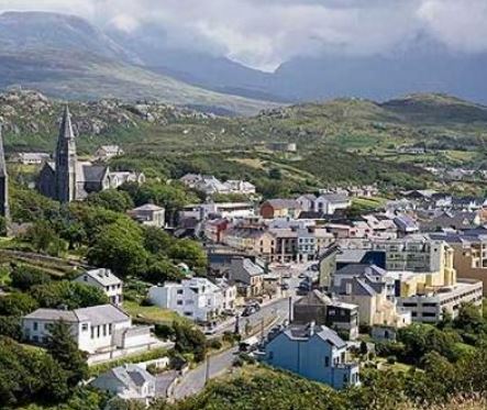
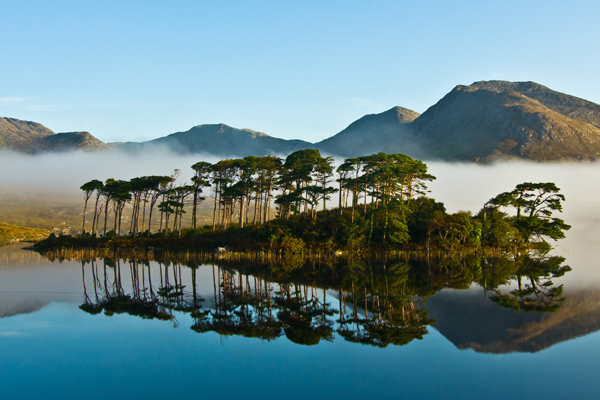
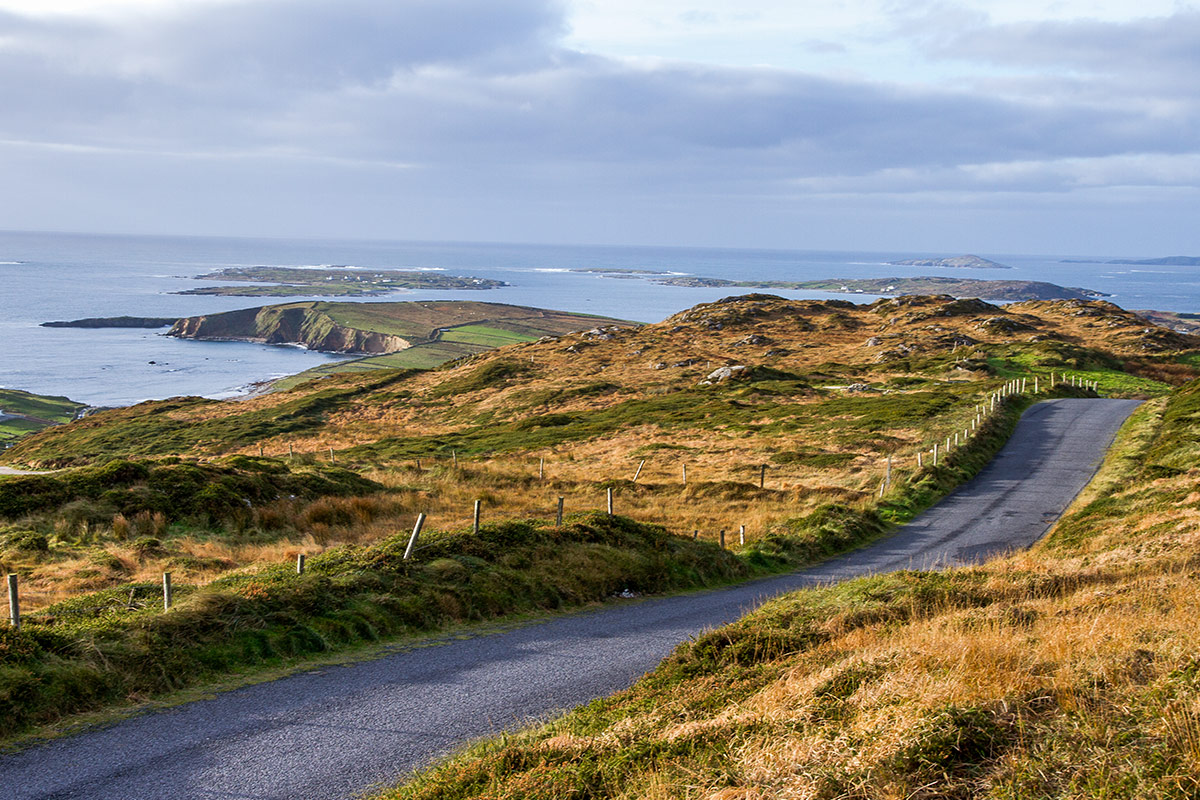
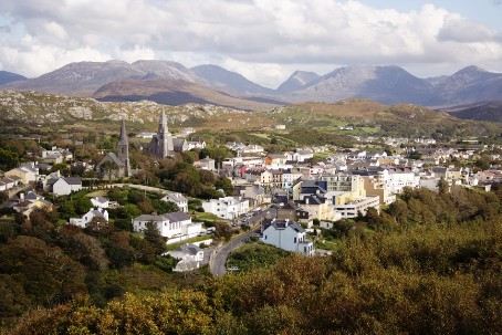
.jpg)